Hills of Britain and Ireland
OS Map of Sgurr a' Choinnich

AS they say ...
06-Jun-20 • goforchris • flickr
walking baronturner forestry cowal hills friends argyll scotland spring covid19 socialdistancing 50184388592

Chaps on the dam
06-Jun-20 • goforchris • flickr
walking baronturner forestry cowal hills friends argyll scotland spring covid19 socialdistancing dams hydro 50184388867

Somewhere, there's another path ...
06-Jun-20 • goforchris • flickr
walking baronturner forestry cowal hills friends argyll scotland spring covid19 socialdistancing dams hydro 50184389297

A path to Loch Long ...
06-Jun-20 • goforchris • flickr
walking baronturner forestry cowal hills friends argyll scotland spring covid19 socialdistancing dams hydro 50183587753

Bracken and burn
06-Jun-20 • goforchris • flickr
walking baronturner forestry cowal hills friends argyll scotland spring covid19 socialdistancing 50184133376

View looks different going back ...
06-Jun-20 • goforchris • flickr
walking baronturner forestry cowal hills friends argyll scotland spring covid19 socialdistancing 50183589518
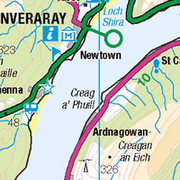
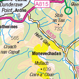
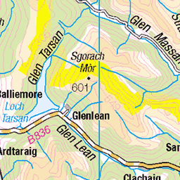
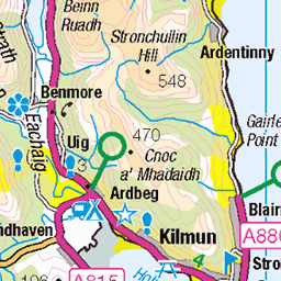
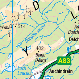
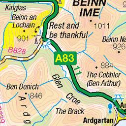
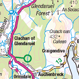
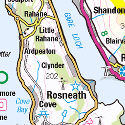
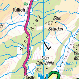
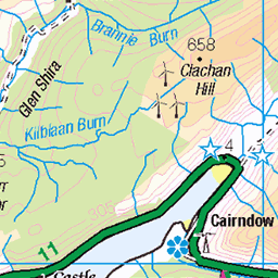
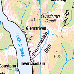
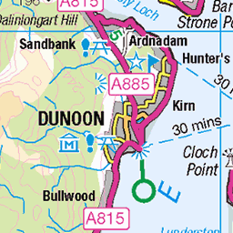
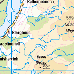
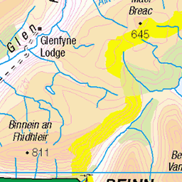
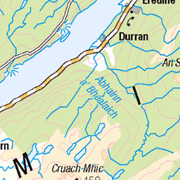
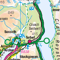
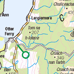
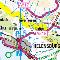
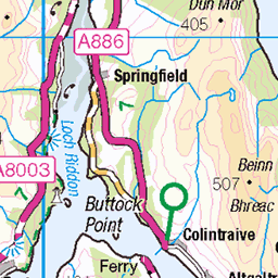
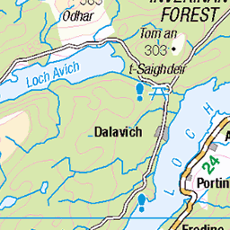
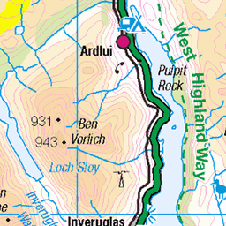
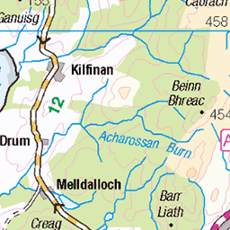
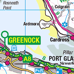
OS Map
This is OS mapping. In some areas, OpenStreetMap shows more footpaths
Spatial NI has online OSNI mapping. Click "Basemap Gallery" (4 squares icon at the top).
Now would be a good time for a cup of tea.

GPX Editor
Record map clicks
Reload map
Photos
Please tag your photos and upload them to the British and Irish Mountains group on Flickr
The other photos have been geo-tagged as on or around the summit. For less busy mountains, it can be a little hit and miss.
AS they say ...
06-Jun-20 • goforchris • flickr
walking baronturner forestry cowal hills friends argyll scotland spring covid19 socialdistancing 50184388592
Chaps on the dam
06-Jun-20 • goforchris • flickr
walking baronturner forestry cowal hills friends argyll scotland spring covid19 socialdistancing dams hydro 50184388867
Somewhere, there's another path ...
06-Jun-20 • goforchris • flickr
walking baronturner forestry cowal hills friends argyll scotland spring covid19 socialdistancing dams hydro 50184389297
A path to Loch Long ...
06-Jun-20 • goforchris • flickr
walking baronturner forestry cowal hills friends argyll scotland spring covid19 socialdistancing dams hydro 50183587753
Bracken and burn
06-Jun-20 • goforchris • flickr
walking baronturner forestry cowal hills friends argyll scotland spring covid19 socialdistancing 50184133376
View looks different going back ...
06-Jun-20 • goforchris • flickr
walking baronturner forestry cowal hills friends argyll scotland spring covid19 socialdistancing 50183589518

Loch Eck looking blue
06-Jun-20 • goforchris • flickr
walking baronturner forestry cowal hills friends argyll scotland spring covid19 socialdistancing locheck 50184391337

Blue sky and green hill
06-Jun-20 • goforchris • flickr
walking baronturner forestry cowal hills friends argyll scotland spring covid19 socialdistancing 50184391607

Brown slime and carnivorous plants
06-Jun-20 • goforchris • flickr
walking baronturner forestry cowal hills friends argyll scotland spring covid19 socialdistancing 50184392272

Carnivorous plant
06-Jun-20 • goforchris • flickr
walking baronturner forestry cowal hills friends argyll scotland spring covid19 socialdistancing plants carnivorousplants 50184392502
Videos
None found
Notes
- Data: Database of British and Irish Hills v18.2
- Maps: We use OS mapping for England, Scotland, Wales, and the Isle of Man. Sadly, Channel Islands, Northern (OSNI) and Southern Ireland (OSI) mapping isn't available online, so we use Openstreetmap.