Hills of Britain and Ireland
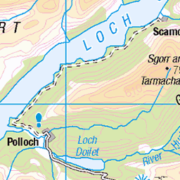
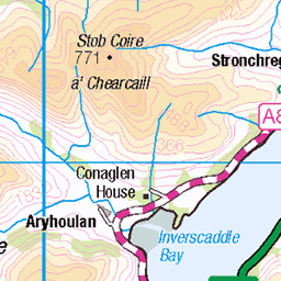
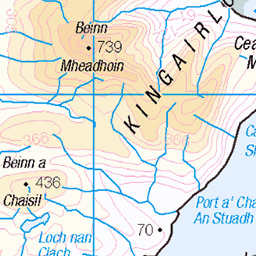
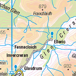
OS Map of Maol Odhar East Top

Andy on Yin and Yang
VS 4c. Second ascent?
28-Jun-14 • Masa Sakano • flickr
scotland climbing highland climber trad yinandyang ardgour gneiss creachbheinn ancoiredubh 14351329277

Andy abseiling back
28-Jun-14 • Masa Sakano • flickr
scotland scenery climbing highland climber trad yinandyang ardgour gneiss creachbheinn glentarbert ancoiredubh 14557916563
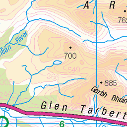
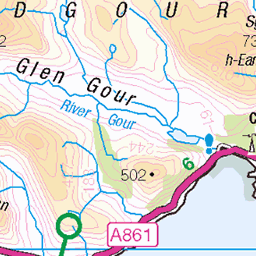
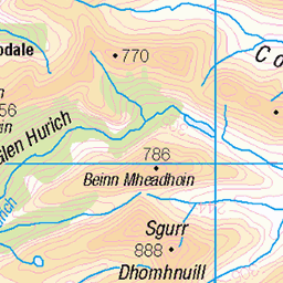
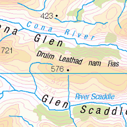
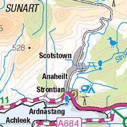
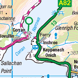
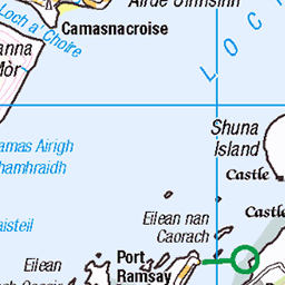
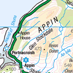
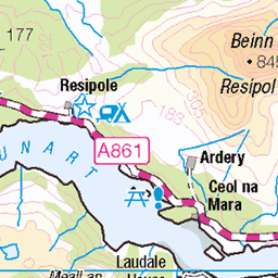
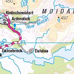
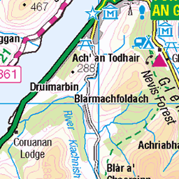
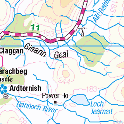
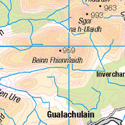
OS Map
This is OS mapping. In some areas, OpenStreetMap shows more footpaths
Spatial NI has online OSNI mapping. Click "Basemap Gallery" (4 squares icon at the top).
Now would be a good time for a cup of tea.

GPX Editor
Record map clicks
Reload map
Photos
Please tag your photos and upload them to the British and Irish Mountains group on Flickr
The other photos have been geo-tagged as on or around the summit. For less busy mountains, it can be a little hit and miss.
Andy on Yin and Yang
VS 4c. Second ascent?
28-Jun-14 • Masa Sakano • flickr
scotland climbing highland climber trad yinandyang ardgour gneiss creachbheinn ancoiredubh 14351329277
Andy abseiling back
28-Jun-14 • Masa Sakano • flickr
scotland scenery climbing highland climber trad yinandyang ardgour gneiss creachbheinn glentarbert ancoiredubh 14557916563
Videos
None found
Notes
- Data: Database of British and Irish Hills v18.2
- Maps: We use OS mapping for England, Scotland, Wales, and the Isle of Man. Sadly, Channel Islands, Northern (OSNI) and Southern Ireland (OSI) mapping isn't available online, so we use Openstreetmap.