Hills of Britain and Ireland
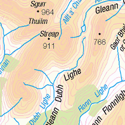
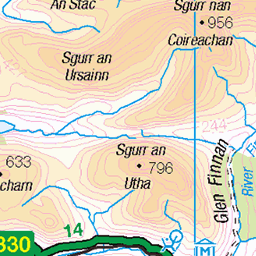
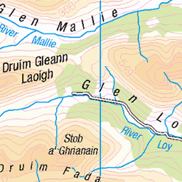
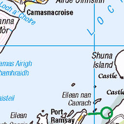
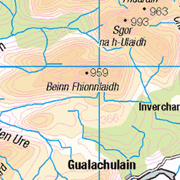
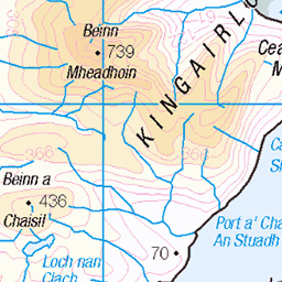
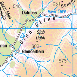
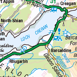
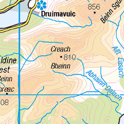
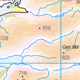
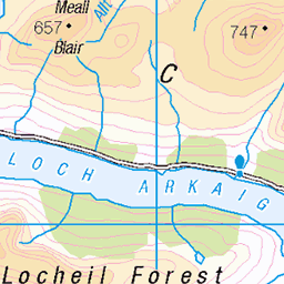
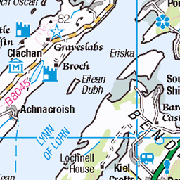
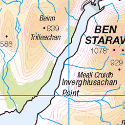
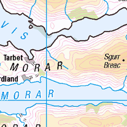
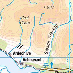
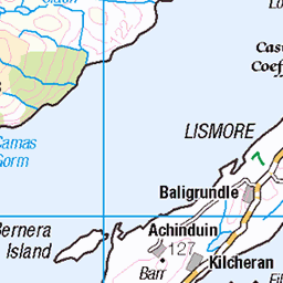
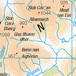
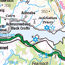
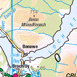
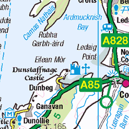
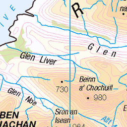
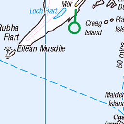
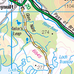
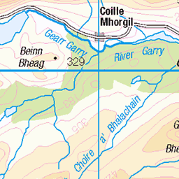
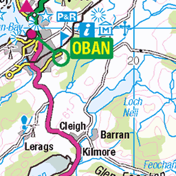
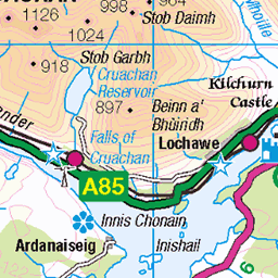
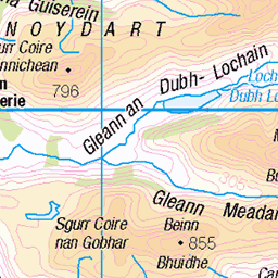
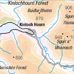
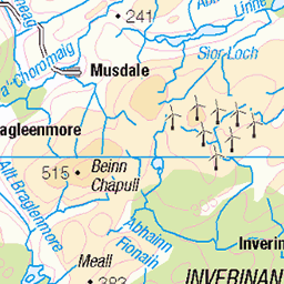
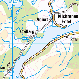
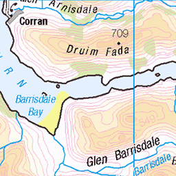
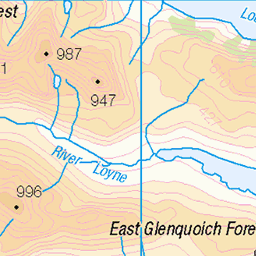
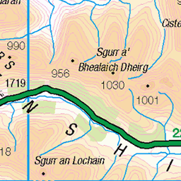
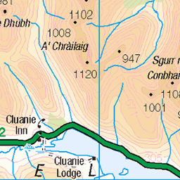
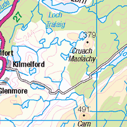
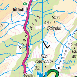
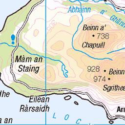
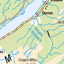
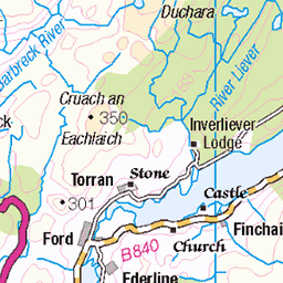
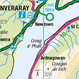
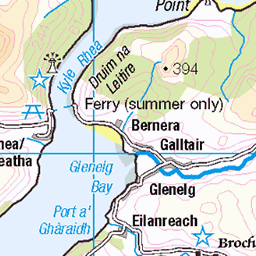
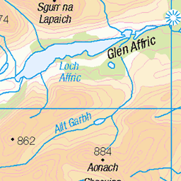
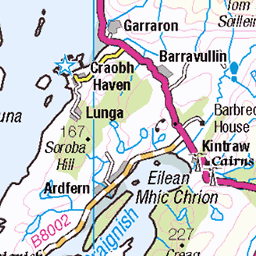
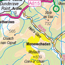
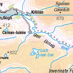
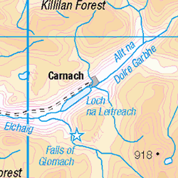
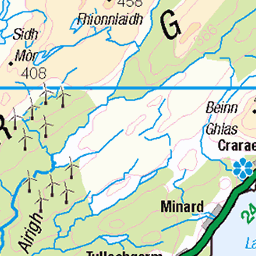
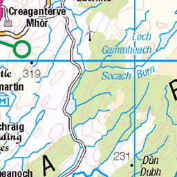
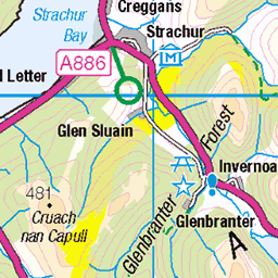
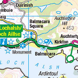
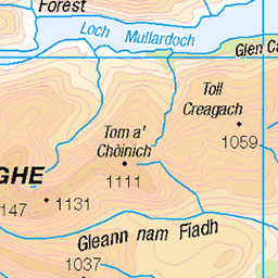
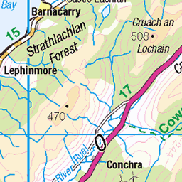
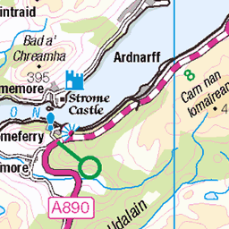
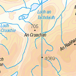
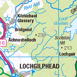
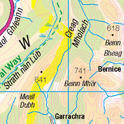
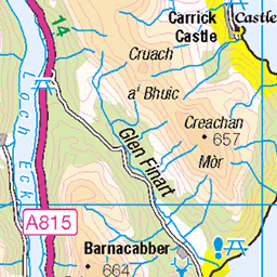
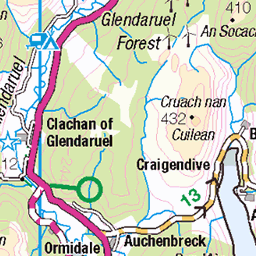
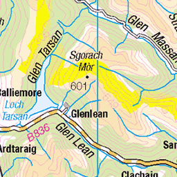
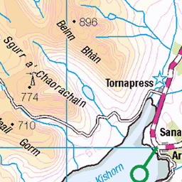
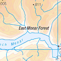
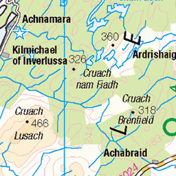
OS Map of Sgurr na h-Eanchainne
Height: 731m / 2398ft • Prominence: 91m / 299ft • Summit : cairn 3m W of trig point • Trip reports (hill-bagging)

GC3-032 Maclean's Towel
30-Jun-24 • ramblingjohn • flickr
hiking scotland highlands hfholidays 53841761388

GC3-036 Ascending from Corran
30-Jun-24 • ramblingjohn • flickr
hiking scotland highlands hfholidays 53841849154

GC3-037 Loch Linnhe
30-Jun-24 • ramblingjohn • flickr
hiking scotland highlands hfholidays 53840601352

GC3-040 Loch Linnhe
30-Jun-24 • ramblingjohn • flickr
hiking scotland highlands hfholidays 53840601387

GC3-050 Carn a Choire Dhuibh, group
30-Jun-24 • ramblingjohn • flickr
hiking scotland highlands hfholidays 53841496086

GC3-058 Schiehallion
30-Jun-24 • ramblingjohn • flickr
hiking scotland highlands hfholidays 53841761133
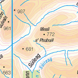
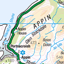
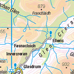
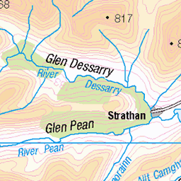
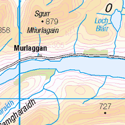
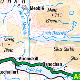
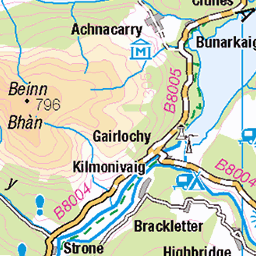
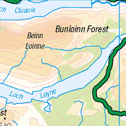
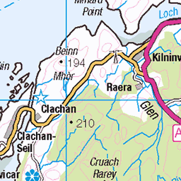
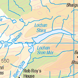
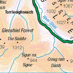
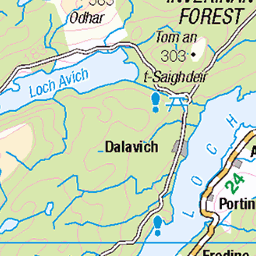
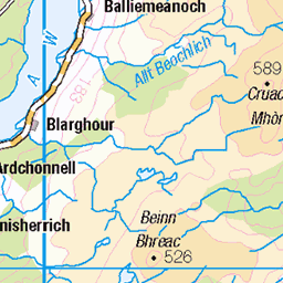
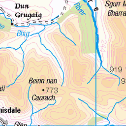
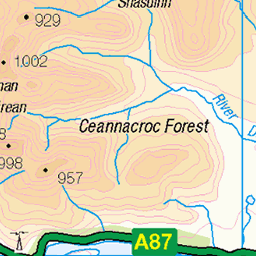
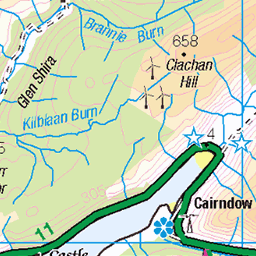
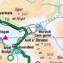
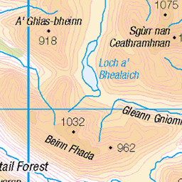
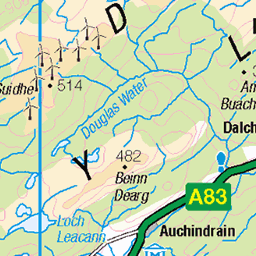
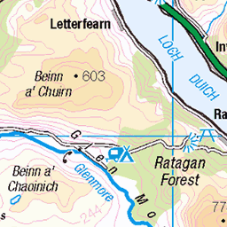
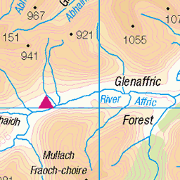
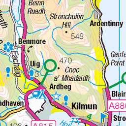
OS Map
This is OS mapping. In some areas, OpenStreetMap shows more footpaths
Spatial NI has online OSNI mapping. Click "Basemap Gallery" (4 squares icon at the top).
Now would be a good time for a cup of tea.


GPX Editor
Record map clicks
Reload map
Photos
Please tag your photos and upload them to the British and Irish Mountains group on Flickr
The other photos have been geo-tagged as on or around the summit. For less busy mountains, it can be a little hit and miss.
GC3-032 Maclean's Towel
30-Jun-24 • ramblingjohn • flickr
hiking scotland highlands hfholidays 53841761388
GC3-036 Ascending from Corran
30-Jun-24 • ramblingjohn • flickr
hiking scotland highlands hfholidays 53841849154
GC3-037 Loch Linnhe
30-Jun-24 • ramblingjohn • flickr
hiking scotland highlands hfholidays 53840601352
GC3-040 Loch Linnhe
30-Jun-24 • ramblingjohn • flickr
hiking scotland highlands hfholidays 53840601387
GC3-050 Carn a Choire Dhuibh, group
30-Jun-24 • ramblingjohn • flickr
hiking scotland highlands hfholidays 53841496086
GC3-058 Schiehallion
30-Jun-24 • ramblingjohn • flickr
hiking scotland highlands hfholidays 53841761133

GC3-062 Coire Dubh
30-Jun-24 • ramblingjohn • flickr
hiking scotland highlands hfholidays 53841940680

GC3-066 Maclean's Towel
30-Jun-24 • ramblingjohn • flickr
hiking scotland highlands hfholidays 53841761173


4511 Sgurr na h-Eanchainne
Second top of the day with Jim Bloomer with a Vanessa Trig and a great view towards the Corran Narrows. Name:Druim na Sgriodain - Sgurr na h-Eanchainne Hill number:4511 Height:731m / 2398ft Area:18B: Sunart and Ardgour Class:GTG,sHu Grid ref: NM 99640 65837 Summit feature:cairn 3m W of trig point Drop:92m Col:639m NM988658
27-Apr-13 • Dugswell2 • flickr
p92 gtg trigpoint sgurrnaheanchainne subhump vanessatrig 12340777824

4511 Sgurr na h-Eanchainne 1
Second top of the day with Jim Bloomer with a Vanessa Trig and a great view towards the Corran Narrows. Name:Druim na Sgriodain - Sgurr na h-Eanchainne Hill number:4511 Height:731m / 2398ft Area:18B: Sunart and Ardgour Class:GTG,sHu Grid ref: NM 99640 65837 Summit feature:cairn 3m W of trig point Drop:92m Col:639m NM988658
27-Apr-13 • Dugswell2 • flickr
p92 gtg trigpoint sgurrnaheanchainne subhump 12340502133
Videos
A short mountain hike in winter conditions in Ardgour, Scotland. This is an ambient hiking film with no talking. More from winter in ...
Notes
- Data: Database of British and Irish Hills v18.2
- Maps: We use OS mapping for England, Scotland, Wales, and the Isle of Man. Sadly, Channel Islands, Northern (OSNI) and Southern Ireland (OSI) mapping isn't available online, so we use Openstreetmap.