Hills of Britain and Ireland
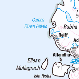
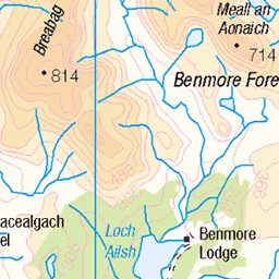
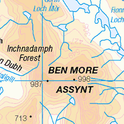
OS Map of Meall Dearg
Height: 657m / 2155ft • Prominence: 75m / 246ft • Summit : rock by cairn • Trip reports (hill-bagging)
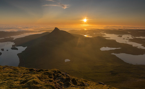
Land of Loch and Hill.
The last shot from the summit of Cul Beag, had to head back down after this..wish i'd taken the tent !
27-Jun-19 • Gordie Broon. • flickr
coigach stacpollaidh westerross paysage landscape aghaidhealtachd hills collines scotland scottishhighlands colinas lac lago sutherland achiltibuie ullapool heuvels paisaje view vista lochinver inverpollyforest lochsionasgaig lochlurgainn lecoucherdusoleil atardecer scenery sunset scenic schottland ecosse escocia caledonia scozia szkocja gordiebroonphotography tramonto achnahaird sonya7rmkii ilce7rm2 sonyzeiss1635f4lens reiff geotagged alba assynt 48670069983

Halfway view
Looking west down Loch Lurgainn from the shoulder on the north side of Cul Beag. Sgorr Tuath is the peak across the loch, and Stac Pollaidh is on the very right-hand edge.
11-Sep-16 • OutdoorMonkey • flickr
scotland assynt culbeag mountain mountainside hillside loch lochlurgainn panorama panoramic bluesky outside outdoor landscape nature lake water 30216955401

sunrise - cul beag - inverpolly
24-Jan-14 • eyeontheworld2008 • flickr
uk morning winter mountain snow mountains nature rural sunrise landscape dawn scotland outdoor scenic loch assynt culbeag inverpolly lochlurgainn 12810370823

cloud over Stac Pollaidh
clouds scotland mountainview stacpollaidh 8769220747


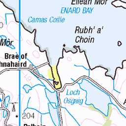
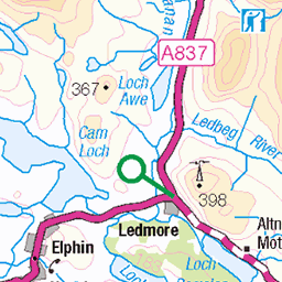
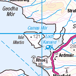
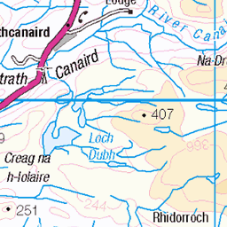
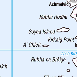
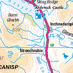
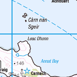
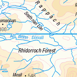
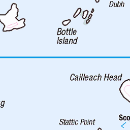
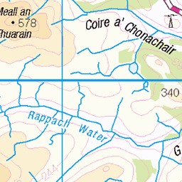
OS Map
This is OS mapping. In some areas, OpenStreetMap shows more footpaths
Spatial NI has online OSNI mapping. Click "Basemap Gallery" (4 squares icon at the top).
Now would be a good time for a cup of tea.

GPX Editor
Record map clicks
Reload map
Photos
Please tag your photos and upload them to the British and Irish Mountains group on Flickr
The other photos have been geo-tagged as on or around the summit. For less busy mountains, it can be a little hit and miss.
Land of Loch and Hill.
The last shot from the summit of Cul Beag, had to head back down after this..wish i'd taken the tent !
27-Jun-19 • Gordie Broon. • flickr
coigach stacpollaidh westerross paysage landscape aghaidhealtachd hills collines scotland scottishhighlands colinas lac lago sutherland achiltibuie ullapool heuvels paisaje view vista lochinver inverpollyforest lochsionasgaig lochlurgainn lecoucherdusoleil atardecer scenery sunset scenic schottland ecosse escocia caledonia scozia szkocja gordiebroonphotography tramonto achnahaird sonya7rmkii ilce7rm2 sonyzeiss1635f4lens reiff geotagged alba assynt 48670069983
Halfway view
Looking west down Loch Lurgainn from the shoulder on the north side of Cul Beag. Sgorr Tuath is the peak across the loch, and Stac Pollaidh is on the very right-hand edge.
11-Sep-16 • OutdoorMonkey • flickr
scotland assynt culbeag mountain mountainside hillside loch lochlurgainn panorama panoramic bluesky outside outdoor landscape nature lake water 30216955401
sunrise - cul beag - inverpolly
24-Jan-14 • eyeontheworld2008 • flickr
uk morning winter mountain snow mountains nature rural sunrise landscape dawn scotland outdoor scenic loch assynt culbeag inverpolly lochlurgainn 12810370823
cloud over Stac Pollaidh
clouds scotland mountainview stacpollaidh 8769220747


Videos
None found
Notes
- Data: Database of British and Irish Hills v18.2
- Maps: We use OS mapping for England, Scotland, Wales, and the Isle of Man. Sadly, Channel Islands, Northern (OSNI) and Southern Ireland (OSI) mapping isn't available online, so we use Openstreetmap.