Hills of Britain and Ireland
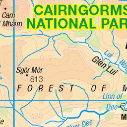
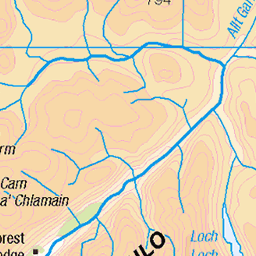
OS Map of Sgor Mor

The Way Ahead
After the first initial climb we reach a small plateau where our route ahead can be seen. A small marker cairn to the left is our next goal while the mountain in the distance marks the final climb to the ridge that will take us to An Socach itself. For scale, people can be see climbing this part, silhouetted against the sky. After a few test runs and weeks of chiropractic care on my back, it's finally time to start the climbing season with a climb up An Socach. An Socach (pronounced An S-Oh-Ack) is my 17th Munro and stands at 944 meters (3097 feet), and although not the longest of climbs parts of it are very steep.
24-Apr-22 • steve_whitmarsh • flickr
aberdeenshire scotland scottishhighlands highlands cairngorms mountain hills glen ansocach landscape topic 52035246933

Clear Mountains
The top of this mountainside was shrouded in cloud when we were climbing An Socach, but after the clouds lifted we get a great view across Glen Baddock to it's steep sides. After a few test runs and weeks of chiropractic care on my back, it's finally time to start the climbing season with a climb up An Socach. An Socach (pronounced An S-Oh-Ack) is my 17th Munro and stands at 944 meters (3097 feet), and although not the longest of climbs parts of it are very steep.
24-Apr-22 • steve_whitmarsh • flickr
aberdeenshire scotland scottishhighlands highlands cairngorms mountain hills glen ansocach landscape rock rocks topic rockpaper 52070187984


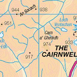
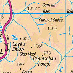
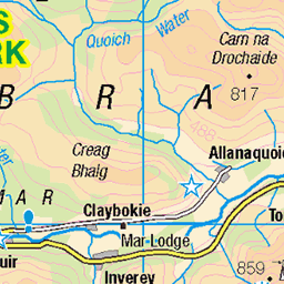
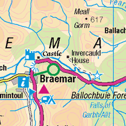
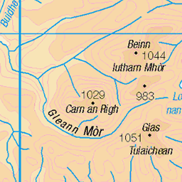
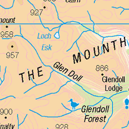
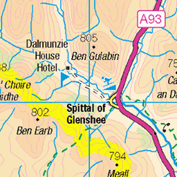
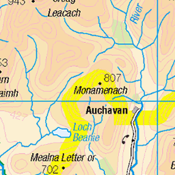
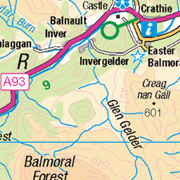
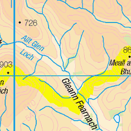
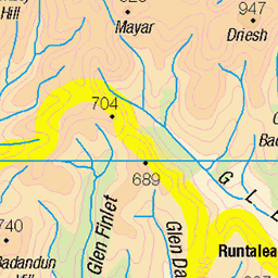
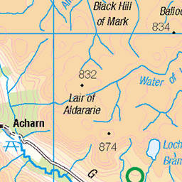
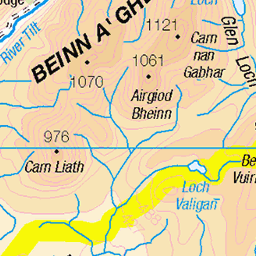
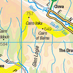
OS Map
This is OS mapping. In some areas, OpenStreetMap shows more footpaths
Spatial NI has online OSNI mapping. Click "Basemap Gallery" (4 squares icon at the top).
Now would be a good time for a cup of tea.
GPX Editor
Record map clicks
Reload map
Photos
Please tag your photos and upload them to the British and Irish Mountains group on Flickr
The other photos have been geo-tagged as on or around the summit. For less busy mountains, it can be a little hit and miss.
The Way Ahead
After the first initial climb we reach a small plateau where our route ahead can be seen. A small marker cairn to the left is our next goal while the mountain in the distance marks the final climb to the ridge that will take us to An Socach itself. For scale, people can be see climbing this part, silhouetted against the sky. After a few test runs and weeks of chiropractic care on my back, it's finally time to start the climbing season with a climb up An Socach. An Socach (pronounced An S-Oh-Ack) is my 17th Munro and stands at 944 meters (3097 feet), and although not the longest of climbs parts of it are very steep.
24-Apr-22 • steve_whitmarsh • flickr
aberdeenshire scotland scottishhighlands highlands cairngorms mountain hills glen ansocach landscape topic 52035246933
Clear Mountains
The top of this mountainside was shrouded in cloud when we were climbing An Socach, but after the clouds lifted we get a great view across Glen Baddock to it's steep sides. After a few test runs and weeks of chiropractic care on my back, it's finally time to start the climbing season with a climb up An Socach. An Socach (pronounced An S-Oh-Ack) is my 17th Munro and stands at 944 meters (3097 feet), and although not the longest of climbs parts of it are very steep.
24-Apr-22 • steve_whitmarsh • flickr
aberdeenshire scotland scottishhighlands highlands cairngorms mountain hills glen ansocach landscape rock rocks topic rockpaper 52070187984


Dark Mountains
Sgor Mor, some of the mountains in Glen Clunie just up the way from the Cairnwell in Glenshee. An experimental processing, aiming for a very dark low-key effect with just a hint of light to show the snow on the tops.
winter blackandwhite snow art nature monochrome lines weather composite composition manipulated dark lens landscape photography scotland spring highlands warm raw moody glenshee emotion unitedkingdom space seasonal perthshire aspiration places calm diagonal equipment negativespace filter zen vista balance striking simple toned lowkey pure breakingrules contrasts tranquil hdr lightanddark elegance shapely gbr crazyart sumptuous digikam tonemapped skyearth shapeandform rawconversion glenclunie enfuse calmstill digitalred meaningemptiness darktable photivo abstractqualities digitalbloom digitallowpass sony55210mm 19694568431

Pond
A blue-sky day: clouds reflecting of a small pond, Glen Clunie. Also available in www.flickr.com/photos/spodzone/19725812771 black and white . Copyright (C) www.shinyphoto.co.uk/" rel="nofollow Tim Haynes 2015.
light sunlight colour art nature beautiful composite composition manipulated lens landscape photography scotland highlands glenshee emotion unitedkingdom perthshire sunny places rules hills equipment filter zen vista beyond isolation colourful moment idyll favourite awe striking distance toned pure contrasts tranquil hdr contentment elegance gbr nearfar digikam tonemapped landwater skyearth rawconversion glenclunie enfuse sony1855 darktable photivo digitalgradnd digitallowpass digitaldodgeburn nearmidfardistance 19533206390

Pond
A blue-sky day: clouds reflecting of a small pond, Glen Clunie. Also available in www.flickr.com/photos/spodzone/19533206390/ shiny coloura>. Copyright (C) www.shinyphoto.co.uk/ Tim Haynes 2015.
light blackandwhite sunlight art monochrome beautiful composite composition manipulated lens landscape photography scotland highlands glenshee emotion unitedkingdom perthshire sunny places rules equipment filter zen vista beyond isolation moment idyll favourite awe striking distance toned pure contrasts tranquil hdr contentment elegance gbr nearfar digikam tonemapped landwater skyearth rawconversion glenclunie enfuse sony1855 darktable photivo digitalgradnd digitallowpass digitaldodgeburn nearmidfardistance 19725812771
Videos
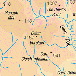
In today's video I will be climbing two munros in the heart of the Cairngorms.. Monadh Mor & Beinn Bhrotain THE ROUTE: ...
I took the train up to the Cairngorms National Park, Scotland, in early January 2024. In 3 days, I did 4 hikes in the park, of varying ...
A wonderful Munro with a fantastic view in The Cairngorms mountains in Scotland. Join Big Stoozer and his pal 'Roley' (from The ...
Nationalist Man chases mountain biker. This was a very rewarding cross country mountain bike trail to the top of Mullach Clach a ...
Notes
- Data: Database of British and Irish Hills v18.2
- Maps: We use OS mapping for England, Scotland, Wales, and the Isle of Man. Sadly, Channel Islands, Northern (OSNI) and Southern Ireland (OSI) mapping isn't available online, so we use Openstreetmap.