Hills of Britain and Ireland
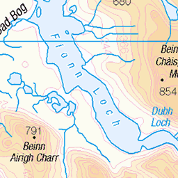
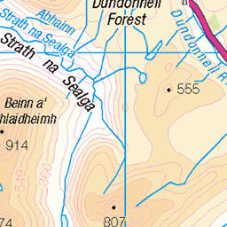
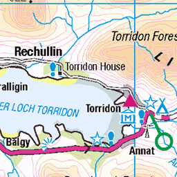
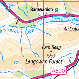
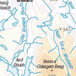
OS Map of Sgurr Dubh
Height: 738m / 2421ft • Prominence: 59m / 194ft • Summit : outcrop 3m S of cairn • Trip reports (hill-bagging)
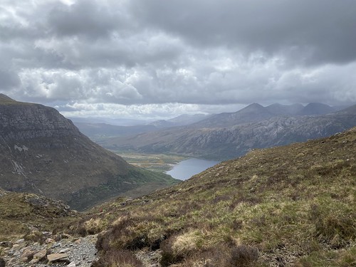
Part of Loch Maree and Mountains beyond, from ascent
Day 1 Walk 15/05/23: Slioch from Kinlochewe Lodge [taken by Jenny P]
15-May-23 • thomasgrabow • flickr
swcwalks kinlochewe 52926303042
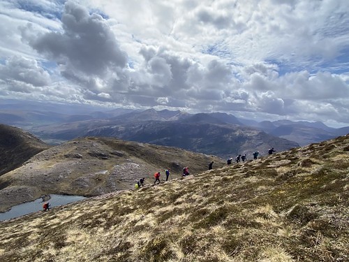
The last steep bit to the top plateau
Day 1 Walk 15/05/23: Slioch from Kinlochewe Lodge [taken by Jenny P]
15-May-23 • thomasgrabow • flickr
swcwalks kinlochewe 52926891151
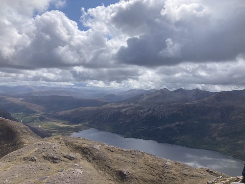
Loch Maree and Kinlochewe from top of Slioch
Day 1 Walk 15/05/23: Slioch from Kinlochewe Lodge [taken by Jenny P]
15-May-23 • thomasgrabow • flickr
swcwalks kinlochewe 52926891106

Steep descent back to outbound route
Day 1 Walk 15/05/23: Slioch from Kinlochewe Lodge [taken by Jenny P]
15-May-23 • thomasgrabow • flickr
swcwalks kinlochewe 52927330198


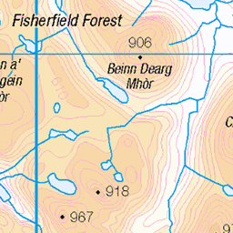
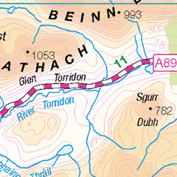
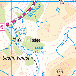
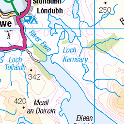
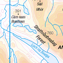
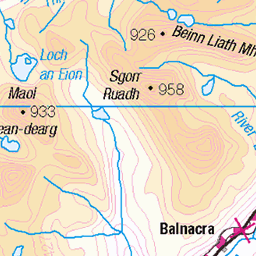
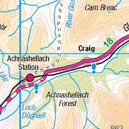
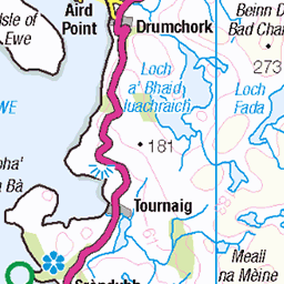
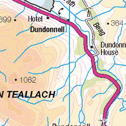
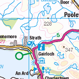
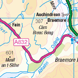
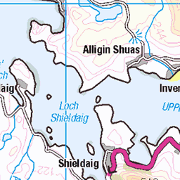
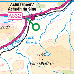
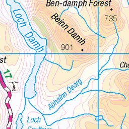
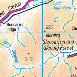
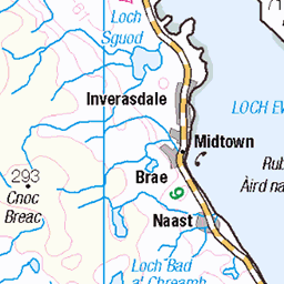
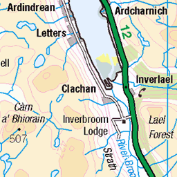
OS Map
This is OS mapping. In some areas, OpenStreetMap shows more footpaths
Spatial NI has online OSNI mapping. Click "Basemap Gallery" (4 squares icon at the top).
Now would be a good time for a cup of tea.
GPX Editor
Record map clicks
Reload map
Photos
Please tag your photos and upload them to the British and Irish Mountains group on Flickr
The other photos have been geo-tagged as on or around the summit. For less busy mountains, it can be a little hit and miss.
Part of Loch Maree and Mountains beyond, from ascent
Day 1 Walk 15/05/23: Slioch from Kinlochewe Lodge [taken by Jenny P]
15-May-23 • thomasgrabow • flickr
swcwalks kinlochewe 52926303042
The last steep bit to the top plateau
Day 1 Walk 15/05/23: Slioch from Kinlochewe Lodge [taken by Jenny P]
15-May-23 • thomasgrabow • flickr
swcwalks kinlochewe 52926891151
Loch Maree and Kinlochewe from top of Slioch
Day 1 Walk 15/05/23: Slioch from Kinlochewe Lodge [taken by Jenny P]
15-May-23 • thomasgrabow • flickr
swcwalks kinlochewe 52926891106
Steep descent back to outbound route
Day 1 Walk 15/05/23: Slioch from Kinlochewe Lodge [taken by Jenny P]
15-May-23 • thomasgrabow • flickr
swcwalks kinlochewe 52927330198


Videos
Torridon mountain's walk,Sgorr nan Lochan Uaine Sgurr Dubh, Beinn Alligin,loch torridon,beinn alligin horns.beinn alligin-tom na ...
Panoramic shot from the top of Sgurr Dubh.
Panoramic shot from the top of Sgurr Dubh (Torridon)
Bike & Hike Torridon .Beinn an Eoin erdale Scotland near gairloch. Walk start a832 car park. Torridon hills beinn eighe trail. triple ...
Glen torridon .Munro Bagging.Walks in torridon mountains. Ridge walk Hike to Ruadh-stac Mor ben eighe.Beinn Eighe-Spidean ...
Notes
- Data: Database of British and Irish Hills v18.2
- Maps: We use OS mapping for England, Scotland, Wales, and the Isle of Man. Sadly, Channel Islands, Northern (OSNI) and Southern Ireland (OSI) mapping isn't available online, so we use Openstreetmap.