Hills of Britain and Ireland
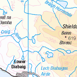
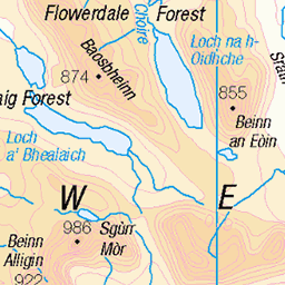
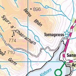
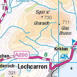
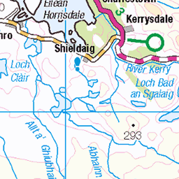
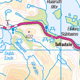
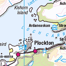
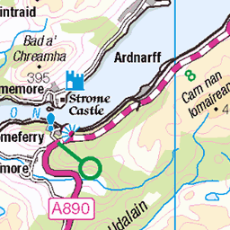
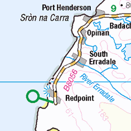
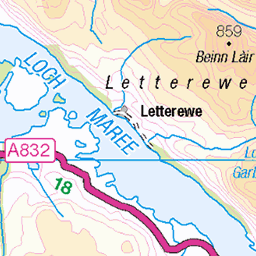
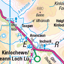
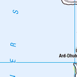
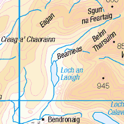
OS Map of Sgurr na Bana-Mhoraire
Height: 687m / 2253ft • Prominence: 102m / 335ft • Summit : trig point • Trip reports (hill-bagging)

Looking over Loch Damh towards the Kyle of Lochalsh and Applecross
en.wikipedia.org/wiki/Beinn_Damh" rel="noreferrer nofollow en.wikipedia.org/wiki/Beinn_Damh
53761804928

Eas an Ruaig below Beinn Damh, Torridon
19-Jun-23 • Mumbles Head • flickr
waterfall landscape scotland highlands 53027236807


Torridon sunrise
Sunrise at Torridon looking over Upper Loch Torridon from our sleep out location. Beinn Alligin straight ahead, the west end of Liathach on the right and Beinn Dearg behind them. Lovely in the evening but Midge hell in the morning.
24-Aug-21 • Carinbrook • flickr
torridon mountains loch 51401465583
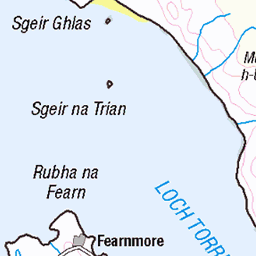
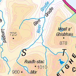
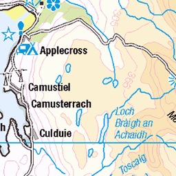
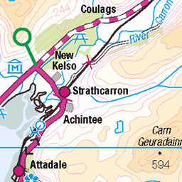
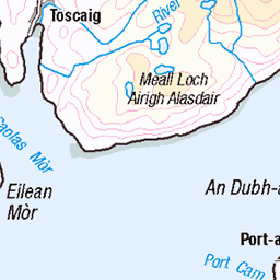
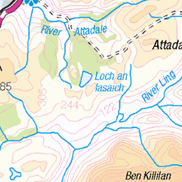
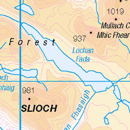
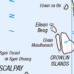
OS Map
This is OS mapping. In some areas, OpenStreetMap shows more footpaths
Spatial NI has online OSNI mapping. Click "Basemap Gallery" (4 squares icon at the top).
Now would be a good time for a cup of tea.


GPX Editor
Record map clicks
Reload map
Photos
Please tag your photos and upload them to the British and Irish Mountains group on Flickr
The other photos have been geo-tagged as on or around the summit. For less busy mountains, it can be a little hit and miss.
Looking over Loch Damh towards the Kyle of Lochalsh and Applecross
en.wikipedia.org/wiki/Beinn_Damh" rel="noreferrer nofollow en.wikipedia.org/wiki/Beinn_Damh
53761804928
Eas an Ruaig below Beinn Damh, Torridon
19-Jun-23 • Mumbles Head • flickr
waterfall landscape scotland highlands 53027236807
Torridon sunrise
Sunrise at Torridon looking over Upper Loch Torridon from our sleep out location. Beinn Alligin straight ahead, the west end of Liathach on the right and Beinn Dearg behind them. Lovely in the evening but Midge hell in the morning.
24-Aug-21 • Carinbrook • flickr
torridon mountains loch 51401465583

Torridon sunset
Upper Loch Torridon sunset
23-Aug-21 • Carinbrook • flickr
sunset scotland torridon 51401205191

photo
04-Apr-12 • Marie-Laure Even • flickr
spring landscape highlands nature unitedkingdom wild roadtrip travel uk mountain marielaureeven nikond5000 2012 scotland europe wilderness april alba avril eu ecossais ecossaise ecosse fjall montagne paysage printemps royaumeuni scottish voyage гора природа шотландия écosse 53785686085

photo
04-Apr-12 • Marie-Laure Even • flickr
shadow spring landscape highlands nature upperlochtorridon sea coast snow ocean wild roadtrip tree travel torridonnationalpark mountain scotland nikond5000 2012 marielaureeven europe wilderness april alba arbre avril côte eu ecossais ecossaise ecosse fjall mer montagne neige ombre paysage printemps scottish uk unitedkingdom voyage го шотландия écosse royaumeuni 52881986484

photo
04-Apr-12 • Marie-Laure Even • flickr
spring sheep landscape highlands nature snow wild roadtrip travel torridonnationalpark marielaureeven mountain nikond5000 2012 scotland europe wilderness april alba avril eu ecossais ecossaise ecosse fjall montagne neige paysage printemps scottish uk unitedkingdom voyage гора природа шотландия écosse royaumeuni 51748443837
Videos
This walk is started from the road side near the Torridon Hotel (I found a dirt layby just beside the river bridge). I found this walk to ...
Panoramic shot from the top of Sgurr na Bana-Mhoraire.
Panoramic shot from the top of Sgurr na Bana-Mhoraire.
Panoramic shot from the top of Sgurr na Bana-Mhoraire.
I have been busy developing a better introduction to the videos and tried my hand at 3D animation to get the effect that I wanted.
Notes
- Data: Database of British and Irish Hills v18.2
- Maps: We use OS mapping for England, Scotland, Wales, and the Isle of Man. Sadly, Channel Islands, Northern (OSNI) and Southern Ireland (OSI) mapping isn't available online, so we use Openstreetmap.