Hills of Britain and Ireland
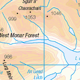
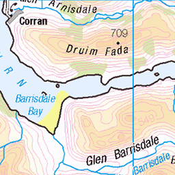
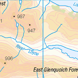
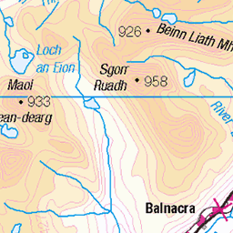
OS Map of Suie Dhu
Height: 614m / 2014ft • Prominence: 30m / 98ft • Summit : ground by small cairn • Trip reports (hill-bagging)

The top of the falls of Glomach
The Allt a' Ghlomaich just before it falls 113 meter down the Falls of Glomach, one of the highest waterfalls in the UK. www.nts.org.uk/visit/places/falls-of-glomach" rel="noreferrer nofollow www.nts.org.uk/visit/places/falls-of-glomach
04-May-24 • Kees Waterlander • flickr
capewrathtrail greatbritain grootbrittannië schotlandmei2024 scotlandmainland uk verenigdkoninkrijk waterfall waterval fallsofglomach kyle schotland 53745149480


Udea decrepitalis, Bealach na Sroine, Highland, Scotland
28-May-18 • Terathopius • flickr
udeadecrepitalis bealachnasroine crambidae spilomelinae highland scotland spring springwatch unitedkingdom greatbritain moth lepidoptera arthropod entomology insect invertebrate nature naturephotography naturaleza natureza wildlife wildlifephotography fauna animal macro closeup outside canon canon5d 44775828481

70.177 Satyr Pug (Eupithecia satyrata), Bealach na Sroine, Highland, Scotland
27-May-18 • Terathopius • flickr
satyrpug bealachnasroine geometridae larentiinae eupitheciasatyrata moth spring springwatch highland scotland unitedkingdom greatbritain macro closeup outside nature naturephotography naturaleza natureza wildlife wildlifephotography canon canon5d lepidoptera arthropod entomology insect invertebrate 44506974141
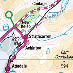
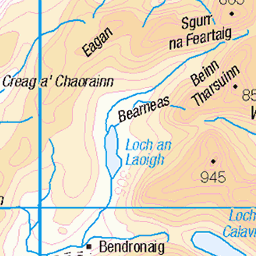
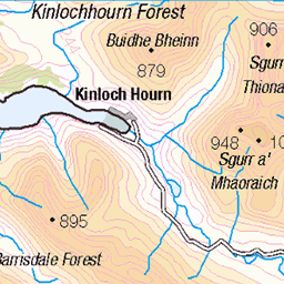
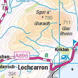
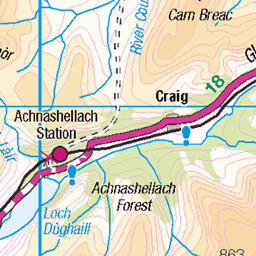
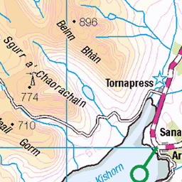
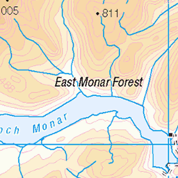
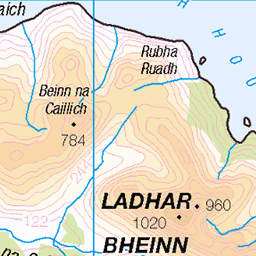
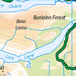
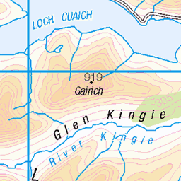
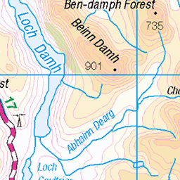
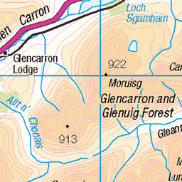
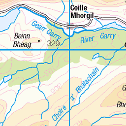
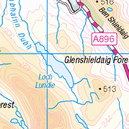
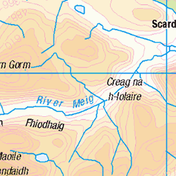
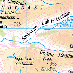
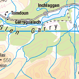
OS Map
This is OS mapping. In some areas, OpenStreetMap shows more footpaths
Spatial NI has online OSNI mapping. Click "Basemap Gallery" (4 squares icon at the top).
Now would be a good time for a cup of tea.


GPX Editor
Record map clicks
Reload map
Photos
Please tag your photos and upload them to the British and Irish Mountains group on Flickr
The other photos have been geo-tagged as on or around the summit. For less busy mountains, it can be a little hit and miss.
The top of the falls of Glomach
The Allt a' Ghlomaich just before it falls 113 meter down the Falls of Glomach, one of the highest waterfalls in the UK. www.nts.org.uk/visit/places/falls-of-glomach" rel="noreferrer nofollow www.nts.org.uk/visit/places/falls-of-glomach
04-May-24 • Kees Waterlander • flickr
capewrathtrail greatbritain grootbrittannië schotlandmei2024 scotlandmainland uk verenigdkoninkrijk waterfall waterval fallsofglomach kyle schotland 53745149480
Udea decrepitalis, Bealach na Sroine, Highland, Scotland
28-May-18 • Terathopius • flickr
udeadecrepitalis bealachnasroine crambidae spilomelinae highland scotland spring springwatch unitedkingdom greatbritain moth lepidoptera arthropod entomology insect invertebrate nature naturephotography naturaleza natureza wildlife wildlifephotography fauna animal macro closeup outside canon canon5d 44775828481
70.177 Satyr Pug (Eupithecia satyrata), Bealach na Sroine, Highland, Scotland
27-May-18 • Terathopius • flickr
satyrpug bealachnasroine geometridae larentiinae eupitheciasatyrata moth spring springwatch highland scotland unitedkingdom greatbritain macro closeup outside nature naturephotography naturaleza natureza wildlife wildlifephotography canon canon5d lepidoptera arthropod entomology insect invertebrate 44506974141

70.177 Satyr Pug (Eupithecia satyrata), Bealach na Sroine, Highland, Scotland
27-May-18 • Terathopius • flickr
satyrpug bealachnasroine geometridae larentiinae highland eupitheciasatyrata scotland greatbritain unitedkingdom moth lepidoptera arthropod entomology insect invertebrate macro closeup animal fauna wildlife wildlifephotography nature naturephotography naturaleza natureza outside canon canon5d 48028058472


Videos
None found
Notes
- Data: Database of British and Irish Hills v18.2
- Maps: We use OS mapping for England, Scotland, Wales, and the Isle of Man. Sadly, Channel Islands, Northern (OSNI) and Southern Ireland (OSI) mapping isn't available online, so we use Openstreetmap.