Hills of Britain and Ireland
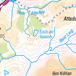
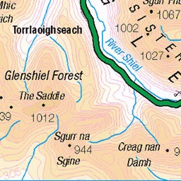
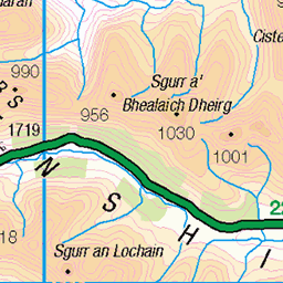
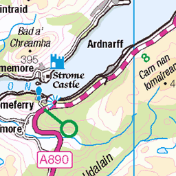
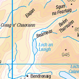
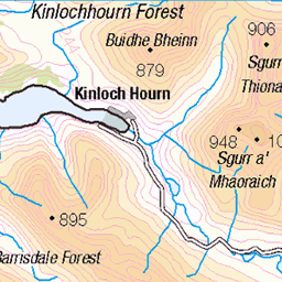
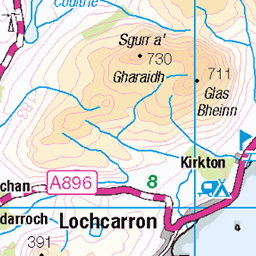
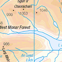
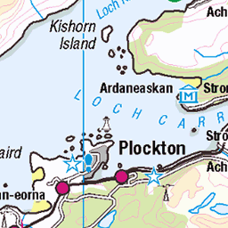
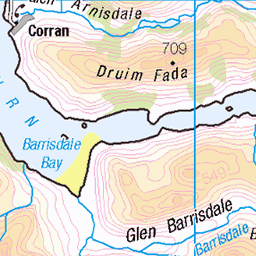
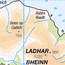
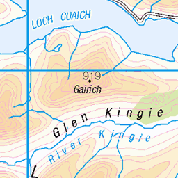
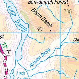
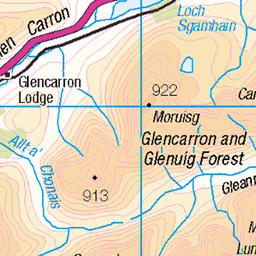
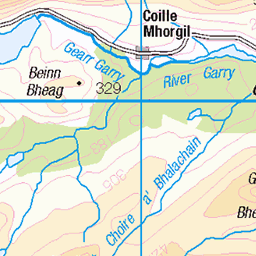
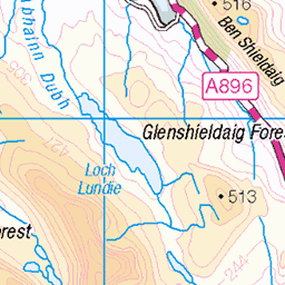
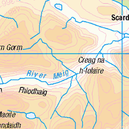
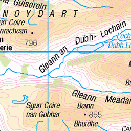
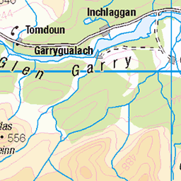
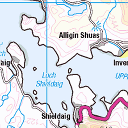
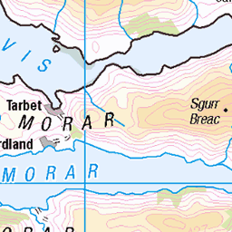
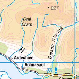
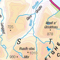
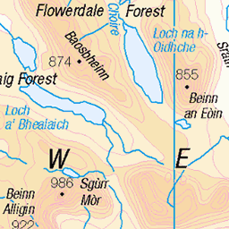
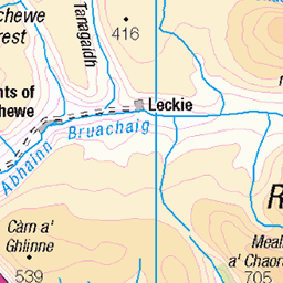
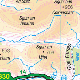
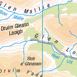
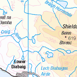
OS Map of Beinn Bhreac


Inverinate forest, Strath Croe, Scotland
Two weeks hiking in Scotland. Hikes 9 and 10 were from our base at Shiel Bridge. The weather turned to more typical West Highlands cloud and rain, but we still managed a couple of hikes to the Corbett Sgurr Gaorsaic and to The Falls of Glomach.
06-Sep-21 • Miche & Jon Rousell • flickr
scotland glen shiel shielbridge loch duich highland munro corbett sgurrgaorsaic waterfall glomach sky iphone iphonography iphone8 51656803891


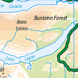
View southeast from footpath between Beinn Bhreac and Carnan Cruithneachd.
View southeast from footpath between Beinn Bhreac and Carnan Cruithneachd. Showing A' Mhuc and Beinn Bhuidhe, with Sgurr na Moraich, Beinn Bhuidhe, and Sgurr nan Saighead in the distance. Lowe Alpine Mountain Marathon 2009, Morvich, Kintail
07-Jun-09 • jameshead • flickr
geotagged scotland unitedkingdom highland gbr kintail lamm mountainmarathon beinnbhreac morvich beinnbhuidhe lowealpinemountainmarathon sgurrnansaighead sgurrnamoraich amhuc carnancruithneachd geo:lat=5726707075 geo:lon=534476280 3627106208

Andrew walking south down the footpath between Beinn Bhreac and Carnan Cruithneachd.
Andrew walking south down the footpath between Beinn Bhreac and Carnan Cruithneachd. Lowe Alpine Mountain Marathon 2009, Morvich, Kintail
07-Jun-09 • jameshead • flickr
geotagged scotland unitedkingdom highland gbr kintail lamm mountainmarathon morvich lowealpinemountainmarathon andrewhead geo:lat=5726707075 geo:lon=534476280 3626292033
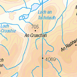
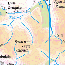
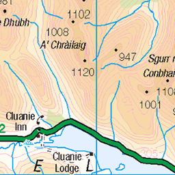
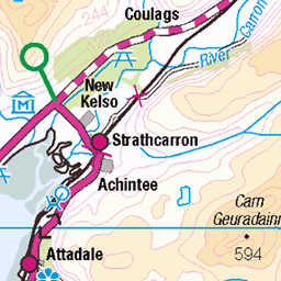
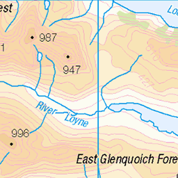
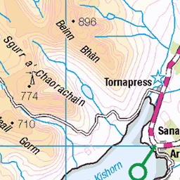
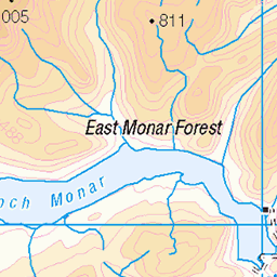
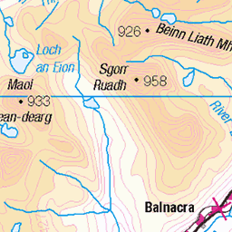
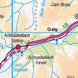
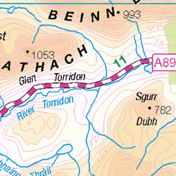
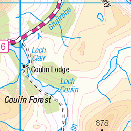
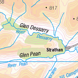
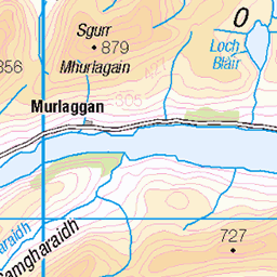
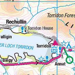
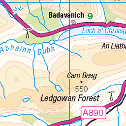
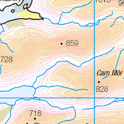
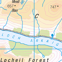
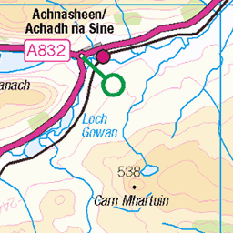
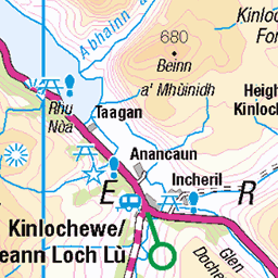
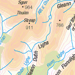
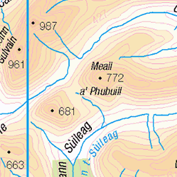
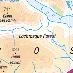
OS Map
This is OS mapping. In some areas, OpenStreetMap shows more footpaths
Spatial NI has online OSNI mapping. Click "Basemap Gallery" (4 squares icon at the top).
Now would be a good time for a cup of tea.


GPX Editor
Record map clicks
Reload map
Photos
Please tag your photos and upload them to the British and Irish Mountains group on Flickr
The other photos have been geo-tagged as on or around the summit. For less busy mountains, it can be a little hit and miss.
Inverinate forest, Strath Croe, Scotland
Two weeks hiking in Scotland. Hikes 9 and 10 were from our base at Shiel Bridge. The weather turned to more typical West Highlands cloud and rain, but we still managed a couple of hikes to the Corbett Sgurr Gaorsaic and to The Falls of Glomach.
06-Sep-21 • Miche & Jon Rousell • flickr
scotland glen shiel shielbridge loch duich highland munro corbett sgurrgaorsaic waterfall glomach sky iphone iphonography iphone8 51656803891
View southeast from footpath between Beinn Bhreac and Carnan Cruithneachd.
View southeast from footpath between Beinn Bhreac and Carnan Cruithneachd. Showing A' Mhuc and Beinn Bhuidhe, with Sgurr na Moraich, Beinn Bhuidhe, and Sgurr nan Saighead in the distance. Lowe Alpine Mountain Marathon 2009, Morvich, Kintail
07-Jun-09 • jameshead • flickr
geotagged scotland unitedkingdom highland gbr kintail lamm mountainmarathon beinnbhreac morvich beinnbhuidhe lowealpinemountainmarathon sgurrnansaighead sgurrnamoraich amhuc carnancruithneachd geo:lat=5726707075 geo:lon=534476280 3627106208
Andrew walking south down the footpath between Beinn Bhreac and Carnan Cruithneachd.
Andrew walking south down the footpath between Beinn Bhreac and Carnan Cruithneachd. Lowe Alpine Mountain Marathon 2009, Morvich, Kintail
07-Jun-09 • jameshead • flickr
geotagged scotland unitedkingdom highland gbr kintail lamm mountainmarathon morvich lowealpinemountainmarathon andrewhead geo:lat=5726707075 geo:lon=534476280 3626292033

Andrew's refreshment stop along the LAMM
Andrew's refreshment stop along the LAMM. Lowe Alpine Mountain Marathon 2009, Morvich, Kintail
07-Jun-09 • jameshead • flickr
geotagged scotland unitedkingdom highland gbr kintail lamm mountainmarathon morvich lowealpinemountainmarathon andrewhead geo:lat=5725987639 geo:lon=534514904 3626292829

The Antler we found on Beinn Bhuidhe
The Antler we found on Beinn Bhuidhe. Lowe Alpine Mountain Marathon 2009, Morvich, Kintail
07-Jun-09 • jameshead • flickr
geotagged scotland unitedkingdom highland gbr kintail lamm deerantler mountainmarathon morvich beinnbhuidhe lowealpinemountainmarathon geo:lat=5725987639 geo:lon=534514904 3627108256

The Antler we found on Beinn Bhuidhe
The Antler we found on Beinn Bhuidhe. Lowe Alpine Mountain Marathon 2009, Morvich, Kintail
07-Jun-09 • jameshead • flickr
geotagged scotland unitedkingdom highland gbr kintail lamm deerantler mountainmarathon morvich beinnbhuidhe lowealpinemountainmarathon geo:lat=5725987639 geo:lon=534514904 3627109344

The last tree standing
This was the last tree on the hill we were climbing. Although it appeared nearly dead, it made quite an impact against the empty sky behind it. Canon EOS 5D Mark II with Canon EF 24-105 f/4L IS Post processing: Crop, localized curves, texture, colour filter, composited moon www.fluidr.com/photos/sidaths/5077553829/" rel="nofollow view this photo large
scotland highlands texture square flong tree moon manip decent cameracanon5d2 5077553829
Videos
None found
Notes
- Data: Database of British and Irish Hills v18.2
- Maps: We use OS mapping for England, Scotland, Wales, and the Isle of Man. Sadly, Channel Islands, Northern (OSNI) and Southern Ireland (OSI) mapping isn't available online, so we use Openstreetmap.