Hills of Britain and Ireland
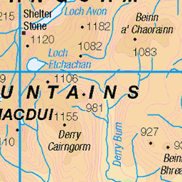
OS Map of Meall an t-Seangain
Height: 629m / 2064ft • Prominence: 65m / 213ft • Summit : embedded rock • Trip reports (hill-bagging)

Builg burn
21-Jun-23 • AndrewSpink • flickr
geo:lat=5713823450 geo:lon=335559840 geotagged gbr inchrory scotland speysideglenlivetward unitedkingdom 52997907130

Loch Builg
21-Jun-23 • AndrewSpink • flickr
geo:lat=5712232080 geo:lon=334445360 geotagged aboyneupperdeesideanddonsideward gbr inchrory scotland unitedkingdom aboyneupperdeesideanddonsid 52996935552

P23 Spiderman on Cairn Culchavie
Found on the high moorland leading to the Brown Cow.
09-Jul-18 • Grahamtravels • flickr
45270279491

P24 Well of Don
The grassy area in the middle appears to be regarded as the source of the River Don, Well of Don on the western slopes of the Brown Cow.
09-Jul-18 • Grahamtravels • flickr
44548236394

P27 Loch Builg from Meikle Geal Charn
A view of lonely Loch Builg, far up Glen Gairn, at the foot of Ben Avon.
09-Jul-18 • Grahamtravels • flickr
31396053608

P28 Glen Avon from Meikle Geal Charn
The section of Glen Avon leading from Inchrory to Tomintoul.
09-Jul-18 • Grahamtravels • flickr
44358402495
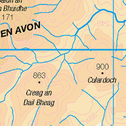
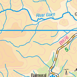
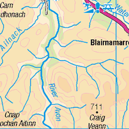
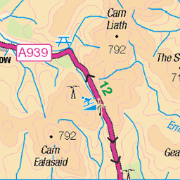
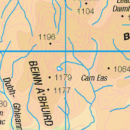
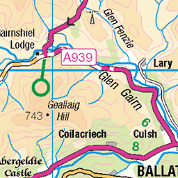
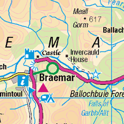
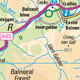
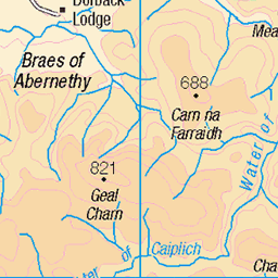
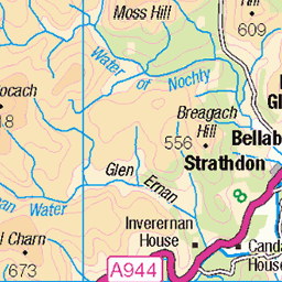
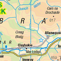
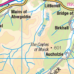
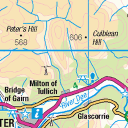
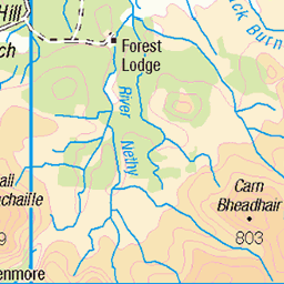
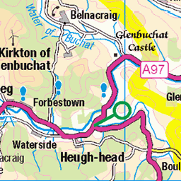
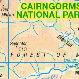
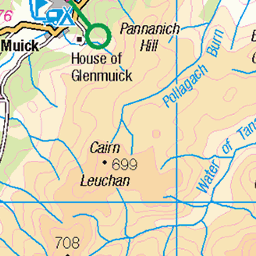
OS Map
This is OS mapping. In some areas, OpenStreetMap shows more footpaths
Spatial NI has online OSNI mapping. Click "Basemap Gallery" (4 squares icon at the top).
Now would be a good time for a cup of tea.
GPX Editor
Record map clicks
Reload map
Photos
Please tag your photos and upload them to the British and Irish Mountains group on Flickr
The other photos have been geo-tagged as on or around the summit. For less busy mountains, it can be a little hit and miss.
Builg burn
21-Jun-23 • AndrewSpink • flickr
geo:lat=5713823450 geo:lon=335559840 geotagged gbr inchrory scotland speysideglenlivetward unitedkingdom 52997907130
Loch Builg
21-Jun-23 • AndrewSpink • flickr
geo:lat=5712232080 geo:lon=334445360 geotagged aboyneupperdeesideanddonsideward gbr inchrory scotland unitedkingdom aboyneupperdeesideanddonsid 52996935552
P23 Spiderman on Cairn Culchavie
Found on the high moorland leading to the Brown Cow.
09-Jul-18 • Grahamtravels • flickr
45270279491
P24 Well of Don
The grassy area in the middle appears to be regarded as the source of the River Don, Well of Don on the western slopes of the Brown Cow.
09-Jul-18 • Grahamtravels • flickr
44548236394
P27 Loch Builg from Meikle Geal Charn
A view of lonely Loch Builg, far up Glen Gairn, at the foot of Ben Avon.
09-Jul-18 • Grahamtravels • flickr
31396053608
P28 Glen Avon from Meikle Geal Charn
The section of Glen Avon leading from Inchrory to Tomintoul.
09-Jul-18 • Grahamtravels • flickr
44358402495

P29 Ben Avon
The view west to Ben Avon from the Brown Cow.
09-Jul-18 • Grahamtravels • flickr
31396014948


Videos
None found
Notes
- Data: Database of British and Irish Hills v18.2
- Maps: We use OS mapping for England, Scotland, Wales, and the Isle of Man. Sadly, Channel Islands, Northern (OSNI) and Southern Ireland (OSI) mapping isn't available online, so we use Openstreetmap.