Hills of Britain and Ireland
OS Map of A' Chaoirnich (Maol Creag an Loch)
Height: 876m / 2873ft • Prominence: 214m / 702ft • Summit : cairn and ground to 5m W • Trip reports (hill-bagging)
In the middle of Gaick Forest
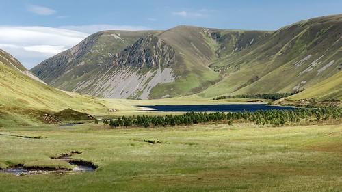
25-Jul-19 • Paweł Błaszak • flickr
uk grampians landscape mountains nature scotland 49573922211

We're again fording streams that have become rivers
With all the rain lately the boggy sections of the trail are extremely soggy and the stream crossings deeper and faster. Scouting a crossing reminds me of scouting rapids when whitewater canoeing :)
03-Jun-19 • k mceachern • flickr
48011746457


OS Map
This is OS mapping. In some areas, OpenStreetMap shows more footpaths
Spatial NI has online OSNI mapping. Click "Basemap Gallery" (4 squares icon at the top).
Now would be a good time for a cup of tea.
GPX Editor
Record map clicks
Reload map
Photos
Please tag your photos and upload them to the British and Irish Mountains group on Flickr
The other photos have been geo-tagged as on or around the summit. For less busy mountains, it can be a little hit and miss.
In the middle of Gaick Forest
25-Jul-19 • Paweł Błaszak • flickr
uk grampians landscape mountains nature scotland 49573922211
We're again fording streams that have become rivers
With all the rain lately the boggy sections of the trail are extremely soggy and the stream crossings deeper and faster. Scouting a crossing reminds me of scouting rapids when whitewater canoeing :)
03-Jun-19 • k mceachern • flickr
48011746457

P17 Grassy flats at N end of Loch an Duin
After passing Loch an Duin the route crosses grassy flats as the Allt Loch an Duin emerges from the loch flowing northwards.
06-Aug-09 • Grahamtravels • flickr
6298769025

P18 Ford Allt Loch an Duin
The burn has to be forded but was not deep. But it is in remote country and care needs to be taken.
06-Aug-09 • Grahamtravels • flickr
6299304644

P19 Start of track heading N
A track is found heading north once the Allt Loch an Duin has been forded.
06-Aug-09 • Grahamtravels • flickr
6298773393

Videos
As Scotland eased its travel restrictions I started to plan to venture further a field once again. Not wanting to travel to far I decided ...
Notes
- Data: Database of British and Irish Hills v18.2
- Maps: We use OS mapping for England, Scotland, Wales, and the Isle of Man. Sadly, Channel Islands, Northern (OSNI) and Southern Ireland (OSI) mapping isn't available online, so we use Openstreetmap.