Hills of Britain and Ireland
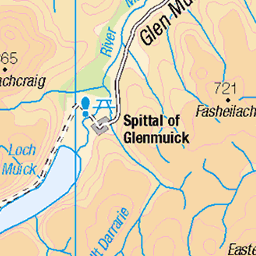
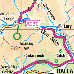
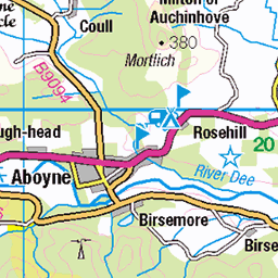
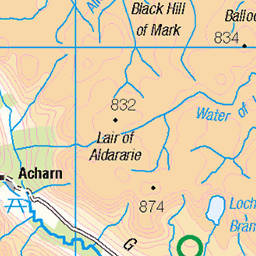
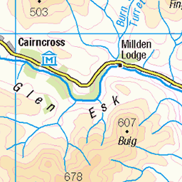
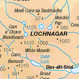
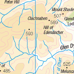
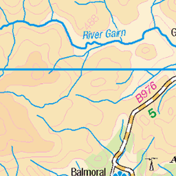
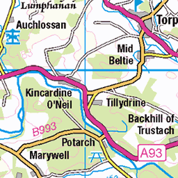
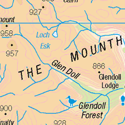
OS Map of Black Craig
Height: 640m / 2100ft • Prominence: 81m / 266ft • Summit : embedded boulder • Trip reports (hill-bagging)

Abode With Me
After cycling 7 miles up the gravel track in Glen Tanar we come across this rather remote cottage set among the Scottish Highlands. A lovely place, but a bugger if you've forgotten to get the milk! We're nearly at the foot of Mount Keen now though, so gotta keep moving. Mount Keen is my 11th Munro and this is my second time of climbing it. It is the most easterly of all the Munros and stands at 939 Meters (3080 feet), forming an almost perfect cone. A 7 mile cycle up Glen Tanar gets us to the foot of the 2 mile ascent up the mountain.
19-Sep-20 • steve_whitmarsh • flickr
mountkeen aberdeenshire scotland scottishhighlands highlands cairngorms landscape glen glentanar mountain hills panorama topic 50384949653


Under the milky way tonight
View from the bivi. A good night under the stars.
23-Aug-15 • We travel the Spaceways • flickr
stars 20845771255

The Water of Tanar
Long exposure of some falls on the Water of Tanar in Glen Tanar
02-Jan-12 • Nick Bramhall • flickr
longexposure river waterfall sh 6622704521


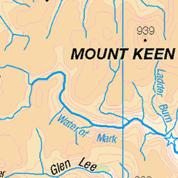
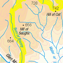
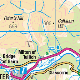
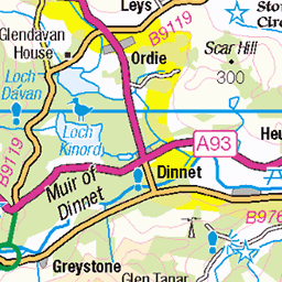
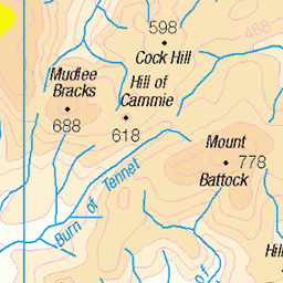
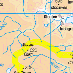
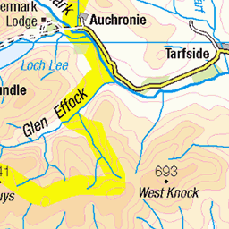
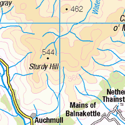
OS Map
This is OS mapping. In some areas, OpenStreetMap shows more footpaths
Spatial NI has online OSNI mapping. Click "Basemap Gallery" (4 squares icon at the top).
Now would be a good time for a cup of tea.
GPX Editor
Record map clicks
Reload map
Photos
Please tag your photos and upload them to the British and Irish Mountains group on Flickr
The other photos have been geo-tagged as on or around the summit. For less busy mountains, it can be a little hit and miss.
Abode With Me
After cycling 7 miles up the gravel track in Glen Tanar we come across this rather remote cottage set among the Scottish Highlands. A lovely place, but a bugger if you've forgotten to get the milk! We're nearly at the foot of Mount Keen now though, so gotta keep moving. Mount Keen is my 11th Munro and this is my second time of climbing it. It is the most easterly of all the Munros and stands at 939 Meters (3080 feet), forming an almost perfect cone. A 7 mile cycle up Glen Tanar gets us to the foot of the 2 mile ascent up the mountain.
19-Sep-20 • steve_whitmarsh • flickr
mountkeen aberdeenshire scotland scottishhighlands highlands cairngorms landscape glen glentanar mountain hills panorama topic 50384949653
Under the milky way tonight
View from the bivi. A good night under the stars.
23-Aug-15 • We travel the Spaceways • flickr
stars 20845771255
The Water of Tanar
Long exposure of some falls on the Water of Tanar in Glen Tanar
02-Jan-12 • Nick Bramhall • flickr
longexposure river waterfall sh 6622704521


Videos
None found
Notes
- Data: Database of British and Irish Hills v18.2
- Maps: We use OS mapping for England, Scotland, Wales, and the Isle of Man. Sadly, Channel Islands, Northern (OSNI) and Southern Ireland (OSI) mapping isn't available online, so we use Openstreetmap.