Hills of Britain and Ireland
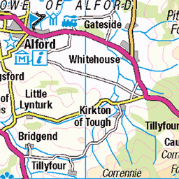
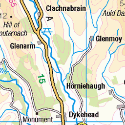
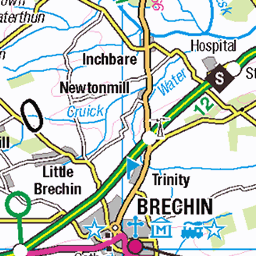
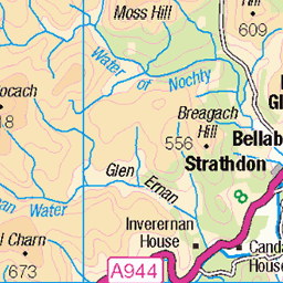
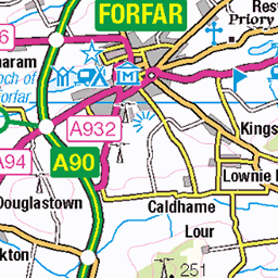
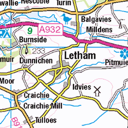
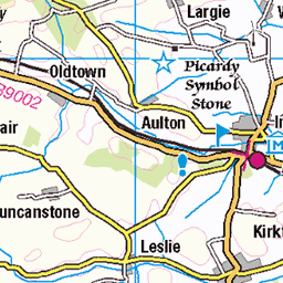
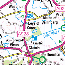
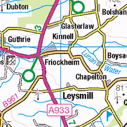
OS Map of Gannoch

Visit to Hill of Cat for sunset
Can't remember another hill with two trigs on the top. The remains of the old one lay just behind.
01-Oct-22 • We travel the Spaceways • flickr
52399001690

Dark now by the time we reached Gannoch
A good walk back along the old Firmount Road to Glen Tanar. Stars were great tonight.
01-Oct-22 • We travel the Spaceways • flickr
52399001470

The long walk out
A beautiful sunny morning to come down from the hilltops.
12-Jun-21 • We travel the Spaceways • flickr
51242970529

P3027080
Summit of Mount Keen. Too cold to take any more photos!
02-Mar-14 • rum-doodle • flickr
12884474113


P23 Second ford on path
There are a couple of minor fords on the path which have stepping stones.
23-Jan-09 • Grahamtravels • flickr
6223325259
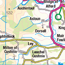
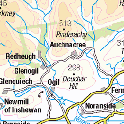
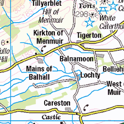
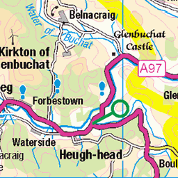
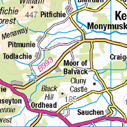
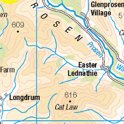
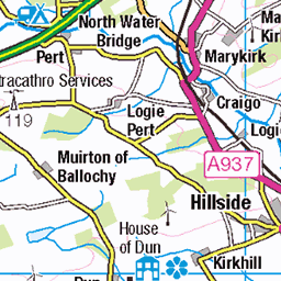
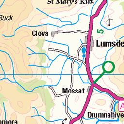
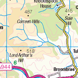
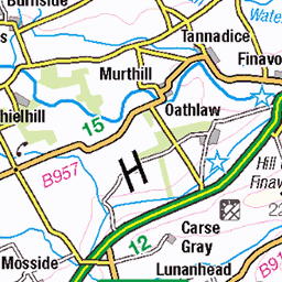
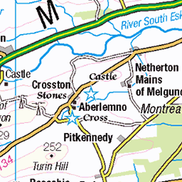
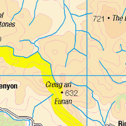
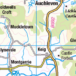
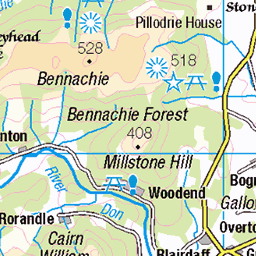
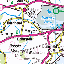
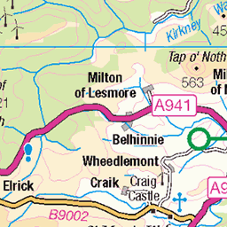
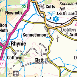
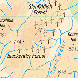
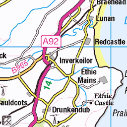
OS Map
This is OS mapping. In some areas, OpenStreetMap shows more footpaths
Spatial NI has online OSNI mapping. Click "Basemap Gallery" (4 squares icon at the top).
Now would be a good time for a cup of tea.


GPX Editor
Record map clicks
Reload map
Photos
Please tag your photos and upload them to the British and Irish Mountains group on Flickr
The other photos have been geo-tagged as on or around the summit. For less busy mountains, it can be a little hit and miss.
Visit to Hill of Cat for sunset
Can't remember another hill with two trigs on the top. The remains of the old one lay just behind.
01-Oct-22 • We travel the Spaceways • flickr
52399001690
Dark now by the time we reached Gannoch
A good walk back along the old Firmount Road to Glen Tanar. Stars were great tonight.
01-Oct-22 • We travel the Spaceways • flickr
52399001470
The long walk out
A beautiful sunny morning to come down from the hilltops.
12-Jun-21 • We travel the Spaceways • flickr
51242970529
P3027080
Summit of Mount Keen. Too cold to take any more photos!
02-Mar-14 • rum-doodle • flickr
12884474113
P23 Second ford on path
There are a couple of minor fords on the path which have stepping stones.
23-Jan-09 • Grahamtravels • flickr
6223325259

P22 Path near watershed
This path descends towards Birse.
23-Jan-09 • Grahamtravels • flickr
6223847652

P21 Path on watershed
At this watershed a modern footpath is met which heads to wards Birse.
23-Jan-09 • Grahamtravels • flickr
6223849554

P20 Mounth pass with marker stones
At the highest point of the Fungle between Glen Esk and Birse the road appears to have stone markers.
23-Jan-09 • Grahamtravels • flickr
6223851340

S6949 - Hill of Cat
NJ484871, LR44. HISTORY Pillar completed 27th July 1952, cost not on record. Computed as secondary triangulation station NJ40/2 within the Ballater secondary block and levelled to second class precision during 1956. This station was also used for the reconnaissance of secondary block NO46 (Forfar) during 1956. This pillar station was last maintained by the Ordnance Survey in August 1973. SITE VISIT Overall approach from the north. Walked from Aboyne, over Bridge of Tanar, up via the Firmounth Road to the bealach then made a bee line for the summit. The remains of an abandoned trig pillar lying nearby. The present pillar is in good condition, but the scrapped pillar retains more paint. The flush bracket was obviously reused in the present pillar. Spider centre open. The flush bracket faces NNW. A recent visitor had created their own monument on top of the pillar from large stones and part of the ruined deer fence nearby. Visited in gloomy but clear conditions. Decended back to Aboyne via Glen Tanar and Creag na Slice. Photographed: 16th July 2001, GRP. ═════════════════════════ Interactive index: www.google.com/maps/d/viewer?mid=1arx2Qmo5mVeVUJA2lzVG_uzbYPW59ffh&ll=56.972829,-2.849091&z=12" rel="noreferrer nofollow Google My Maps Map: www.flickr.com/photos/13460108@N06/41110925871/in/album-72157692190778971/ Trig Pillars on OS Landranger 44 ═════════════════════════ Neighbouring Triangulation Pillars www.flickr.com/photos/13460108@N06/7905744810/in/album-72157631348956488/ S1584 - Mount Battock : 4.36 miles to the east. www.flickr.com/photos/13460108@N06/8109926021/in/album-72157631821839859/ S8708 - Carn Ferg : 4.49 miles to the northeast. www.flickr.com/photos/13460108@N06/8100896333/in/album-72157631801120468/ S7047 - Mount Keen : 4.71 miles to the west. www.flickr.com/photos/13460108@N06/8109906777/in/album-72157631821839859/ S8697 - Creag Na Slice : 5.64 miles to the north. www.flickr.com/photos/13460108@N06/8094744754/in/album-72157631778814317/ S5858 - Peter Hill : 5.84 miles to the east. www.flickr.com/photos/13460108@N06/8100917586/in/album-72157631801120468/ S7122 - Cairn Caidloch : 6.42 miles to the southwest. ═════════════════════════
16-Jul-01 • Graeme5015 • flickr
hillofcat s6949 8098097807
Videos
None found
Notes
- Data: Database of British and Irish Hills v18.2
- Maps: We use OS mapping for England, Scotland, Wales, and the Isle of Man. Sadly, Channel Islands, Northern (OSNI) and Southern Ireland (OSI) mapping isn't available online, so we use Openstreetmap.