Hills of Britain and Ireland
OS Map of Tom Anthon
Height: 633m / 2078ft • Prominence: 95m / 312ft • Summit : vegetated rock • Trip reports (hill-bagging)


Victoria Bridge and Mar Lodge Gatehouse
marlodge victoriabridge victoria bridge 54373284281

Victoria Bridge and Mar Lodge Gatehouse
marlodge victoriabridge victoria bridge 54372408192


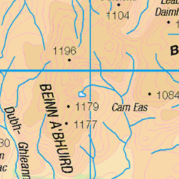
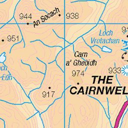
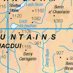
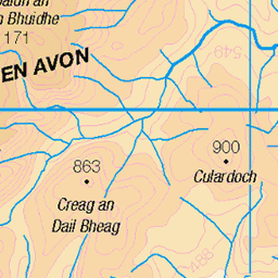
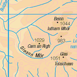
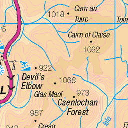
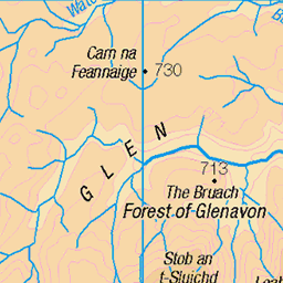
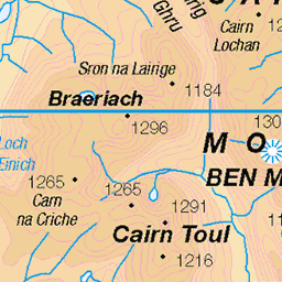
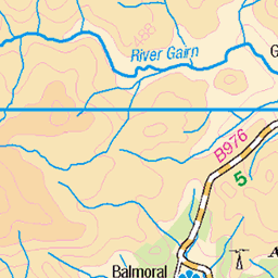
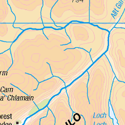
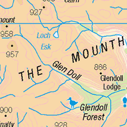
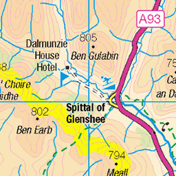
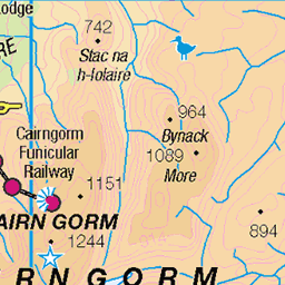
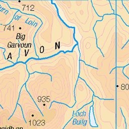
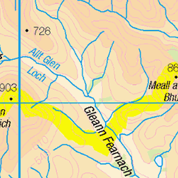
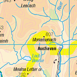
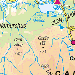
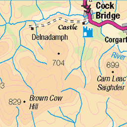
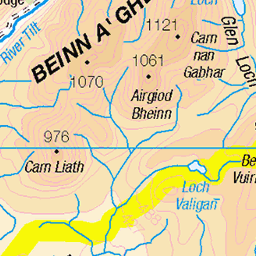
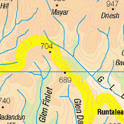
OS Map
This is OS mapping. In some areas, OpenStreetMap shows more footpaths
Spatial NI has online OSNI mapping. Click "Basemap Gallery" (4 squares icon at the top).
Now would be a good time for a cup of tea.
GPX Editor
Record map clicks
Reload map
Photos
Please tag your photos and upload them to the British and Irish Mountains group on Flickr
The other photos have been geo-tagged as on or around the summit. For less busy mountains, it can be a little hit and miss.
Victoria Bridge and Mar Lodge Gatehouse
marlodge victoriabridge victoria bridge 54373284281
Victoria Bridge and Mar Lodge Gatehouse
marlodge victoriabridge victoria bridge 54372408192


Victoria Bridge and Mar Lodge Gatehouse
marlodge victoriabridge victoria bridge 54373283806


Victoria Bridge, Mar Lodge , Braemar..
ballater scotland victoriabridge marlodge scottishhighlands cairngorms cairngormsnationalpark 53279652769
Videos
None found
Notes
- Data: Database of British and Irish Hills v18.2
- Maps: We use OS mapping for England, Scotland, Wales, and the Isle of Man. Sadly, Channel Islands, Northern (OSNI) and Southern Ireland (OSI) mapping isn't available online, so we use Openstreetmap.