Hills of Britain and Ireland
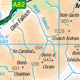
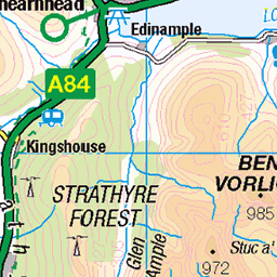
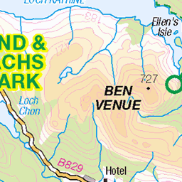
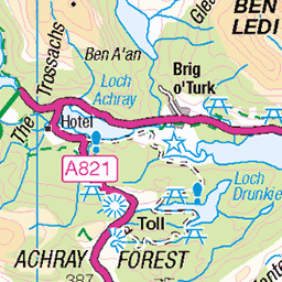
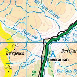
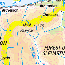
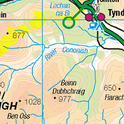
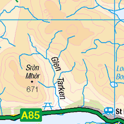
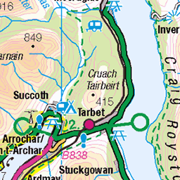
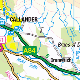
OS Map of Creagan nan Sgiath
Height: 697m / 2287ft • Prominence: 112m / 367ft • Summit : no feature • Trip reports (hill-bagging)

Craig Shuttleton - Peatland Restoration Loch Katrine 1
21-Sep-23 • George Leslie - Est 1964 • flickr
engineering scotland marine water power energy renewables 53769164758

photo
27-May-13 • maddalenasabbatino • flickr
uploaded:by=flickrmobile flickriosapp:filter=nofilter 9263093437


Shooting on the Mell
What a fantastic hike today. Following the track from Glen Finglas on a sixteen mile route, that goes round Meall Cala and rises to 600 metres before dropping back down to the Glen Finglas Reservoir and back to the car. Ian and Martin doing some Raven spotting.
10-Dec-12 • David..Henderson • flickr
snow mountains landscape photography scotland highlands hiking hills trossachs hillwalking themell 8261741161

Paradise in the Trossachs
Further round The Mell with Ian and Martin and starting to drop down again. If you are a Hiker and have never been here, then you have to check it out.
10-Dec-12 • David..Henderson • flickr
scotland countryside highlands hiking hills trossachs hillwalking themell 8262840142
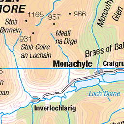
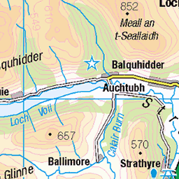
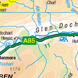
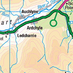
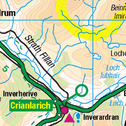
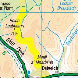
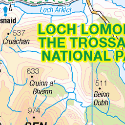
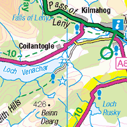
OS Map
This is OS mapping. In some areas, OpenStreetMap shows more footpaths
Spatial NI has online OSNI mapping. Click "Basemap Gallery" (4 squares icon at the top).
Now would be a good time for a cup of tea.
GPX Editor
Record map clicks
Reload map
Photos
Please tag your photos and upload them to the British and Irish Mountains group on Flickr
The other photos have been geo-tagged as on or around the summit. For less busy mountains, it can be a little hit and miss.
Craig Shuttleton - Peatland Restoration Loch Katrine 1
21-Sep-23 • George Leslie - Est 1964 • flickr
engineering scotland marine water power energy renewables 53769164758
photo
27-May-13 • maddalenasabbatino • flickr
uploaded:by=flickrmobile flickriosapp:filter=nofilter 9263093437
Shooting on the Mell
What a fantastic hike today. Following the track from Glen Finglas on a sixteen mile route, that goes round Meall Cala and rises to 600 metres before dropping back down to the Glen Finglas Reservoir and back to the car. Ian and Martin doing some Raven spotting.
10-Dec-12 • David..Henderson • flickr
snow mountains landscape photography scotland highlands hiking hills trossachs hillwalking themell 8261741161
Paradise in the Trossachs
Further round The Mell with Ian and Martin and starting to drop down again. If you are a Hiker and have never been here, then you have to check it out.
10-Dec-12 • David..Henderson • flickr
scotland countryside highlands hiking hills trossachs hillwalking themell 8262840142
Videos
None found
Notes
- Data: Database of British and Irish Hills v18.2
- Maps: We use OS mapping for England, Scotland, Wales, and the Isle of Man. Sadly, Channel Islands, Northern (OSNI) and Southern Ireland (OSI) mapping isn't available online, so we use Openstreetmap.