Hills of Britain and Ireland
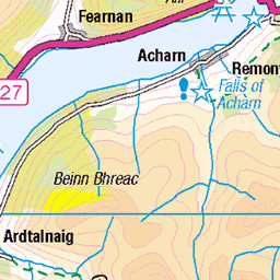
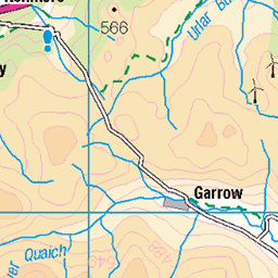
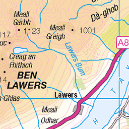
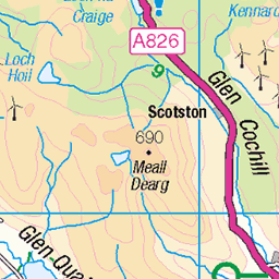
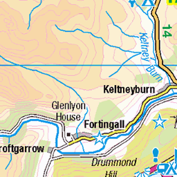
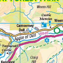
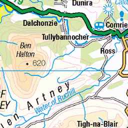
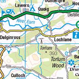
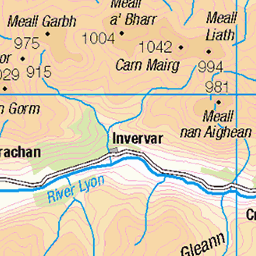
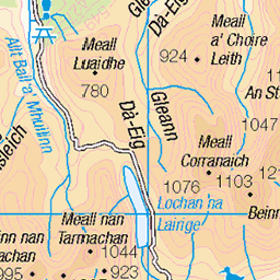
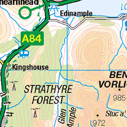
OS Map of Biorach a' Mheannain
Height: 755m / 2477ft • Prominence: 52m / 171ft • Summit : grass-covered outcrop • Trip reports (hill-bagging)


on Ben Chonzie
Testing a new polarising filter
27-Feb-22 • Salty Bear • flickr
scotland scottishcountrysideinwinter scottishhills scottishlandscape hillwalking fuji fujixf1855mm fujixt30 52677438424

View north from Ben Chonzie, Scotland
Two weeks hiking in Scotland. We drove from Dumfries to Stirling and on to Aberfeldy. Our second hike took us to Glen Turret where we hiked a circular route from the dam at the head of Loch Turret to Ben Chonzie and back.
28-Aug-21 • Miche & Jon Rousell • flickr
scotland perthshire stirling aberfeldy glenturret lochturret chonzie benchonzie carnchois water refection blue sky 51678398307

Glen Turret and Loch Turret from Ben Chonzie, Scotland
Two weeks hiking in Scotland. We drove from Dumfries to Stirling and on to Aberfeldy. Our second hike took us to Glen Turret where we hiked a circular route from the dam at the head of Loch Turret to Ben Chonzie and back.
28-Aug-21 • Miche & Jon Rousell • flickr
scotland perthshire stirling aberfeldy glenturret lochturret chonzie benchonzie carnchois water refection blue sky 51680086770

Glen Turret, Lochan Uaine and Loch Turret, Perthshire, Scotland
Two weeks hiking in Scotland. We drove from Dumfries to Stirling and on to Aberfeldy. Our second hike took us to Glen Turret where we hiked a circular route from the dam at the head of Loch Turret to Ben Chonzie and back.
28-Aug-21 • Miche & Jon Rousell • flickr
scotland perthshire stirling aberfeldy glenturret lochturret chonzie benchonzie carnchois water refection blue sky iphone iphonography iphone11 51631849000
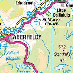
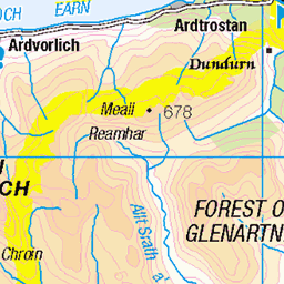
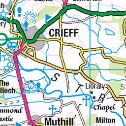
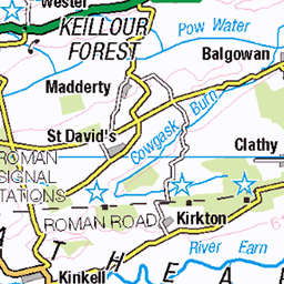
OS Map
This is OS mapping. In some areas, OpenStreetMap shows more footpaths
Spatial NI has online OSNI mapping. Click "Basemap Gallery" (4 squares icon at the top).
Now would be a good time for a cup of tea.
GPX Editor
Record map clicks
Reload map
Photos
Please tag your photos and upload them to the British and Irish Mountains group on Flickr
The other photos have been geo-tagged as on or around the summit. For less busy mountains, it can be a little hit and miss.
on Ben Chonzie
Testing a new polarising filter
27-Feb-22 • Salty Bear • flickr
scotland scottishcountrysideinwinter scottishhills scottishlandscape hillwalking fuji fujixf1855mm fujixt30 52677438424
View north from Ben Chonzie, Scotland
Two weeks hiking in Scotland. We drove from Dumfries to Stirling and on to Aberfeldy. Our second hike took us to Glen Turret where we hiked a circular route from the dam at the head of Loch Turret to Ben Chonzie and back.
28-Aug-21 • Miche & Jon Rousell • flickr
scotland perthshire stirling aberfeldy glenturret lochturret chonzie benchonzie carnchois water refection blue sky 51678398307
Glen Turret and Loch Turret from Ben Chonzie, Scotland
Two weeks hiking in Scotland. We drove from Dumfries to Stirling and on to Aberfeldy. Our second hike took us to Glen Turret where we hiked a circular route from the dam at the head of Loch Turret to Ben Chonzie and back.
28-Aug-21 • Miche & Jon Rousell • flickr
scotland perthshire stirling aberfeldy glenturret lochturret chonzie benchonzie carnchois water refection blue sky 51680086770
Glen Turret, Lochan Uaine and Loch Turret, Perthshire, Scotland
Two weeks hiking in Scotland. We drove from Dumfries to Stirling and on to Aberfeldy. Our second hike took us to Glen Turret where we hiked a circular route from the dam at the head of Loch Turret to Ben Chonzie and back.
28-Aug-21 • Miche & Jon Rousell • flickr
scotland perthshire stirling aberfeldy glenturret lochturret chonzie benchonzie carnchois water refection blue sky iphone iphonography iphone11 51631849000


Loch Turret Reservoir and Barons Haugh March 21
Red Kites
01-Mar-21 • Rushfan 91 • flickr
51001513901


Ben Lawers range
Ben Lawers range from Ben Chonzie
uk britain scotland highlands mountain munro bw blackandwhite 50510924587
Videos
None found
Notes
- Data: Database of British and Irish Hills v18.2
- Maps: We use OS mapping for England, Scotland, Wales, and the Isle of Man. Sadly, Channel Islands, Northern (OSNI) and Southern Ireland (OSI) mapping isn't available online, so we use Openstreetmap.