Hills of Britain and Ireland
OS Map of Beinn Eibhinn
Height: 1103m / 3620ft • Prominence: 127m / 417ft • Summit : cairn 170m E of larger cairn • Trip reports (hill-bagging)


IMG_2421
Aonach Beag - 1116m A marvellous, remote Munro
07-Jun-22 • Powsers Mountaineering Club • flickr
52460829899


IMG_2425
Beinn Eibhinn summit view back to Aonach Beag
07-Jun-22 • Powsers Mountaineering Club • flickr
52460046712

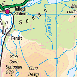
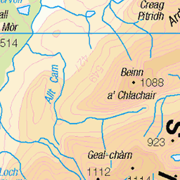
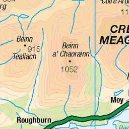
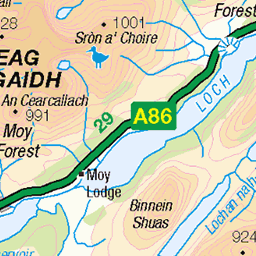
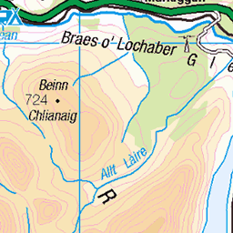
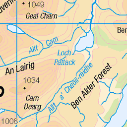
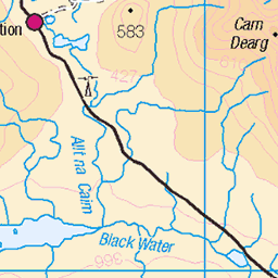
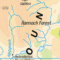
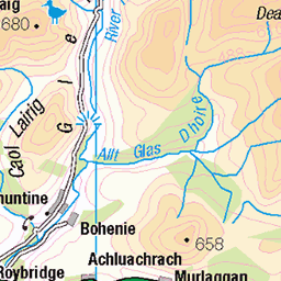
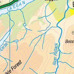
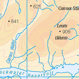
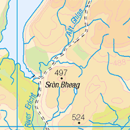
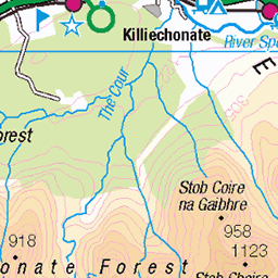
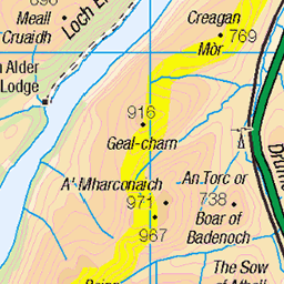
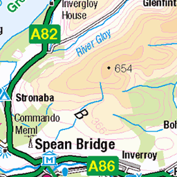
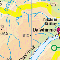
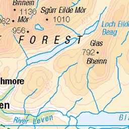
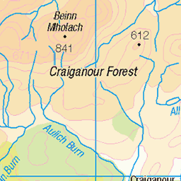
OS Map
This is OS mapping. In some areas, OpenStreetMap shows more footpaths
Spatial NI has online OSNI mapping. Click "Basemap Gallery" (4 squares icon at the top).
Now would be a good time for a cup of tea.
GPX Editor
Record map clicks
Reload map
Photos
Please tag your photos and upload them to the British and Irish Mountains group on Flickr
The other photos have been geo-tagged as on or around the summit. For less busy mountains, it can be a little hit and miss.
IMG_2421
Aonach Beag - 1116m A marvellous, remote Munro
07-Jun-22 • Powsers Mountaineering Club • flickr
52460829899
IMG_2425
Beinn Eibhinn summit view back to Aonach Beag
07-Jun-22 • Powsers Mountaineering Club • flickr
52460046712

IMG_2428
View from Eibhinn SW to Loch Ossian
07-Jun-22 • Powsers Mountaineering Club • flickr
52460046572


Beinn Eibhinn - July 2009 #1a
View towards the Grey Corries rework
mountain landscape scotland munro 8545691161

Beinn Eibhinn - July 2009 #1
View towards the Grey Corries
mountain landscape scotland munro 8098004440
Videos
In today's video I will be climbing the 6 Remote Munros of Ben Alder, this includes a 19 mile cycle & 17 Mile Walk on some pretty ...
Early hours of Saturday morning Paul arrived to pick me up for the epic adventure that awaited us. We reached Dalwhinnie before ...
Beinn Eibhinn 1102m Munro in Strath Ossian, Grid Ref. NN 448 734 27.05.12 @ 15.56.
A Wild camping adventure into Ben Alder Forest: Kev and I set off from Kinloch Laggan for a bike, hike and wild camping trip into ...
munrobagging #leavenotrace #wildcamp Not the best at vlogging? but thought I would share my experience on the 3 hills by Loch ...
Notes
- Data: Database of British and Irish Hills v18.2
- Maps: We use OS mapping for England, Scotland, Wales, and the Isle of Man. Sadly, Channel Islands, Northern (OSNI) and Southern Ireland (OSI) mapping isn't available online, so we use Openstreetmap.