Hills of Britain and Ireland
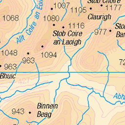
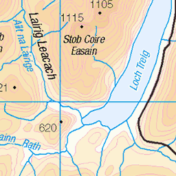
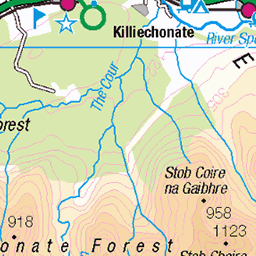
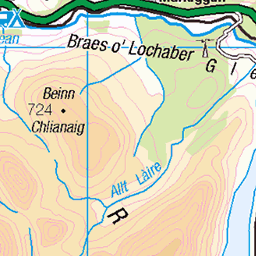
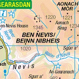
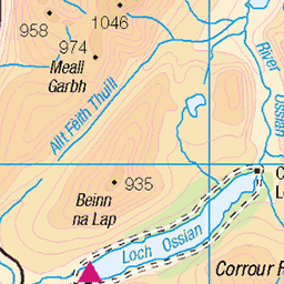
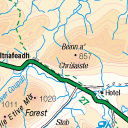
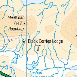
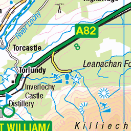
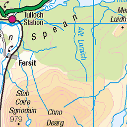
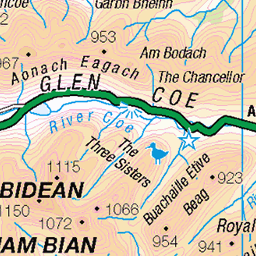
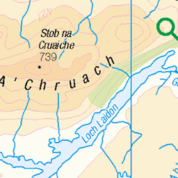
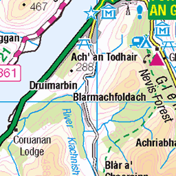
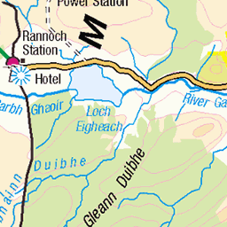
OS Map of Glas Bheinn
Height: 790m / 2591ft • Prominence: 387m / 1270ft • Summit : rock 5m N of large cairn • Trip reports (hill-bagging)

Loch Eilde Mòr ruin at sunrise
25-Jun-18 • Masa Sakano • flickr
activity highland locheildemòr lochaber place ramsayround scotland fellrunning running scenery sunrise 46851336935

Pacerpole used as a monopod
It's in the low light situation and hence it is no surprised this photo is slightly blurred.
25-Jun-18 • Masa Sakano • flickr
activity highland locheildemòr lochaber pacerpole place ramsayround scotland fellrunning gear running scenery sunrise walkingpole 47715335292


Dave Taylor running up to Sgùrr Eilde Mòr
Exposure 1/8 sec. The day is about to break, but it is still pitch dark.
24-May-16 • Masa Sakano • flickr
scotland scenery running highland runner lochaber fellrunning themammores ramsayround locheiltlodge sgùrreildemòr 26677479573
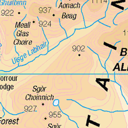
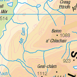
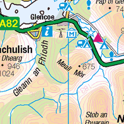
OS Map
This is OS mapping. In some areas, OpenStreetMap shows more footpaths
Spatial NI has online OSNI mapping. Click "Basemap Gallery" (4 squares icon at the top).
Now would be a good time for a cup of tea.

GPX Editor
Record map clicks
Reload map
Photos
Please tag your photos and upload them to the British and Irish Mountains group on Flickr
The other photos have been geo-tagged as on or around the summit. For less busy mountains, it can be a little hit and miss.
Loch Eilde Mòr ruin at sunrise
25-Jun-18 • Masa Sakano • flickr
activity highland locheildemòr lochaber place ramsayround scotland fellrunning running scenery sunrise 46851336935
Pacerpole used as a monopod
It's in the low light situation and hence it is no surprised this photo is slightly blurred.
25-Jun-18 • Masa Sakano • flickr
activity highland locheildemòr lochaber pacerpole place ramsayround scotland fellrunning gear running scenery sunrise walkingpole 47715335292
Dave Taylor running up to Sgùrr Eilde Mòr
Exposure 1/8 sec. The day is about to break, but it is still pitch dark.
24-May-16 • Masa Sakano • flickr
scotland scenery running highland runner lochaber fellrunning themammores ramsayround locheiltlodge sgùrreildemòr 26677479573


loch eilde mor & loch eilde beag b&w
from glas bheinn kinlochleven
25-Feb-13 • galoot fc • flickr
scotland hills loch kinlochleven 8508689806

Ridge to Carn Dearg from Glas Bheinn
23-Jul-11 • Paul Sammonds • flickr
mountain walking scotland 5977190613
Videos
Highways Hillwalking Club from Edinburgh run a monthly bus to the Hills, the second Sunday of each month. Me & Shane head ...
Panoramic shot from the top of Glas Bheinn.
The second day in and around Kinlochleven saw me tackle the distant Corbett Glas Bheinn. Setting of from Kinlochleven I head ...
Name: Garbh Bheinn Classifications: Corbett, Marilyn Area: Kinlochleven Height: 867m / 2844ft Grid Ref. NN 16950 60080 ...
Notes
- Data: Database of British and Irish Hills v18.2
- Maps: We use OS mapping for England, Scotland, Wales, and the Isle of Man. Sadly, Channel Islands, Northern (OSNI) and Southern Ireland (OSI) mapping isn't available online, so we use Openstreetmap.