Hills of Britain and Ireland
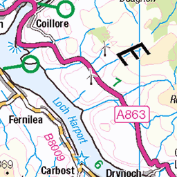
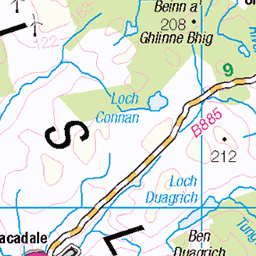
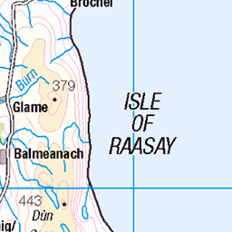
OS Map of Sgurr Thuilm
Height: 880m / 2887ft • Prominence: 131m / 430ft • Summit : tiny cairn • Trip reports (hill-bagging)

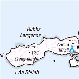
Sgùrr an Fheadain
gleannbhreatail glenbrittle coirenacriche anteileansgitheanach sgitheanach isleofskye skye alba scotland eileansgitheanach schottland ecosse шотландия skotlanti skottland szkocja scozia escocia broskos escòcia skotland schotland σκωτία skócia albain escócia scoţia iskoçya alban highlands gàidhealtachd 54345297254

Eas Alllt Coire an Tairneilear
gleannbhreatail glenbrittle coirenacriche anteileansgitheanach sgitheanach isleofskye skye alba scotland eileansgitheanach schottland ecosse шотландия skotlanti skottland szkocja scozia escocia broskos escòcia skotland schotland σκωτία skócia albain escócia scoţia iskoçya alban highlands gàidhealtachd 54345297249

Eas Alllt Coire an Tairneilear
gleannbhreatail glenbrittle coirenacriche anteileansgitheanach sgitheanach isleofskye skye alba scotland eileansgitheanach schottland ecosse шотландия skotlanti skottland szkocja scozia escocia broskos escòcia skotland schotland σκωτία skócia albain escócia scoţia iskoçya alban highlands gàidhealtachd 54344192197

Sgùrr an Fheadain
gleannbhreatail glenbrittle coirenacriche anteileansgitheanach sgitheanach isleofskye skye alba scotland eileansgitheanach schottland ecosse шотландия skotlanti skottland szkocja scozia escocia broskos escòcia skotland schotland σκωτία skócia albain escócia scoţia iskoçya alban highlands gàidhealtachd 54345504190


Spaziergang bei den Fairy Pools
20-Aug-24 • Bernhard Schlor • flickr
schottland grosbritannien landschaft europa fairypools wasser berg fels natur isleofskye innerehebriden jahreszeiten hebriden wasserfall bach sommer minginish anteileansgitheanach country eileana’cheò europe gb gewässer greatbritain hebrides inseldesnebels skye cascade ilpaese lacqua leau lestate lété lacampagne lasaison landscape leseaux nahinnsegall‚suðreyjar rock seasons stream summer water waterfall waters vereinigteskönigreich 54286622913
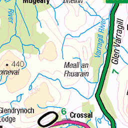
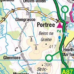
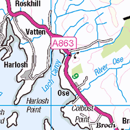
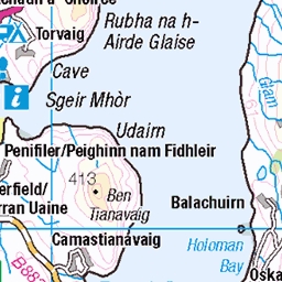
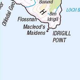
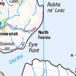
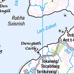
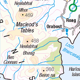
OS Map
This is OS mapping. In some areas, OpenStreetMap shows more footpaths
Spatial NI has online OSNI mapping. Click "Basemap Gallery" (4 squares icon at the top).
Now would be a good time for a cup of tea.

GPX Editor
Record map clicks
Reload map
Photos
Please tag your photos and upload them to the British and Irish Mountains group on Flickr
The other photos have been geo-tagged as on or around the summit. For less busy mountains, it can be a little hit and miss.
Sgùrr an Fheadain
gleannbhreatail glenbrittle coirenacriche anteileansgitheanach sgitheanach isleofskye skye alba scotland eileansgitheanach schottland ecosse шотландия skotlanti skottland szkocja scozia escocia broskos escòcia skotland schotland σκωτία skócia albain escócia scoţia iskoçya alban highlands gàidhealtachd 54345297254
Eas Alllt Coire an Tairneilear
gleannbhreatail glenbrittle coirenacriche anteileansgitheanach sgitheanach isleofskye skye alba scotland eileansgitheanach schottland ecosse шотландия skotlanti skottland szkocja scozia escocia broskos escòcia skotland schotland σκωτία skócia albain escócia scoţia iskoçya alban highlands gàidhealtachd 54345297249
Eas Alllt Coire an Tairneilear
gleannbhreatail glenbrittle coirenacriche anteileansgitheanach sgitheanach isleofskye skye alba scotland eileansgitheanach schottland ecosse шотландия skotlanti skottland szkocja scozia escocia broskos escòcia skotland schotland σκωτία skócia albain escócia scoţia iskoçya alban highlands gàidhealtachd 54344192197
Sgùrr an Fheadain
gleannbhreatail glenbrittle coirenacriche anteileansgitheanach sgitheanach isleofskye skye alba scotland eileansgitheanach schottland ecosse шотландия skotlanti skottland szkocja scozia escocia broskos escòcia skotland schotland σκωτία skócia albain escócia scoţia iskoçya alban highlands gàidhealtachd 54345504190
Spaziergang bei den Fairy Pools
20-Aug-24 • Bernhard Schlor • flickr
schottland grosbritannien landschaft europa fairypools wasser berg fels natur isleofskye innerehebriden jahreszeiten hebriden wasserfall bach sommer minginish anteileansgitheanach country eileana’cheò europe gb gewässer greatbritain hebrides inseldesnebels skye cascade ilpaese lacqua leau lestate lété lacampagne lasaison landscape leseaux nahinnsegall‚suðreyjar rock seasons stream summer water waterfall waters vereinigteskönigreich 54286622913

Spaziergang bei den Fairy Pools
20-Aug-24 • Bernhard Schlor • flickr
schottland grosbritannien landschaft europa fairypools wasser berg fels natur isleofskye innerehebriden jahreszeiten hebriden bach wasserfall sommer minginish anteileansgitheanach country eileana’cheò europe gb gewässer greatbritain hebrides inseldesnebels skye cascade ilpaese lacqua leau lestate lété lacampagne lasaison landscape leseaux nahinnsegall‚suðreyjar rock seasons stream summer water waterfall waters vereinigteskönigreich 54283180706

Spaziergang bei den Fairy Pools
20-Aug-24 • Bernhard Schlor • flickr
schottland aussicht grosbritannien landschaft europa fairypools himmel berg bach natur wetter isleofskye innerehebriden jahreszeiten wasser minginish wolken sommer hebriden anteileansgitheanach country eileana’cheò europe gb gewässer greatbritain hebrides inseldesnebels skye clouds ilpaese lacqua leau lestate lété lacampagne lasaison landscape letemps leseaux nahinnsegall‚suðreyjar seasons sky stream summer water waters weather vereinigteskönigreich 54310742581


Videos
Sgurr Thuilm & Sgurr a Mhadaidh with Angus Macdonald,music Wild Mountain Thyme by the Silencers.
Notes
- Data: Database of British and Irish Hills v18.2
- Maps: We use OS mapping for England, Scotland, Wales, and the Isle of Man. Sadly, Channel Islands, Northern (OSNI) and Southern Ireland (OSI) mapping isn't available online, so we use Openstreetmap.