Hills of Britain and Ireland
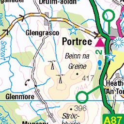
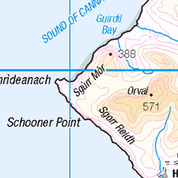
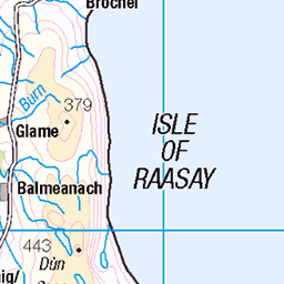
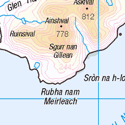
OS Map of Gars-bheinn
Height: 894m / 2934ft • Prominence: 120m / 394ft • Summit : large cairn • Trip reports (hill-bagging)

Sgurr Nan Eag Summit View
The view east to Loch Coruisk and Blà Bheinn from the summit of Sgùrr nan Eag, the southernmost Munro on the Cuillin ridge.
21-Jul-21 • Russell-Davies • flickr
sgurrnaneag munro mountains lochcoruisk skye isleofskye landscape blabheinn cuillin blackcuillin hiking uk scotland highlands canon 6dmkii 51768886502

Bla Bheinn & Loch Coruisk
The view to Loch Coruisk and Blà Bheinn from the summit of Sgùrr nan Eag.
21-Jul-21 • Russell-Davies • flickr
sgurrnaneag lochcoruisk blabheinn blaven munro mountains cuillin blackcuillin landscape loch summer highlands uk scotland skye isleofskye hiking canon 6dmkii 51769950568

Isle Of Rum Surrounded By Haar
The Isle of Rum enveloped in fog viewed from the summit of Sgurr nan Eag on the Cuillin Ridge.
21-Jul-21 • Russell-Davies • flickr
isleofrum rum skye isleofskye sgurrnaneag inversion summer blackcuillin mountains islands landscape uk highlands scoltland canon 6dmkii 51781203325

Black Cuiilin Ridge
Looking along the Cuillin Ridge from above Sgùrr nan Eag.
21-Jul-21 • Russell-Davies • flickr
sgurrnaneag munro munrobagging munros blackcuillin cuillinridge cuillin skyecuillin isleofskye skye ridge ridgeline drone dronephotography highlands hiking landscape mountain mountains scotland summer summit uk 54202535871

Sgùrr nan Eag
Looking south-east past Gars-Bheinn and the culmination of the Cuillin ridge.
21-Jul-21 • Russell-Davies • flickr
sgurrnaneag isleofskye skye skyecuillin blackcuillin cuillinridge munrobagging munro munros ridge ridgeline garsbheinn highlands hiking landscape mountains scotland summer summit uk drone dronephotography 54202784638

South end of the ridge
The southern end of Skye's Cuillin ridge with a glimpse of Blaven (Bla Bheinn) across Loch Coruisk on the left.
03-Jul-21 • OutdoorMonkey • flickr
skye isleofskye scotland cuillin mountain mountains outside outdoor rural nature natural scenic scenery ridge peak summit garsbheinn mountainside rock rocky boulder stone 51312870681
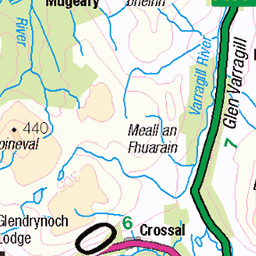
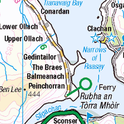
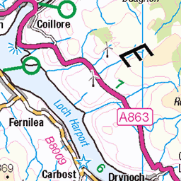
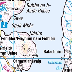
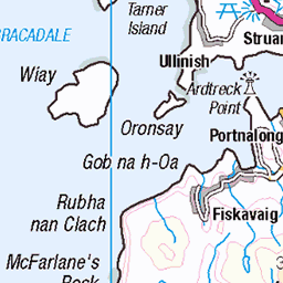
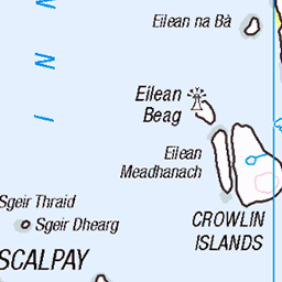
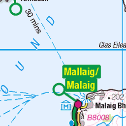
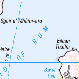
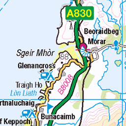
OS Map
This is OS mapping. In some areas, OpenStreetMap shows more footpaths
Spatial NI has online OSNI mapping. Click "Basemap Gallery" (4 squares icon at the top).
Now would be a good time for a cup of tea.

GPX Editor
Record map clicks
Reload map
Photos
Please tag your photos and upload them to the British and Irish Mountains group on Flickr
The other photos have been geo-tagged as on or around the summit. For less busy mountains, it can be a little hit and miss.
Sgurr Nan Eag Summit View
The view east to Loch Coruisk and Blà Bheinn from the summit of Sgùrr nan Eag, the southernmost Munro on the Cuillin ridge.
21-Jul-21 • Russell-Davies • flickr
sgurrnaneag munro mountains lochcoruisk skye isleofskye landscape blabheinn cuillin blackcuillin hiking uk scotland highlands canon 6dmkii 51768886502
Bla Bheinn & Loch Coruisk
The view to Loch Coruisk and Blà Bheinn from the summit of Sgùrr nan Eag.
21-Jul-21 • Russell-Davies • flickr
sgurrnaneag lochcoruisk blabheinn blaven munro mountains cuillin blackcuillin landscape loch summer highlands uk scotland skye isleofskye hiking canon 6dmkii 51769950568
Isle Of Rum Surrounded By Haar
The Isle of Rum enveloped in fog viewed from the summit of Sgurr nan Eag on the Cuillin Ridge.
21-Jul-21 • Russell-Davies • flickr
isleofrum rum skye isleofskye sgurrnaneag inversion summer blackcuillin mountains islands landscape uk highlands scoltland canon 6dmkii 51781203325
Black Cuiilin Ridge
Looking along the Cuillin Ridge from above Sgùrr nan Eag.
21-Jul-21 • Russell-Davies • flickr
sgurrnaneag munro munrobagging munros blackcuillin cuillinridge cuillin skyecuillin isleofskye skye ridge ridgeline drone dronephotography highlands hiking landscape mountain mountains scotland summer summit uk 54202535871
Sgùrr nan Eag
Looking south-east past Gars-Bheinn and the culmination of the Cuillin ridge.
21-Jul-21 • Russell-Davies • flickr
sgurrnaneag isleofskye skye skyecuillin blackcuillin cuillinridge munrobagging munro munros ridge ridgeline garsbheinn highlands hiking landscape mountains scotland summer summit uk drone dronephotography 54202784638
South end of the ridge
The southern end of Skye's Cuillin ridge with a glimpse of Blaven (Bla Bheinn) across Loch Coruisk on the left.
03-Jul-21 • OutdoorMonkey • flickr
skye isleofskye scotland cuillin mountain mountains outside outdoor rural nature natural scenic scenery ridge peak summit garsbheinn mountainside rock rocky boulder stone 51312870681


Loch Brittle and Uist in the outer Hebrides 20180523_105154
23-May-18 • ianthehiker • flickr
40647975480
Videos
Join me on a solo hike on the Isle of Skye to take in two fantastic rocky mountains with airy summits; Garbh-bheinn and Belig.
A great day out on Garbh-Bheinn and Belig, in the Black Cuillins, on Skye. Solo Hike #hiking #scotland #skye.
The Cuillin of Skye are Britain's most technically challenging mountains. Great bastions of gabbro forged from the guts of an ...
Sgùrr na Banachdich in the Black Cuillins, on the Isle of Skye. #skye #hiking #cuillin.
Notes
- Data: Database of British and Irish Hills v18.2
- Maps: We use OS mapping for England, Scotland, Wales, and the Isle of Man. Sadly, Channel Islands, Northern (OSNI) and Southern Ireland (OSI) mapping isn't available online, so we use Openstreetmap.