Hills of Britain and Ireland
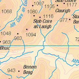
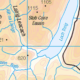
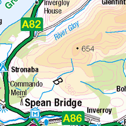
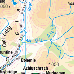
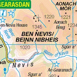
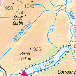
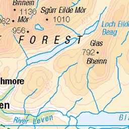
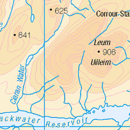
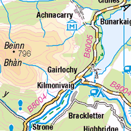
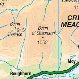
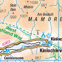
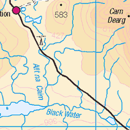
OS Map of Cruach Innse
Height: 857m / 2812ft • Prominence: 306m / 1004ft • Summit : rock 15m SSW of cairn • Trip reports (hill-bagging)

IMG_20220419_110858870_HDR
Corbett Bagging Easter 2022
19-Apr-22 • Phil + Heather • flickr
corbett easter 2022 52026888815

Stob Chorie na Ceannain from Cruach Innse
Corbett Bagging Easter 2022
19-Apr-22 • Phil + Heather • flickr
corbett easter 2022 52025336297


Sgurr Innse
A panorama of the approach to Sgurr Innse from the bealach between it and neighbour Cruach Innse. My way up was just to the right of the scree slope.
29-Aug-20 • OutdoorMonkey • flickr
cruachinnse sgurrinnse greycorries mountain peak summit lairigleacach valley wild wilderness remote scotland highlands outside outdoor rural nature natural countryside corbett 50333349623

Lairig Leacach : North End
OLYMPUS DIGITAL CAMERA
28-Jun-19 • chris.hart_010 • flickr
leacach lairig 49754287652
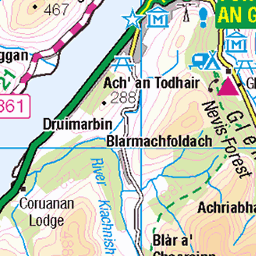
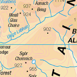
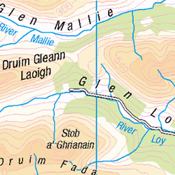
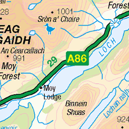
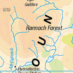
OS Map
This is OS mapping. In some areas, OpenStreetMap shows more footpaths
Spatial NI has online OSNI mapping. Click "Basemap Gallery" (4 squares icon at the top).
Now would be a good time for a cup of tea.

GPX Editor
Record map clicks
Reload map
Photos
Please tag your photos and upload them to the British and Irish Mountains group on Flickr
The other photos have been geo-tagged as on or around the summit. For less busy mountains, it can be a little hit and miss.
IMG_20220419_110858870_HDR
Corbett Bagging Easter 2022
19-Apr-22 • Phil + Heather • flickr
corbett easter 2022 52026888815
Stob Chorie na Ceannain from Cruach Innse
Corbett Bagging Easter 2022
19-Apr-22 • Phil + Heather • flickr
corbett easter 2022 52025336297
Sgurr Innse
A panorama of the approach to Sgurr Innse from the bealach between it and neighbour Cruach Innse. My way up was just to the right of the scree slope.
29-Aug-20 • OutdoorMonkey • flickr
cruachinnse sgurrinnse greycorries mountain peak summit lairigleacach valley wild wilderness remote scotland highlands outside outdoor rural nature natural countryside corbett 50333349623
Lairig Leacach : North End
OLYMPUS DIGITAL CAMERA
28-Jun-19 • chris.hart_010 • flickr
leacach lairig 49754287652


The Easains enveloped in cloud
24-Apr-10 • Nick Bramhall • flickr
cloud raw munro easains 4550389073


Videos
This is a much better version of original video I uploaded 5 years ago.
Myself and Robin head to the Innse Corbetts where we head up the rocky Sgurr Innse & then a summit camp on Cruach Innse.
Wee trip into the Grey Corries, for Corbett's, Cruach Innse and Sgùrr Innse 13km/8 miles, 4.75 hrs, 890m ascent. Steep ups, steep ...
Sgurr Innse 809m Corbett in Lairig Leacach (Grey Corries), Grid Ref. NN 290 748 25.03.2012 @ 13.58.
Notes
- Data: Database of British and Irish Hills v18.2
- Maps: We use OS mapping for England, Scotland, Wales, and the Isle of Man. Sadly, Channel Islands, Northern (OSNI) and Southern Ireland (OSI) mapping isn't available online, so we use Openstreetmap.