Hills of Britain and Ireland
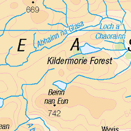
OS Map of Meall Glac an Ruighe
Height: 858m / 2815ft • Prominence: 113m / 371ft • Summit : embedded rock • Trip reports (hill-bagging)

Coire an Lochain Sgeirich
One of the remote lochans in Coire an Lochain Sgeirich, tucked below Eididh nan Clach Geala across the wild moors east of Inverlael.
12-Sep-23 • OutdoorMonkey • flickr
water lake loch highlands scotland outside outdoor rural nature natural scenic scenery cloud cloudy coireanlochainsgeirich lochansgeireach 53209689452

Coire an Lochain Sgeirich
One of the remote lochans in Coire an Lochain Sgeirich, tucked below Eididh nan Clach Geala across the wild moors east of Inverlael.
12-Sep-23 • OutdoorMonkey • flickr
water lake loch highlands scotland outside outdoor rural nature natural scenic scenery cloud cloudy coireanlochainsgeirich lochansgeireach 53210948849

Inverpolly
As the day went on the light and the visibility improved, a great couple of days.
10-Oct-12 • Peter1297 (the finger) • flickr
8082896359

Allt an Lochan Sgeirich
uk camping scotland ross hiking rossshire 2260393786

Approaching the highest point
uk camping scotland ross hiking rossshire 2259601289

Coire an Lochan Sgeirich
uk camping scotland ross hiking rossshire 2260398458
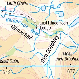
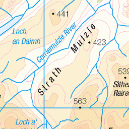
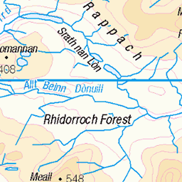
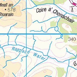
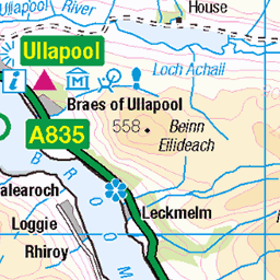
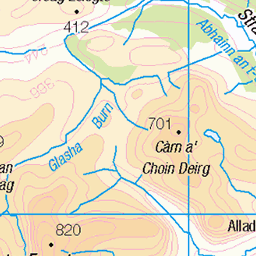
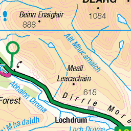
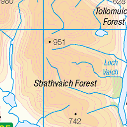
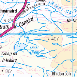
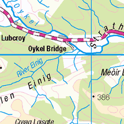
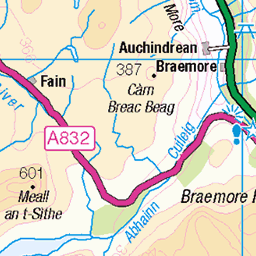
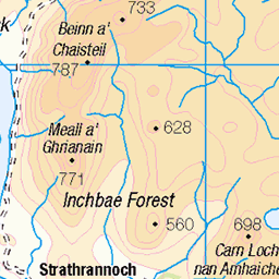
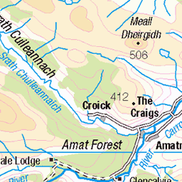
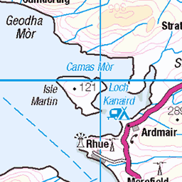
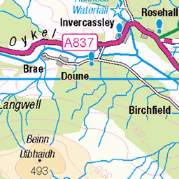
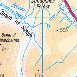
OS Map
This is OS mapping. In some areas, OpenStreetMap shows more footpaths
Spatial NI has online OSNI mapping. Click "Basemap Gallery" (4 squares icon at the top).
Now would be a good time for a cup of tea.

GPX Editor
Record map clicks
Reload map
Photos
Please tag your photos and upload them to the British and Irish Mountains group on Flickr
The other photos have been geo-tagged as on or around the summit. For less busy mountains, it can be a little hit and miss.
Coire an Lochain Sgeirich
One of the remote lochans in Coire an Lochain Sgeirich, tucked below Eididh nan Clach Geala across the wild moors east of Inverlael.
12-Sep-23 • OutdoorMonkey • flickr
water lake loch highlands scotland outside outdoor rural nature natural scenic scenery cloud cloudy coireanlochainsgeirich lochansgeireach 53209689452
Coire an Lochain Sgeirich
One of the remote lochans in Coire an Lochain Sgeirich, tucked below Eididh nan Clach Geala across the wild moors east of Inverlael.
12-Sep-23 • OutdoorMonkey • flickr
water lake loch highlands scotland outside outdoor rural nature natural scenic scenery cloud cloudy coireanlochainsgeirich lochansgeireach 53210948849
Inverpolly
As the day went on the light and the visibility improved, a great couple of days.
10-Oct-12 • Peter1297 (the finger) • flickr
8082896359
Allt an Lochan Sgeirich
uk camping scotland ross hiking rossshire 2260393786
Approaching the highest point
uk camping scotland ross hiking rossshire 2259601289
Coire an Lochan Sgeirich
uk camping scotland ross hiking rossshire 2260398458

The high path near Meall a Choire Ghlais
uk camping scotland ross hiking rossshire 2259606597

Looking east into Gleann Beag
uk camping scotland ross hiking rossshire 2259609261

Deer on Meall na Choire Ghlais
uk camping scotland ross hiking deer rossshire 2259612087

Meall a Choire Ghlais
uk camping scotland ross hiking rossshire 2259615175
Videos
None found
Notes
- Data: Database of British and Irish Hills v18.2
- Maps: We use OS mapping for England, Scotland, Wales, and the Isle of Man. Sadly, Channel Islands, Northern (OSNI) and Southern Ireland (OSI) mapping isn't available online, so we use Openstreetmap.