Hills of Britain and Ireland
OS Map of Leum Uilleim
Height: 907m / 2974ft • Prominence: 496m / 1627ft • Summit : large cairn on pile of stones • Trip reports (hill-bagging)


327 Leum Uilleim
Corrour station circular with the 5th Marilyn completion party for Martin Richardson, Leum Uilleim South Top, Leum Uilleim and finally Beinn a'Bhric in super spring weather. Name:Leum Uilleim Hill number:327 Height:906.4m / 2974ft Section:04A: Fort William to Loch Treig and Loch Leven County/UA:Highland (UA) Class:Marilyn, Hump, Simm, Corbett (Ma,Hu,Tu,Sim,C) Grid ref:NN 33074 64132 Summit feature:large cairn on pile of stones Drop:496m Col:410m NN352668 Observations:rock 20m W of cairn at NN 33053 64129 is 15cm higher but higher ground may well exist under cairn Survey:Abney level/Leica RX1250
19-Mar-16 • Dugswell2 • flickr
marilyn hump corbett simm tump leumuilleim p496 25371428034
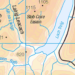
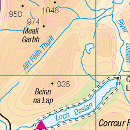
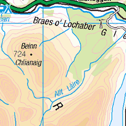
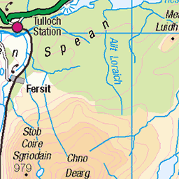
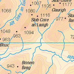
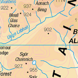
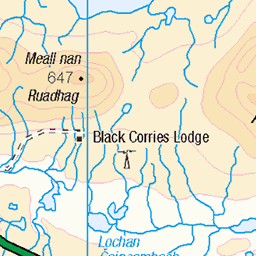
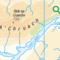
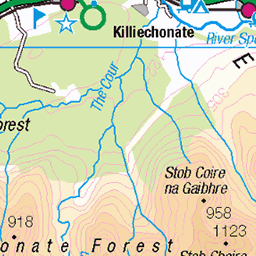
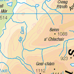
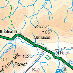
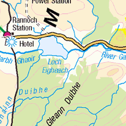
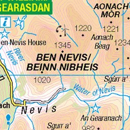
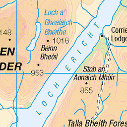
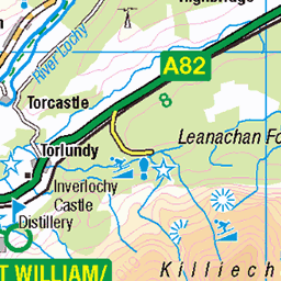
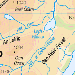
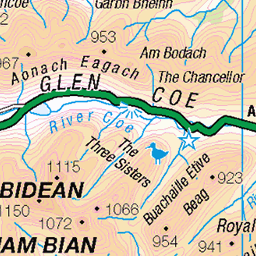
OS Map
This is OS mapping. In some areas, OpenStreetMap shows more footpaths
Spatial NI has online OSNI mapping. Click "Basemap Gallery" (4 squares icon at the top).
Now would be a good time for a cup of tea.
GPX Editor
Record map clicks
Reload map
Photos
Please tag your photos and upload them to the British and Irish Mountains group on Flickr
The other photos have been geo-tagged as on or around the summit. For less busy mountains, it can be a little hit and miss.
327 Leum Uilleim
Corrour station circular with the 5th Marilyn completion party for Martin Richardson, Leum Uilleim South Top, Leum Uilleim and finally Beinn a'Bhric in super spring weather. Name:Leum Uilleim Hill number:327 Height:906.4m / 2974ft Section:04A: Fort William to Loch Treig and Loch Leven County/UA:Highland (UA) Class:Marilyn, Hump, Simm, Corbett (Ma,Hu,Tu,Sim,C) Grid ref:NN 33074 64132 Summit feature:large cairn on pile of stones Drop:496m Col:410m NN352668 Observations:rock 20m W of cairn at NN 33053 64129 is 15cm higher but higher ground may well exist under cairn Survey:Abney level/Leica RX1250
19-Mar-16 • Dugswell2 • flickr
marilyn hump corbett simm tump leumuilleim p496 25371428034

Buachaille Etive Mor
Buachaille Etive Mor by Great Gulley Buttress. Starting on the A82, Wandering over to Stob na Doire after the scramble, then down into Lairig Gartain and back to the A82.
28-Jul-15 • David Biggins • flickr
scotland unitedkingdom gb glencoe hfholidays iphone kinlochleven aonacheagach buachailleetivemor 19843801483

Grey Corries and Easains from Leum Uilleim
23-Jul-11 • Paul Sammonds • flickr
mountain walking scotland 5977747084

Glas Bheinn from Beinn a' Bhric
23-Jul-11 • Paul Sammonds • flickr
mountain walking scotland 5977184819
Videos
For the second time on this channel we return to the fabulous Corrour! Scene of one of the most iconic film locations from the film ...
Panoramic shot from the top of Leum Uilleim.
Tour Scotland short travel video clip of a steam train near Corrour on ancestry, genealogy, history visit to the Scottish Highlands.
Tour Scotland 4K short travel video clip of a steam train near Corrour on ancestry, genealogy, history visit to the Scottish ...
Braw day on Beinn na Lap, from Corrour....... with Manran for entertainment! 13/12/2012, 2.9 hours, 9.75 km/6.1 miles, 591m of ...
Notes
- Data: Database of British and Irish Hills v18.2
- Maps: We use OS mapping for England, Scotland, Wales, and the Isle of Man. Sadly, Channel Islands, Northern (OSNI) and Southern Ireland (OSI) mapping isn't available online, so we use Openstreetmap.