Hills of Britain and Ireland
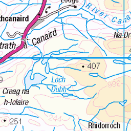
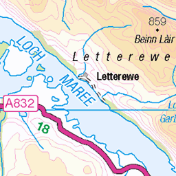
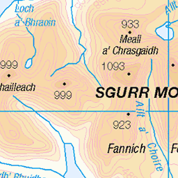
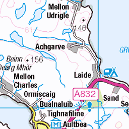
OS Map of Sgurr Creag an Eich West Top


An Teallach Ridge
April 2006. Wester Ross, Scotland
02-Apr-06 • Sandy MacLennan • flickr
winter mountains scottish ridge 3008531568

An Teallach, Dundonell
One of the great ridges of Scotland. A great week, with some of Scotland's great ridges climbed. September 2005. Image scanned from negative.
01-Sep-05 • Miche & Jon Rousell • flickr
mountains scotland hiking climbing torridon scrambling munro littlelochbroom anteallach theanvil theforge corragbhuidhe munrobagging dundonell bideanaghlasthuill lordberkeleysseat sgùrrfiona 6937542499

An Teallach, Dundonell
One of the great ridges of Scotland. A great week, with some of Scotland's great ridges climbed. September 2005. Image scanned from negative.
01-Sep-05 • Miche & Jon Rousell • flickr
mountains scotland hiking climbing torridon scrambling munro littlelochbroom anteallach theanvil theforge corragbhuidhe munrobagging dundonell bideanaghlasthuill lordberkeleysseat sgùrrfiona 6756626767

From the summit of An Teallach a spectacular view of Sail Mhor (rounded) 767 metres, the remote Scoraig Peninsula, the Summer Isles and the Coigach coast, Wester Ross, Scotland.
Commentary. 1,062 metre view from Bidein a ‘ Ghlas Thuill, one of ten tops making up the mighty AnTeallach. A soft light blends moorland, mountain, sea-loch, peninsulas, headlands, Summer Isles and sky, looking north-west to the Atlantic, beyond. The views down to the corrie-lake, Loch Toll an Lochain, and along the fiercely serrated ridge, are grandeur personified. A variety of directions feasts our eyes on the Sutherland monoliths, Sgurr Mor, Ben Wyvis, Slioch, the peaks of Fisherfield and Letterewe Forests and as far as the Torridon Range. Sensational! For many reasons An Teallach is my favourite Scottish mountain!
06-Sep-84 • Scotland by NJC. • flickr
53670560584
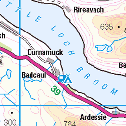
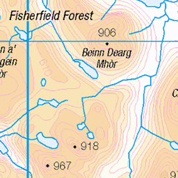
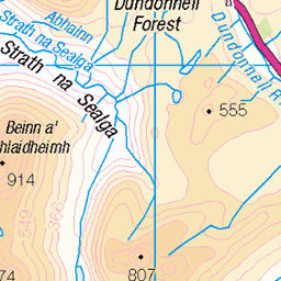
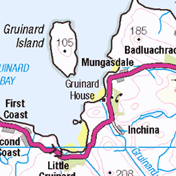
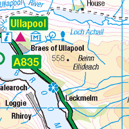
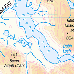
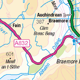
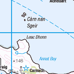
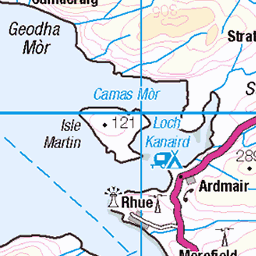
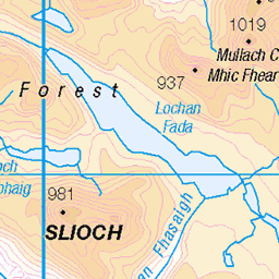
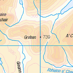
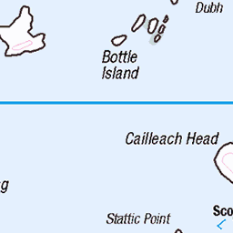
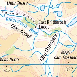
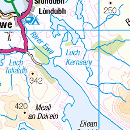
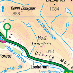
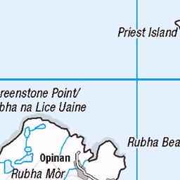
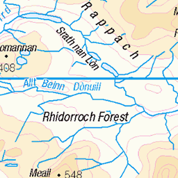
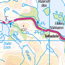
OS Map
This is OS mapping. In some areas, OpenStreetMap shows more footpaths
Spatial NI has online OSNI mapping. Click "Basemap Gallery" (4 squares icon at the top).
Now would be a good time for a cup of tea.


GPX Editor
Record map clicks
Reload map
Photos
Please tag your photos and upload them to the British and Irish Mountains group on Flickr
The other photos have been geo-tagged as on or around the summit. For less busy mountains, it can be a little hit and miss.
An Teallach Ridge
April 2006. Wester Ross, Scotland
02-Apr-06 • Sandy MacLennan • flickr
winter mountains scottish ridge 3008531568
An Teallach, Dundonell
One of the great ridges of Scotland. A great week, with some of Scotland's great ridges climbed. September 2005. Image scanned from negative.
01-Sep-05 • Miche & Jon Rousell • flickr
mountains scotland hiking climbing torridon scrambling munro littlelochbroom anteallach theanvil theforge corragbhuidhe munrobagging dundonell bideanaghlasthuill lordberkeleysseat sgùrrfiona 6937542499
An Teallach, Dundonell
One of the great ridges of Scotland. A great week, with some of Scotland's great ridges climbed. September 2005. Image scanned from negative.
01-Sep-05 • Miche & Jon Rousell • flickr
mountains scotland hiking climbing torridon scrambling munro littlelochbroom anteallach theanvil theforge corragbhuidhe munrobagging dundonell bideanaghlasthuill lordberkeleysseat sgùrrfiona 6756626767
From the summit of An Teallach a spectacular view of Sail Mhor (rounded) 767 metres, the remote Scoraig Peninsula, the Summer Isles and the Coigach coast, Wester Ross, Scotland.
Commentary. 1,062 metre view from Bidein a ‘ Ghlas Thuill, one of ten tops making up the mighty AnTeallach. A soft light blends moorland, mountain, sea-loch, peninsulas, headlands, Summer Isles and sky, looking north-west to the Atlantic, beyond. The views down to the corrie-lake, Loch Toll an Lochain, and along the fiercely serrated ridge, are grandeur personified. A variety of directions feasts our eyes on the Sutherland monoliths, Sgurr Mor, Ben Wyvis, Slioch, the peaks of Fisherfield and Letterewe Forests and as far as the Torridon Range. Sensational! For many reasons An Teallach is my favourite Scottish mountain!
06-Sep-84 • Scotland by NJC. • flickr
53670560584
Videos
None found
Notes
- Data: Database of British and Irish Hills v18.2
- Maps: We use OS mapping for England, Scotland, Wales, and the Isle of Man. Sadly, Channel Islands, Northern (OSNI) and Southern Ireland (OSI) mapping isn't available online, so we use Openstreetmap.