Hills of Britain and Ireland
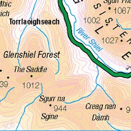
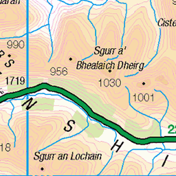
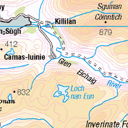
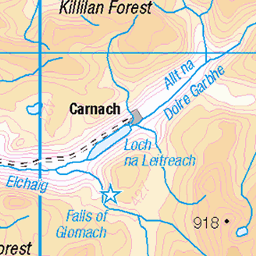
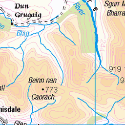
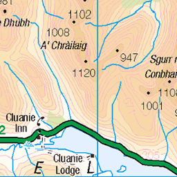
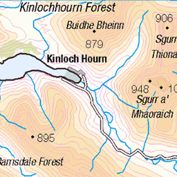
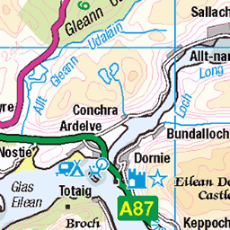
OS Map of Sgurr na Moraich


20241110_142228~2
Affric Kintail Way, Nov 2024
walking hiking backpacking scotland affric kintail way 54147059858

20241110_143012~2
Affric Kintail Way, Nov 2024
walking hiking backpacking scotland affric kintail way 54145921632

20241110_143237~2
Affric Kintail Way, Nov 2024
walking hiking backpacking scotland affric kintail way 54146771371

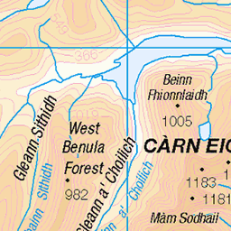
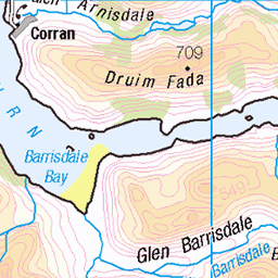
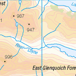
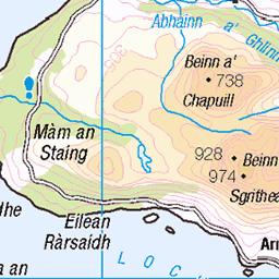
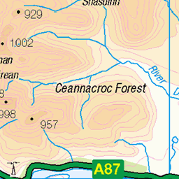
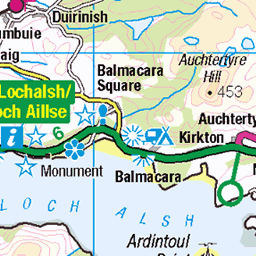
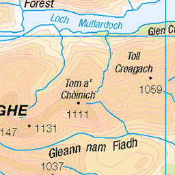
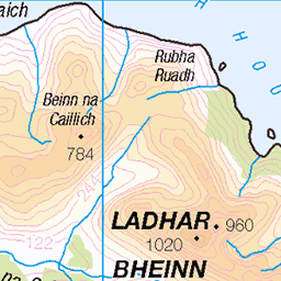
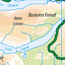
OS Map
This is OS mapping. In some areas, OpenStreetMap shows more footpaths
Spatial NI has online OSNI mapping. Click "Basemap Gallery" (4 squares icon at the top).
Now would be a good time for a cup of tea.

GPX Editor
Record map clicks
Reload map
Photos
Please tag your photos and upload them to the British and Irish Mountains group on Flickr
The other photos have been geo-tagged as on or around the summit. For less busy mountains, it can be a little hit and miss.
20241110_142228~2
Affric Kintail Way, Nov 2024
walking hiking backpacking scotland affric kintail way 54147059858
20241110_143012~2
Affric Kintail Way, Nov 2024
walking hiking backpacking scotland affric kintail way 54145921632
20241110_143237~2
Affric Kintail Way, Nov 2024
walking hiking backpacking scotland affric kintail way 54146771371


Videos
Tour Scotland travel video, with Scottish music, of the Five Sisters Of Kintail Mountains , on visit to the Scottish Highlands. The five ...
The Five Sisters of Kintail, Sgùrr Fhuaran, Sgùrr na Càrnach, Sgùrr na Ciste Duibhe. 06/11/2019, Time taken: 6.75 hours, ...
Notes
- Data: Database of British and Irish Hills v18.2
- Maps: We use OS mapping for England, Scotland, Wales, and the Isle of Man. Sadly, Channel Islands, Northern (OSNI) and Southern Ireland (OSI) mapping isn't available online, so we use Openstreetmap.