Hills of Britain and Ireland
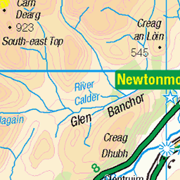
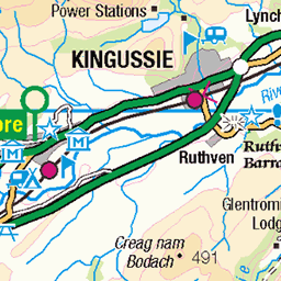
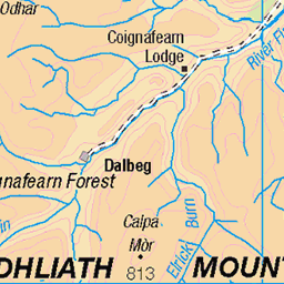
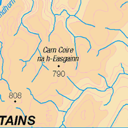
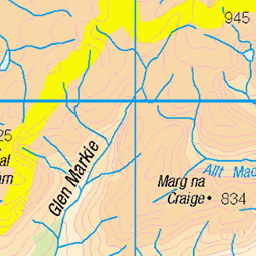
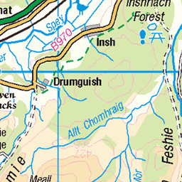
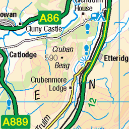
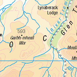
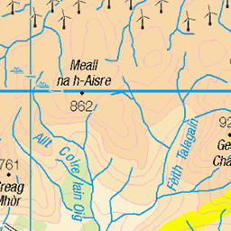
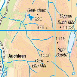
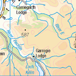
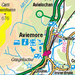
OS Map of Creag Dhubh

Wind-swept snowy slope, viewing Newtonmore village
Somewhere close to Càrn Coire na h-Inghinn summit (749m)
07-Jan-21 • Masa Sakano • flickr
activity càrncoirenahinghinn highland kingussie monadhliathmountains newtonmore place scotland fellrunning walking 50811038268

09/04/2004 View to Kingussie from A Chailleach
From A Chailleach the view extends back towards Kingussie.
07-Aug-12 • Grahamtravels • flickr
7733268906

09/04/2004 View south from A Chailleach
From A Chailleach the view south includes Carn Dearg the southerly Munro with its rocky face.
07-Aug-12 • Grahamtravels • flickr
7733269512

09/04/2004 Carn Sgulain
Carn Sgulain sits well into the rolling plateau of the Monadh Liath.
07-Aug-12 • Grahamtravels • flickr
7733270208

02/11/1985 A Chailleach
Various old fence posts cross the plateau seen here in November 1985.
07-Aug-12 • Grahamtravels • flickr
7733270590

02/11/1985 Carn Sgulain from A Chailleach
Carn Sgulain is a Munro behind A Chailleach which is also a Munro. They sit on the featureless plateau to the west of Kingussie.
07-Aug-12 • Grahamtravels • flickr
7733271022
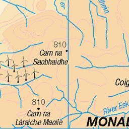
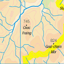
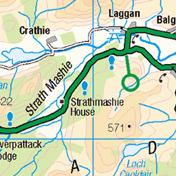
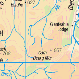
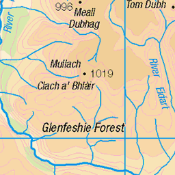
OS Map
This is OS mapping. In some areas, OpenStreetMap shows more footpaths
Spatial NI has online OSNI mapping. Click "Basemap Gallery" (4 squares icon at the top).
Now would be a good time for a cup of tea.

GPX Editor
Record map clicks
Reload map
Photos
Please tag your photos and upload them to the British and Irish Mountains group on Flickr
The other photos have been geo-tagged as on or around the summit. For less busy mountains, it can be a little hit and miss.
Wind-swept snowy slope, viewing Newtonmore village
Somewhere close to Càrn Coire na h-Inghinn summit (749m)
07-Jan-21 • Masa Sakano • flickr
activity càrncoirenahinghinn highland kingussie monadhliathmountains newtonmore place scotland fellrunning walking 50811038268
09/04/2004 View to Kingussie from A Chailleach
From A Chailleach the view extends back towards Kingussie.
07-Aug-12 • Grahamtravels • flickr
7733268906
09/04/2004 View south from A Chailleach
From A Chailleach the view south includes Carn Dearg the southerly Munro with its rocky face.
07-Aug-12 • Grahamtravels • flickr
7733269512
09/04/2004 Carn Sgulain
Carn Sgulain sits well into the rolling plateau of the Monadh Liath.
07-Aug-12 • Grahamtravels • flickr
7733270208
02/11/1985 A Chailleach
Various old fence posts cross the plateau seen here in November 1985.
07-Aug-12 • Grahamtravels • flickr
7733270590
02/11/1985 Carn Sgulain from A Chailleach
Carn Sgulain is a Munro behind A Chailleach which is also a Munro. They sit on the featureless plateau to the west of Kingussie.
07-Aug-12 • Grahamtravels • flickr
7733271022

02/11/1985 A Chailleach from Am Bodach
In the Monadh Liath a high plateau has a few Munros on it. In winter it is a featureless area.
07-Aug-12 • Grahamtravels • flickr
7733271442

21/11/1987 Carn Dearg Glen Banchor
From Glen Banchor to the west of Newtonmore the Munro Carn Dearg can be climbed by an easy route.
07-Aug-12 • Grahamtravels • flickr
7733271876
Videos
Small granite dykes showing comb texture and large grain size.
A short but steep ascent of one of Scotland's "Grahams" ( a hill between 2000 and 2499 feet high with a drop of at least 150 ...
Highways Hillwalking Club from Edinburgh run a monthly bus to the hills, the second Sunday of each month. The destination in ...
Creag Bheag is a Marilyn (sub 2000) hill just outside Kingussie. It is a steep hill with an altitude of 487 metres. I did this on a small ...
A short montage of Newtonmore in Scotland.
Notes
- Data: Database of British and Irish Hills v18.2
- Maps: We use OS mapping for England, Scotland, Wales, and the Isle of Man. Sadly, Channel Islands, Northern (OSNI) and Southern Ireland (OSI) mapping isn't available online, so we use Openstreetmap.