Hills of Britain and Ireland
OS Map of Carn Macoul
Height: 804m / 2639ft • Prominence: 77m / 253ft • Summit : small cairn • Trip reports (hill-bagging)

Loch Dubh
After over 4 hours of wind driven rain, hail and snow I eventually dropped out of the mist.
27-May-15 • Paul Sammonds • flickr
loch dubh monadhliath 17609836454


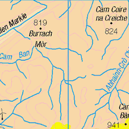
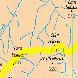
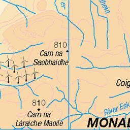
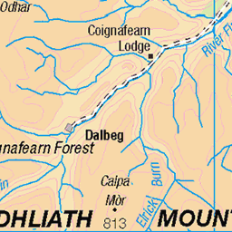
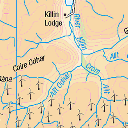
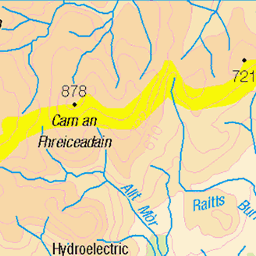
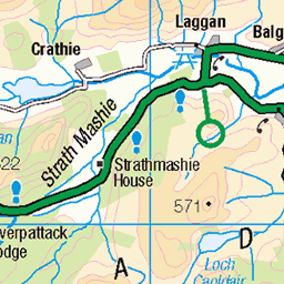
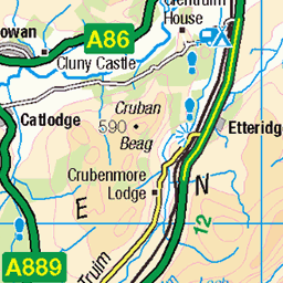
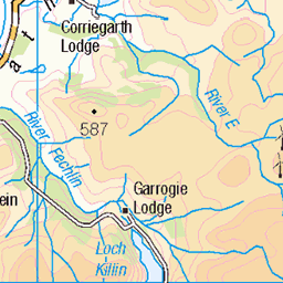
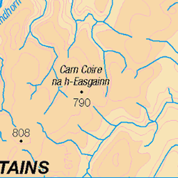
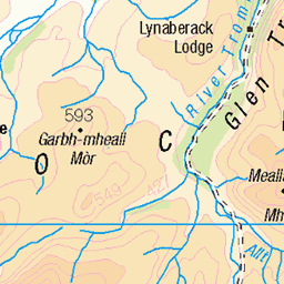
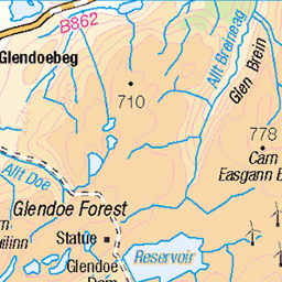
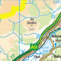
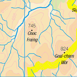
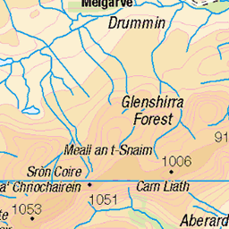
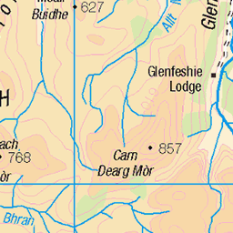
OS Map
This is OS mapping. In some areas, OpenStreetMap shows more footpaths
Spatial NI has online OSNI mapping. Click "Basemap Gallery" (4 squares icon at the top).
Now would be a good time for a cup of tea.


GPX Editor
Record map clicks
Reload map
Photos
Please tag your photos and upload them to the British and Irish Mountains group on Flickr
The other photos have been geo-tagged as on or around the summit. For less busy mountains, it can be a little hit and miss.
Loch Dubh
After over 4 hours of wind driven rain, hail and snow I eventually dropped out of the mist.
27-May-15 • Paul Sammonds • flickr
loch dubh monadhliath 17609836454


Walk along the woods
23-Aug-11 • Pritish Fotographia • flickr
uk trees holiday tourism forest photography scotland woods britain pritishfotographia 8423515943
Videos
None found
Notes
- Data: Database of British and Irish Hills v18.2
- Maps: We use OS mapping for England, Scotland, Wales, and the Isle of Man. Sadly, Channel Islands, Northern (OSNI) and Southern Ireland (OSI) mapping isn't available online, so we use Openstreetmap.