Hills of Britain and Ireland
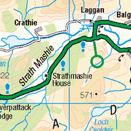
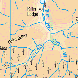
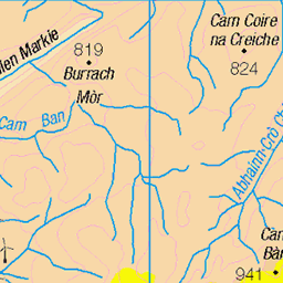
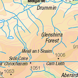
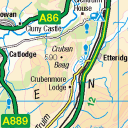
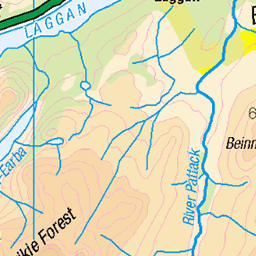
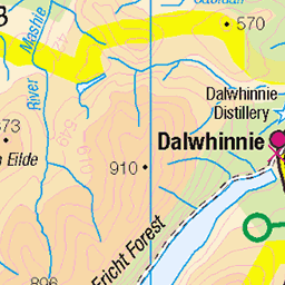
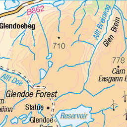
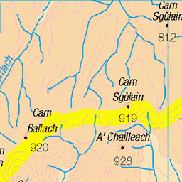
OS Map of Beinn Sgiath
Height: 887m / 2909ft • Prominence: 48m / 157ft • Summit : a few stones • Trip reports (hill-bagging)


Lochan a' Choire
The loch tucked away in the corrie below Geal Charn and Beinn Sgiath in the Monadhliath. Looking at the map this view is *just* inside the boundary of the Cairngorms National Park.
09-Sep-20 • OutdoorMonkey • flickr
gealcharn mondadhliath monadhliath scotland highlands outside outdoor rural scenic scenery countryside loch lochan water lake lochanachoire mountain mountainside hill hillside sunshine sunlight shadow cloud cloudy 50355838502
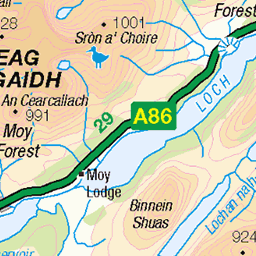
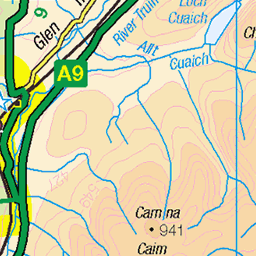
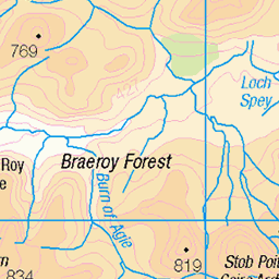
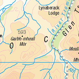
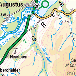
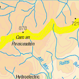
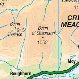
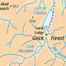
OS Map
This is OS mapping. In some areas, OpenStreetMap shows more footpaths
Spatial NI has online OSNI mapping. Click "Basemap Gallery" (4 squares icon at the top).
Now would be a good time for a cup of tea.

GPX Editor
Record map clicks
Reload map
Photos
Please tag your photos and upload them to the British and Irish Mountains group on Flickr
The other photos have been geo-tagged as on or around the summit. For less busy mountains, it can be a little hit and miss.
Lochan a' Choire
The loch tucked away in the corrie below Geal Charn and Beinn Sgiath in the Monadhliath. Looking at the map this view is *just* inside the boundary of the Cairngorms National Park.
09-Sep-20 • OutdoorMonkey • flickr
gealcharn mondadhliath monadhliath scotland highlands outside outdoor rural scenic scenery countryside loch lochan water lake lochanachoire mountain mountainside hill hillside sunshine sunlight shadow cloud cloudy 50355838502

First views
The moment a 20 minute wait in clag and a bitter wind at Geal Charn's summit was rewarded with the clouds clearing away to reveal views and blue-sky. The speed it went from cold and grey to this was exhilarating.
09-Sep-20 • OutdoorMonkey • flickr
gealcharn mondadhliath monadhliath scotland highlands outside outdoor rural scenic scenery countryside 50355839452

The eastern flanks of Gael Charn in the Monadhliath mountains from Glen Markie, Scotland
Two weeks touring and hiking in the western highlands of Scotland, in between lockdowns... From Stirling we headed north to Glen Shiel. On the way we stopped at the Spey Damn for a hike up Gael Charn via Glen Markie. Despite being September there were still plenty of midges.....
30-Aug-20 • Miche & Jon Rousell • flickr
scotland highlands monadhliath gaelcharn munro munrobagger munrobagging glen markie stream spey speydamn speyreservoir iphone iphonography iphone11 50762032097

View south above Glen Markie, Gael Charn, Scotland
Two weeks touring and hiking in the western highlands of Scotland, in between lockdowns... From Stirling we headed north to Glen Shiel. On the way we stopped at the Spey Damn for a hike up Gael Charn via Glen Markie. Despite being September there were still plenty of midges.....
30-Aug-20 • Miche & Jon Rousell • flickr
scotland highlands monadhliath gaelcharn munro munrobagger munrobagging glen markie stream spey speydamn speyreservoir 50761193688

The eastern flanks of Gael Charn in the Monadhliath mountains from Glen Markie, Scotland
Two weeks touring and hiking in the western highlands of Scotland, in between lockdowns... From Stirling we headed north to Glen Shiel. On the way we stopped at the Spey Damn for a hike up Gael Charn via Glen Markie. Despite being September there were still plenty of midges.....
30-Aug-20 • Miche & Jon Rousell • flickr
scotland highlands monadhliath gaelcharn munro munrobagger munrobagging glen markie stream spey speydamn speyreservoir 50762031747
Videos
None found
Notes
- Data: Database of British and Irish Hills v18.2
- Maps: We use OS mapping for England, Scotland, Wales, and the Isle of Man. Sadly, Channel Islands, Northern (OSNI) and Southern Ireland (OSI) mapping isn't available online, so we use Openstreetmap.