Hills of Britain and Ireland
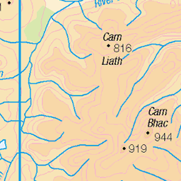
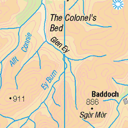
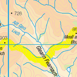
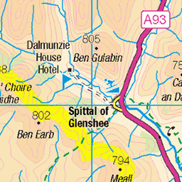
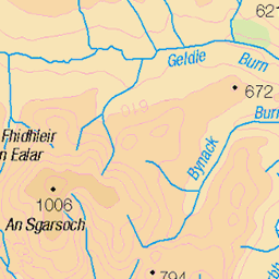
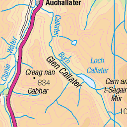
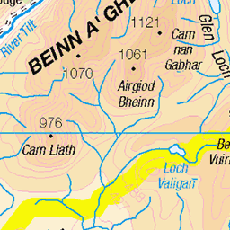
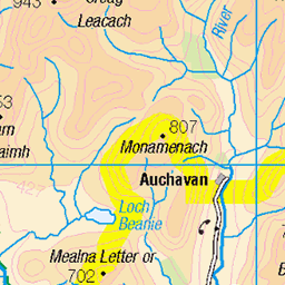
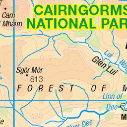
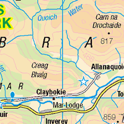
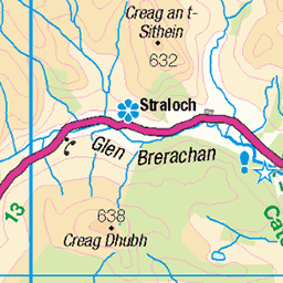
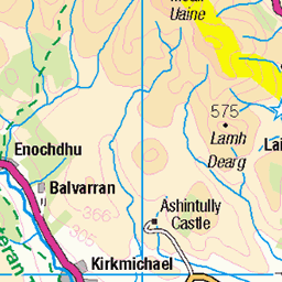
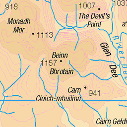
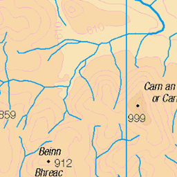
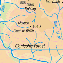
OS Map of Carn a' Chlarsaich
Height: 871m / 2858ft • Prominence: 85m / 279ft • Summit : vegetated outcrop • Trip reports (hill-bagging)


Return from Beinn Iutharn Mhor
A view across Loch nan Eun and down Gleann Taitneach (right) in the southern Cairngorms. This was after a hike out to Beinn Iutharn Mhor (easy to include this mountain as part of the Glas Tulaichean & Carn an Righ outing from the Dalmunzie Castle Hotel) and return over hills to the NW of the loch.
24-Jun-23 • OutdoorMonkey • flickr
water lake loch lochnaneun scotland highlands cairngorms cloud cloudy outside outdoor rural countryside remote wild wilderness landscape scenery scenic 53017012283
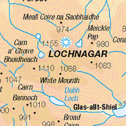
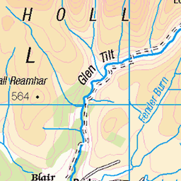
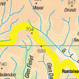
OS Map
This is OS mapping. In some areas, OpenStreetMap shows more footpaths
Spatial NI has online OSNI mapping. Click "Basemap Gallery" (4 squares icon at the top).
Now would be a good time for a cup of tea.
GPX Editor
Record map clicks
Reload map
Photos
Please tag your photos and upload them to the British and Irish Mountains group on Flickr
The other photos have been geo-tagged as on or around the summit. For less busy mountains, it can be a little hit and miss.
Return from Beinn Iutharn Mhor
A view across Loch nan Eun and down Gleann Taitneach (right) in the southern Cairngorms. This was after a hike out to Beinn Iutharn Mhor (easy to include this mountain as part of the Glas Tulaichean & Carn an Righ outing from the Dalmunzie Castle Hotel) and return over hills to the NW of the loch.
24-Jun-23 • OutdoorMonkey • flickr
water lake loch lochnaneun scotland highlands cairngorms cloud cloudy outside outdoor rural countryside remote wild wilderness landscape scenery scenic 53017012283

Loch nan Eun
The remote loch at the head of Gleann Taitneach in the southern Cairngorms.
24-Jun-23 • OutdoorMonkey • flickr
water lake loch lochnaneun scotland highlands cairngorms cloud cloudy outside outdoor rural countryside remote wild wilderness landscape scenery scenic 53016531686

Gleann Taitneach
Looking towards the return walk down Gleann Taitneach after hiking Glas Tulaichean & Càrn an Rìgh.
23-Sep-22 • Russell-Davies • flickr
glastulaichean càrnanrìgh gleanntaitneach cairngorms cairngormsnationalpark munro munrobagging hillwalking glenshee landscape uk scotland highlands canon r6 canonr6 52631647839


Videos
None found
Notes
- Data: Database of British and Irish Hills v18.2
- Maps: We use OS mapping for England, Scotland, Wales, and the Isle of Man. Sadly, Channel Islands, Northern (OSNI) and Southern Ireland (OSI) mapping isn't available online, so we use Openstreetmap.