Hills of Britain and Ireland
OS Map of Braigh nan Creagan Breac


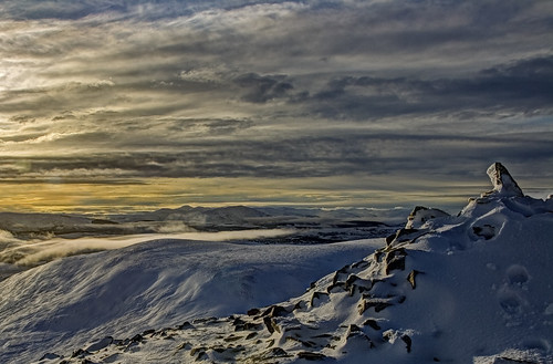
Feith an Lochan
Looking towards Loch Mairg and Beinn Bhreac
23-Mar-12 • Nick Bramhall • flickr
6875893668

OS Map
This is OS mapping. In some areas, OpenStreetMap shows more footpaths
Spatial NI has online OSNI mapping. Click "Basemap Gallery" (4 squares icon at the top).
Now would be a good time for a cup of tea.
GPX Editor
Record map clicks
Reload map
Photos
Please tag your photos and upload them to the British and Irish Mountains group on Flickr
The other photos have been geo-tagged as on or around the summit. For less busy mountains, it can be a little hit and miss.
Feith an Lochan
Looking towards Loch Mairg and Beinn Bhreac
23-Mar-12 • Nick Bramhall • flickr
6875893668

Carn a Chlamain Dec 2011 #15
Carn a Chlamain summit
mountain landscape scotland wintersunset munro 8705546044

Carn a Chlamain Dec 2011 #16
Beinn a Ghlo from Carn a Chlamain summit
winter mountain landscape scotland munro 8704527775

Carn a Chlamain Dec 2011 #14
Carn a Chlamain summit
winter mountain landscape scotland munro 8546390456
Videos
None found
Notes
- Data: Database of British and Irish Hills v18.2
- Maps: We use OS mapping for England, Scotland, Wales, and the Isle of Man. Sadly, Channel Islands, Northern (OSNI) and Southern Ireland (OSI) mapping isn't available online, so we use Openstreetmap.