Hills of Britain and Ireland
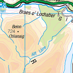
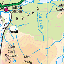
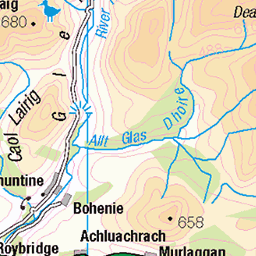
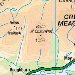
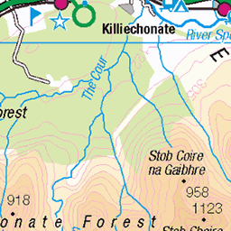
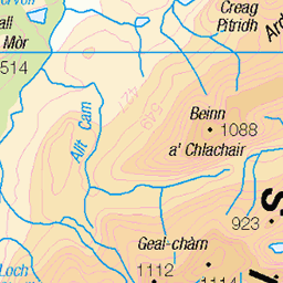
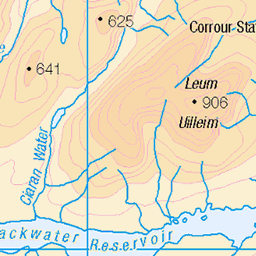
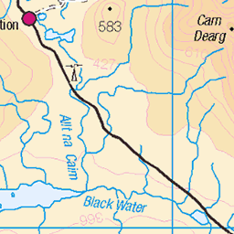
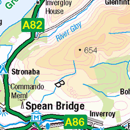
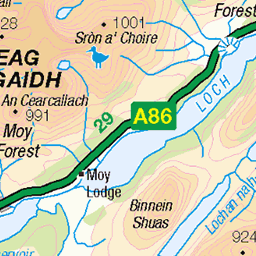
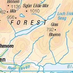
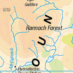
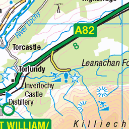
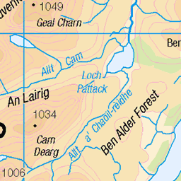
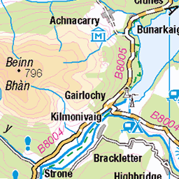
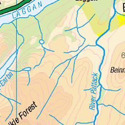
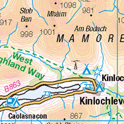
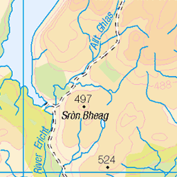
OS Map of Garbh-bheinn
Height: 857m / 2812ft • Prominence: 33m / 108ft • Summit : embedded rock • Trip reports (hill-bagging)

Chno Dearg - Mar 2014 #1
Mamores and Ben Nevis from Chno Dearg
winter mountain landscape scotland munro 13115824555

Chno Dearg - Mar 2014 #8
Mamores from Chno Dearg
winter mountain landscape scotland munro 13128583885

Chno Dearg - Mar 2014 #19
Glen Nevis from Chno Dearg
winter mountain landscape scotland munro 13202389783

Chno Dearg - Mar 2014 #10
Glen Nevis from Chno Dearg
winter mountain landscape scotland munro 13133972273

Chno Dearg - Mar 2014 #7
Glen Nevis from Chno Dearg
winter mountain landscape scotland munro 13128309624

OS Map
This is OS mapping. In some areas, OpenStreetMap shows more footpaths
Spatial NI has online OSNI mapping. Click "Basemap Gallery" (4 squares icon at the top).
Now would be a good time for a cup of tea.
GPX Editor
Record map clicks
Reload map
Photos
Please tag your photos and upload them to the British and Irish Mountains group on Flickr
The other photos have been geo-tagged as on or around the summit. For less busy mountains, it can be a little hit and miss.
Chno Dearg - Mar 2014 #1
Mamores and Ben Nevis from Chno Dearg
winter mountain landscape scotland munro 13115824555
Chno Dearg - Mar 2014 #8
Mamores from Chno Dearg
winter mountain landscape scotland munro 13128583885
Chno Dearg - Mar 2014 #19
Glen Nevis from Chno Dearg
winter mountain landscape scotland munro 13202389783
Chno Dearg - Mar 2014 #10
Glen Nevis from Chno Dearg
winter mountain landscape scotland munro 13133972273
Chno Dearg - Mar 2014 #7
Glen Nevis from Chno Dearg
winter mountain landscape scotland munro 13128309624

Chno Dearg - Mar 2014 #15
Stob Coire Easain and Stob a Choire Mheadhoin from Chno Dearg
winter mountain landscape scotland munro 13153608384

Chno Dearg - Mar 2014 #16
Mamores and Ben Nevis at dusk
winter mountain landscape scotland munro 13154035593

Chno Dearg - Mar 2014 #3
Mamores and Ben Nevis from Chno Dearg
winter mountain landscape scotland munro 13116196303
Videos
None found
Notes
- Data: Database of British and Irish Hills v18.2
- Maps: We use OS mapping for England, Scotland, Wales, and the Isle of Man. Sadly, Channel Islands, Northern (OSNI) and Southern Ireland (OSI) mapping isn't available online, so we use Openstreetmap.