Hills of Britain and Ireland
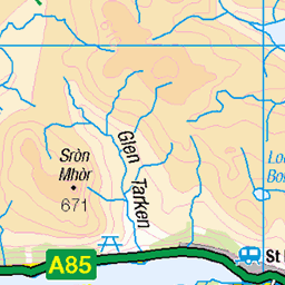
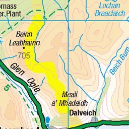
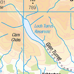
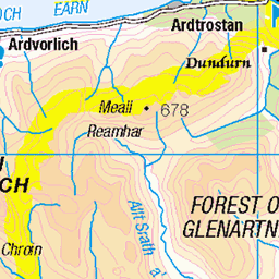
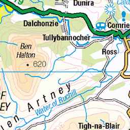
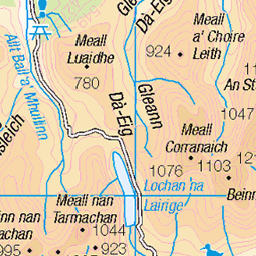
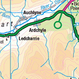
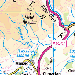
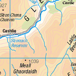
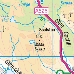
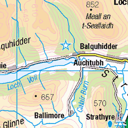
OS Map of Creag Uchdag
Height: 879m / 2883ft • Prominence: 276m / 906ft • Summit : trig point • Trip reports (hill-bagging)


Waterfall nr Killin Loch, Scotland
Opted for a shorter exposure in order to use the only available lens I had to capture the full width of the water fall.
04-Jun-11 • Ghostly Presents • flickr
nature britishwildlife biodiversity ukwildlife 6624114037

S6473 - Creag Uchdag
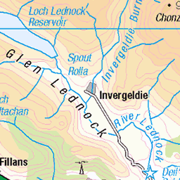
NN708323, LR51 & LR52. HISTORY Pillar completed 9th June 1951, cost not on record. Computed as secondary triangulation station NO02/6 within the Perth Block, and levelled to second class precision during 1951. This pillar station was last maintained by the Ordnance Survey in June 1980. SITE VISIT Set off from Comrie and walked the unclassified road then track through Glen Lednock to NN730300. Then in a nominally straight line NW to top. The pillar is in good condition. Spider centre open. The flush bracket faces southeast, compass measurement 141°. Vented through left (SW) sight hole. 360° panorama to many other identifiable tops. Photographed: 1st June 2006, GRP. ═════════════════════════ Interactive index: www.google.com/maps/d/viewer?mid=1arx2Qmo5mVeVUJA2lzVG_uzbYPW59ffh&ll=56.46526355,-4.09811833&z=11" rel="noreferrer nofollow Google My Maps ═════════════════════════ Neighbouring Triangulation Pillars www.flickr.com/photos/13460108@N06/8097999794/in/set-72157631793900484/ S6182 - Creag Gharbh : 4.73 miles to the west. www.flickr.com/photos/13460108@N06/8166144215/in/album-72157631793900484/ S6233 - Sron A' Chaoineidh : 4.89 miles to the northeast. www.flickr.com/photos/13460108@N06/8098000172/in/album-72157631793900484/ S6178 - Beinn Bhreac : 5.18 miles to the north. www.flickr.com/photos/13460108@N06/8098042696/in/album-72157631793900484/ S6474 - Carn Chois : 5.91 miles to the southeast. www.flickr.com/photos/13460108@N06/8098013800/in/album-72157631793900484/ S6220 - Creag Each : 7.22 miles to the southeast. www.flickr.com/photos/13460108@N06/7905744232/in/album-72157631348956488/ S1590 - Ben Lawers : 7.24 miles to the northwest. ═════════════════════════
01-Jun-06 • Graeme5015 • flickr
creaguchdag s6473 ardeonaig 8098013631
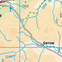
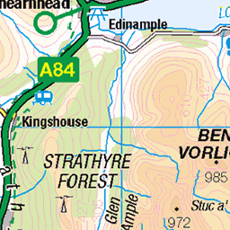
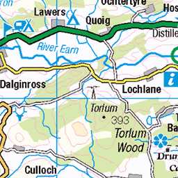
OS Map
This is OS mapping. In some areas, OpenStreetMap shows more footpaths
Spatial NI has online OSNI mapping. Click "Basemap Gallery" (4 squares icon at the top).
Now would be a good time for a cup of tea.
GPX Editor
Record map clicks
Reload map
Photos
Please tag your photos and upload them to the British and Irish Mountains group on Flickr
The other photos have been geo-tagged as on or around the summit. For less busy mountains, it can be a little hit and miss.
Waterfall nr Killin Loch, Scotland
Opted for a shorter exposure in order to use the only available lens I had to capture the full width of the water fall.
04-Jun-11 • Ghostly Presents • flickr
nature britishwildlife biodiversity ukwildlife 6624114037
S6473 - Creag Uchdag
NN708323, LR51 & LR52. HISTORY Pillar completed 9th June 1951, cost not on record. Computed as secondary triangulation station NO02/6 within the Perth Block, and levelled to second class precision during 1951. This pillar station was last maintained by the Ordnance Survey in June 1980. SITE VISIT Set off from Comrie and walked the unclassified road then track through Glen Lednock to NN730300. Then in a nominally straight line NW to top. The pillar is in good condition. Spider centre open. The flush bracket faces southeast, compass measurement 141°. Vented through left (SW) sight hole. 360° panorama to many other identifiable tops. Photographed: 1st June 2006, GRP. ═════════════════════════ Interactive index: www.google.com/maps/d/viewer?mid=1arx2Qmo5mVeVUJA2lzVG_uzbYPW59ffh&ll=56.46526355,-4.09811833&z=11" rel="noreferrer nofollow Google My Maps ═════════════════════════ Neighbouring Triangulation Pillars www.flickr.com/photos/13460108@N06/8097999794/in/set-72157631793900484/ S6182 - Creag Gharbh : 4.73 miles to the west. www.flickr.com/photos/13460108@N06/8166144215/in/album-72157631793900484/ S6233 - Sron A' Chaoineidh : 4.89 miles to the northeast. www.flickr.com/photos/13460108@N06/8098000172/in/album-72157631793900484/ S6178 - Beinn Bhreac : 5.18 miles to the north. www.flickr.com/photos/13460108@N06/8098042696/in/album-72157631793900484/ S6474 - Carn Chois : 5.91 miles to the southeast. www.flickr.com/photos/13460108@N06/8098013800/in/album-72157631793900484/ S6220 - Creag Each : 7.22 miles to the southeast. www.flickr.com/photos/13460108@N06/7905744232/in/album-72157631348956488/ S1590 - Ben Lawers : 7.24 miles to the northwest. ═════════════════════════
01-Jun-06 • Graeme5015 • flickr
creaguchdag s6473 ardeonaig 8098013631
Videos
A cracking day on a fantastic Scottish Corbett, beautiful Winter conditions and stunning views in the lovely Glen Lednock.
A walk up the little known hill of Creag Uchdag via Glen Lednock in Perth and Kinross. The route back down followed the shore of ...
Grassy foreground not great, but an attractive autumn day gave good views of the surrounding Highlands, especially from Stuc a' ...
The day starts in an icy Lochearnhead, Unsure if the equipment I brought will be enough to get me to the summit. A journey up ...
An awesome adventure with Ian circumnavigating Loch Lednock taking in Creag Uchdag.
Notes
- Data: Database of British and Irish Hills v18.2
- Maps: We use OS mapping for England, Scotland, Wales, and the Isle of Man. Sadly, Channel Islands, Northern (OSNI) and Southern Ireland (OSI) mapping isn't available online, so we use Openstreetmap.