Hills of Britain and Ireland
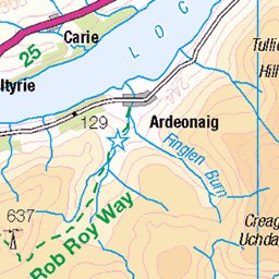
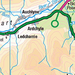
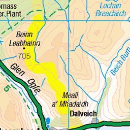
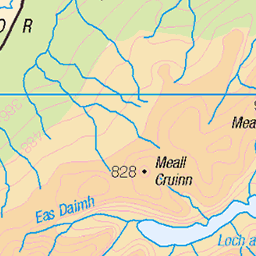
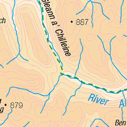
OS Map of Creag an Lochain
Height: 840m / 2757ft • Prominence: 48m / 157ft • Summit : embedded rock • Trip reports (hill-bagging)

Creag an Lochain, Ben Lawers...habitat of Scoliocentra flavotestacea
[Photo: Sam Thomas] Montane Salix scrub and species rich tall herb communities on Creag an Lochain, Ben Lawers. July 2024
54338494264

Malaise trap, Creag an Lochain
24-Jul-24 • sjthomasbotany5 • flickr
aberfeldy scotland unitedkingdom 54073669030

Creag an Lochain, Ben Lawers...habitat of Scoliocentra flavotestacea
[Photo: Sam Thomas] Montane Salix scrub and species-rich tall herb communities on Creag an Lochain, Ben Lawers. July 2024
54338494259

Malaise trap, Creag an Lochain
21-Jul-24 • sjthomasbotany5 • flickr
aberfeldy scotland unitedkingdom 54073668665

Habitat of Stenoptilia islandicus, Creag an Lochain
21-Jul-24 • sjthomasbotany5 • flickr
aberfeldy scotland unitedkingdom 54073669850

Cirsium heterophyllum, Creag an Lochain
21-Jul-24 • sjthomasbotany5 • flickr
cirsiumheterophyllum 54072331812
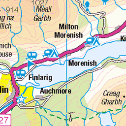
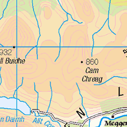
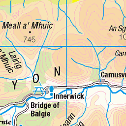
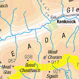
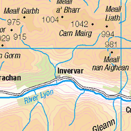
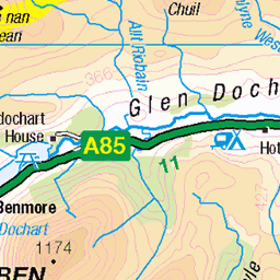
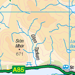
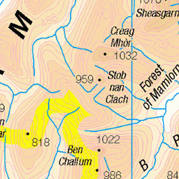
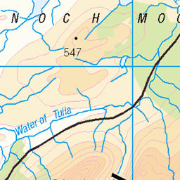
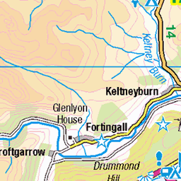
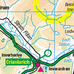
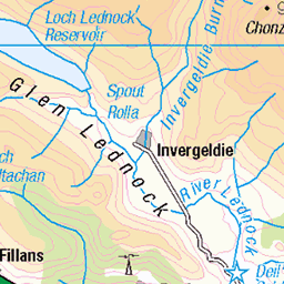
OS Map
This is OS mapping. In some areas, OpenStreetMap shows more footpaths
Spatial NI has online OSNI mapping. Click "Basemap Gallery" (4 squares icon at the top).
Now would be a good time for a cup of tea.
GPX Editor
Record map clicks
Reload map
Photos
Please tag your photos and upload them to the British and Irish Mountains group on Flickr
The other photos have been geo-tagged as on or around the summit. For less busy mountains, it can be a little hit and miss.
Creag an Lochain, Ben Lawers...habitat of Scoliocentra flavotestacea
[Photo: Sam Thomas] Montane Salix scrub and species rich tall herb communities on Creag an Lochain, Ben Lawers. July 2024
54338494264
Malaise trap, Creag an Lochain
24-Jul-24 • sjthomasbotany5 • flickr
aberfeldy scotland unitedkingdom 54073669030
Creag an Lochain, Ben Lawers...habitat of Scoliocentra flavotestacea
[Photo: Sam Thomas] Montane Salix scrub and species-rich tall herb communities on Creag an Lochain, Ben Lawers. July 2024
54338494259
Malaise trap, Creag an Lochain
21-Jul-24 • sjthomasbotany5 • flickr
aberfeldy scotland unitedkingdom 54073668665
Habitat of Stenoptilia islandicus, Creag an Lochain
21-Jul-24 • sjthomasbotany5 • flickr
aberfeldy scotland unitedkingdom 54073669850
Cirsium heterophyllum, Creag an Lochain
21-Jul-24 • sjthomasbotany5 • flickr
cirsiumheterophyllum 54072331812

Cirsium heterophyllum, Creag an Lochain
21-Jul-24 • sjthomasbotany5 • flickr
cirsiumheterophyllum 54073217566

Euphrasia frigida, Creag an Lochain
21-Jul-24 • sjthomasbotany5 • flickr
euphrasiafrigida 54073543554


Angelica sylvestris, Creag an Lochain
21-Jul-24 • sjthomasbotany5 • flickr
angelicasylvestris 54073672195
Videos
In today's video I will be Munro Bagging two single Munros on either side of Loch an Daimh, with the start point of Giorra Dam.
Murrayofscotland #killin #hike #hiking #summit #creaggharbh #robroyway.
No.,58, Stuchd an Lochain and No., 59, Meall Buidhe, 07/07/2014, 5 hours, 17.5 km/11 miles, 1277m ascent. Was looking for ...
7.05.2022 The South Glen Shiel Ridge: Creag a'Mhaim (947m), Druim Shionnach (987m), Aonach air Chrith (1021m), Maol ...
16.01.2022 An Lochan Uaine (Green Loch)
Notes
- Data: Database of British and Irish Hills v18.2
- Maps: We use OS mapping for England, Scotland, Wales, and the Isle of Man. Sadly, Channel Islands, Northern (OSNI) and Southern Ireland (OSI) mapping isn't available online, so we use Openstreetmap.