Hills of Britain and Ireland
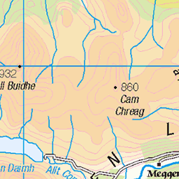
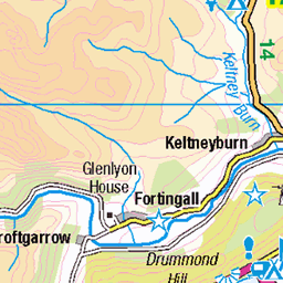
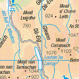
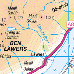
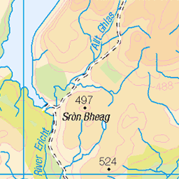
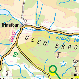
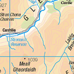
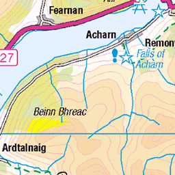
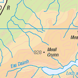
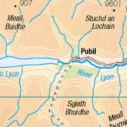
OS Map of Meall Breac
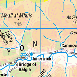
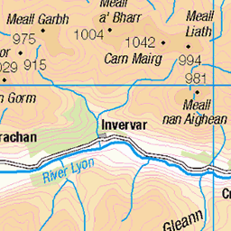
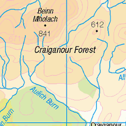
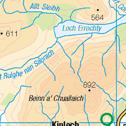
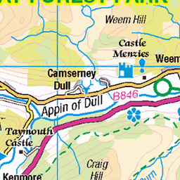
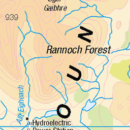
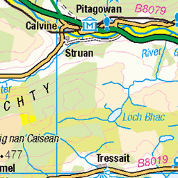
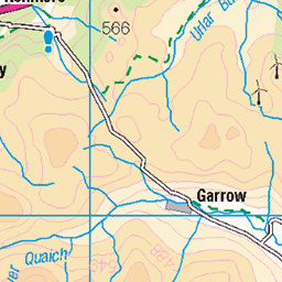
OS Map
This is OS mapping. In some areas, OpenStreetMap shows more footpaths
Spatial NI has online OSNI mapping. Click "Basemap Gallery" (4 squares icon at the top).
Now would be a good time for a cup of tea.
Try disabling your ad-blocker if the map doesn't appear.
GPX Editor
Record map clicks
Reload map
Initialising...
Photos
bmdhill
hill2971
Please tag your photos and upload them to the British and Irish Mountains group on Flickr
The other photos have been geo-tagged as on or around the summit. For less busy mountains, it can be a little hit and miss.
Be the first to add photos to the Flickr Group.
Videos
Scottish Morning rolls 🏴😋 Straight from the oven! Click for the whole video recipe ❤️
What's For Tea?, Mar-23
Pan Haggerty! An amazing combo of ingredients 😋🏴 find the video on my YouTube channel!
What's For Tea?, Apr-23
This corned beef hash as a pie filling is absolutely amazing! Quick & tasty too 😋🏴
What's For Tea?, Apr-23
Poor Boy In The Kitchen : Sandwich
Poor Boy, Fri 11-Apr
Poor Boy cooking a cheap easy meal using: Bread, peanut butter, banana and cinnamon.
Not ROASTED cheese! #cooking #food #dinner #snacks #scotland #yum #cheese #cheeseontoast
&y, May-24
We all have to own our mistakes. It's cheese on toast. Your turn.
Notes
- Data: Database of British and Irish Hills v18.2
- Maps: We use OS mapping for England, Scotland, Wales, and the Isle of Man. Sadly, Channel Islands, Northern (OSNI) and Southern Ireland (OSI) mapping isn't available online, so we use Openstreetmap.