Hills of Britain and Ireland
OS Map of Cam Chreag


OS Map
This is OS mapping. In some areas, OpenStreetMap shows more footpaths
Spatial NI has online OSNI mapping. Click "Basemap Gallery" (4 squares icon at the top).
Now would be a good time for a cup of tea.
GPX Editor
Record map clicks
Reload map
Photos
Please tag your photos and upload them to the British and Irish Mountains group on Flickr
The other photos have been geo-tagged as on or around the summit. For less busy mountains, it can be a little hit and miss.

Meall an t-Seallaidh
15-Jun-13 • Mumbles Head • flickr
mountains scotland highlands corbetts 9184159104

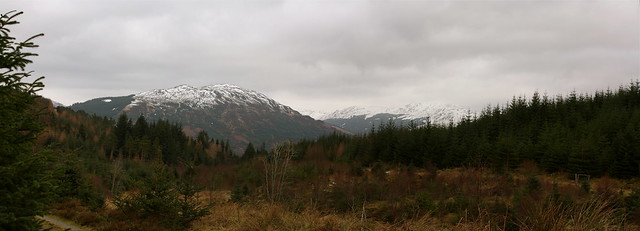
South path, Glen Massan
All afternoon, these grey clouds threatened to come our way, but didn't.
28-Jul-12 • goforchris • flickr
sky clouds scotland landscapes argyll glenkin 7672522696

Kirkton Glen
Looking up Kirkton Glen near Balquhidder. The snow was drifting in and starting to obscure the hilltops. Looks best bighugelabs.com/flickr/onblack.php?id=3246036774&size=large" rel="nofollow Large On Black .
01-Feb-09 • Allan Ogg • flickr
winter panorama snow walking landscape scotland balquhidder kirktonglen 3246036774
Kirkton Glen
Looking down Kirkton Glen near Balquhidder. Looks better bighugelabs.com/flickr/onblack.php?id=3248317583&size=large" rel="nofollow Large On Black .
01-Feb-09 • Allan Ogg • flickr
winter panorama snow walking landscape scotland balquhidder kirktonglen 3248317583
Videos
None found
Notes
- Data: Database of British and Irish Hills v18.2
- Maps: We use OS mapping for England, Scotland, Wales, and the Isle of Man. Sadly, Channel Islands, Northern (OSNI) and Southern Ireland (OSI) mapping isn't available online, so we use Openstreetmap.