Hills of Britain and Ireland
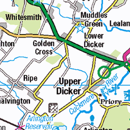
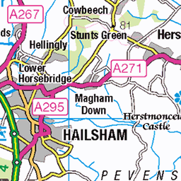
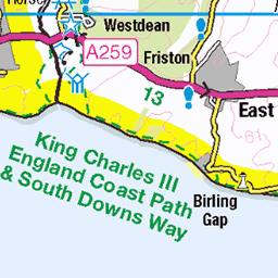
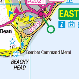
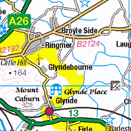
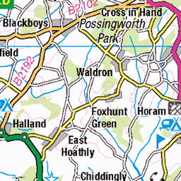
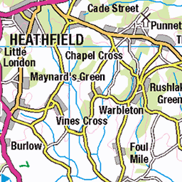
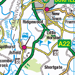
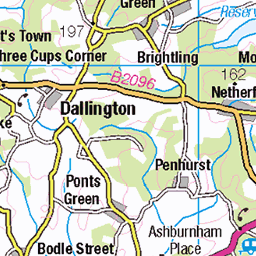
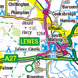
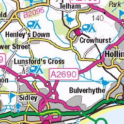
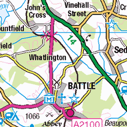
OS Map of Wilmington Hill
Height: 215m / 704ft • Prominence: 195m / 640ft • Summit : no feature: ground 20m ENE of trig point • Trip reports (hill-bagging)


Figure
The Long Man of Wilmington on a warm late summer day.
01-Sep-24 • Frantastic. • flickr
figure hill countryside sussex wilmington england 53997866792

Wilmington Long Man
25-Aug-24 • CdL Creative • flickr
bn26 cdlcreative longman southdownsway stevehutchings sussex wilmington geo:lat=508150 geo:lon=01888 geotagged polegate england unitedkingdom 54023884708


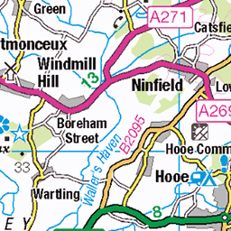
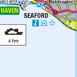
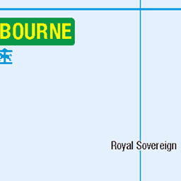
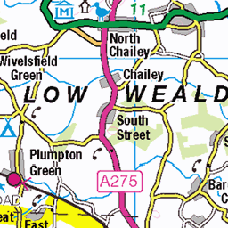
OS Map
This is OS mapping. In some areas, OpenStreetMap shows more footpaths
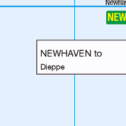
Spatial NI has online OSNI mapping. Click "Basemap Gallery" (4 squares icon at the top).
Now would be a good time for a cup of tea.


GPX Editor
Record map clicks
Reload map
Photos
Please tag your photos and upload them to the British and Irish Mountains group on Flickr
The other photos have been geo-tagged as on or around the summit. For less busy mountains, it can be a little hit and miss.
Figure
The Long Man of Wilmington on a warm late summer day.
01-Sep-24 • Frantastic. • flickr
figure hill countryside sussex wilmington england 53997866792
Wilmington Long Man
25-Aug-24 • CdL Creative • flickr
bn26 cdlcreative longman southdownsway stevehutchings sussex wilmington geo:lat=508150 geo:lon=01888 geotagged polegate england unitedkingdom 54023884708


Long Man of Wilmington (South Downs National Park,) Wilmington
17-Jul-24 • Sittingbourne Snappa • flickr
53967318472

Polegate (South Downs National Park,) Wealden District
17-Jul-24 • Sittingbourne Snappa • flickr
53968452323

2919 Wilmington Hill b
Third of six Marilyns on a rest day from FMD duties at Guildford LDCC. Parked in car park in Jevington on right south of pub and Church Lane. Up passed church on South Down Way. Detour off SDW to summit trig point in cereal field. Name:Wilmington Hill Hill number:2919 Height:214m / 702ft RHB Section:42: South-East England & the Isle of Wight County/UA:East Sussex (CoU) Catchment:Minor Rivers only (South) Class:Marilyn, Hump, Tump (200-299m), Clem Grid ref:TQ 54850 03448 Summit feature:no feature: ground 25m ENE of trig point Drop:192m Col:22m TQ587091 Observations:summit is 0.75m higher than trig point (TQ 54831 03437) Survey:Abney level
16-Aug-07 • Dugswell2 • flickr
trigpoint s3986 wilmingtonhilltrigpoint wilmingtonhill p192 marilyn hump tump clem 48879604371
Videos
On todays epispde we climb and take a look at The long man of wilmington and wilmington hill the long man is 200ft odd not the ...
The Long Man of Wilmington is a hill figure on the steep slopes of Windover Hill near Wilmington, East Sussex, England.
Drone footage of the Long Man of Wilmington, an iconic hillside figure located in Wilmington, East Sussex, England ...
A September day-hike from the village of Jevington to the South Downs peaks of Windover & Wilmington Hills with a wild-camp on ...
We only noticed that you can the famous Long Man of Wilmington from Arlington Reservoir on a recent visit! Here's some more ...
Notes
- Data: Database of British and Irish Hills v18.2
- Maps: We use OS mapping for England, Scotland, Wales, and the Isle of Man. Sadly, Channel Islands, Northern (OSNI) and Southern Ireland (OSI) mapping isn't available online, so we use Openstreetmap.