Hills of Britain and Ireland
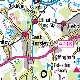
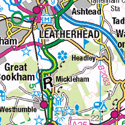
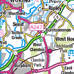
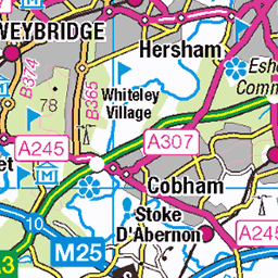
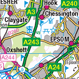
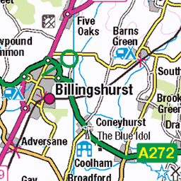
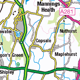
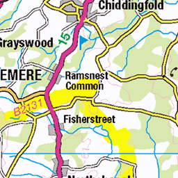
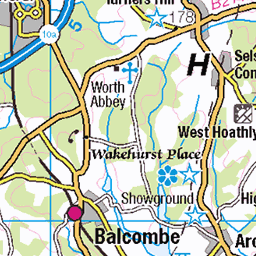
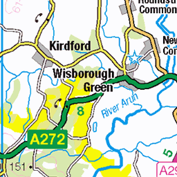
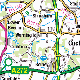
OS Map of Leith Hill
Height: 294m / 965ft • Prominence: 247m / 810ft • Summit : grassy knoll with seat • Trip reports (hill-bagging)

Entangled in Green
An interesting Photography Workshop laid on by the National Trust at Leith Hill Rhododendron Wood.
06-Oct-24 • PaulOfHorsham • flickr
leithhill leithhillplace nationaltrust rhododendronwood 54057442534

On the lower slopes of Leith Hill a field of Maize is growing. Then the wooded Weald. On the horizon is the South Downs. Left to right: Chanctonbury Ring, Church tower in Petworth, Arun Valley, Westburton and Bignor Hills, Duncton , Graffham and Heyshott
Commentary. Leith Hill is the highest point of the High Weald in South-East England. The backslope of this Sandstone escarpment climbs steadily but gently from Wotton to the tower at the summit. The south-facing Scarp slope, however, is much steeper. Its dramatic rise from the Weald below, presents views such as this. A chequerboard of woodland and fields spreads southwards as far as the South Downs. On a clear day even the English Channel can be seen through the Shoreham Gap. On this hill, even half way up, it is as if life continues uninterrupted below, with roads, traffic, farms, houses and villages, but here, from its slopes a still, silent breath of fresh air creates a welcome peace, just for a while.
27-Jul-24 • Scotland by NJC. • flickr
54070921181

View from the lower slopes of Leith Hill to Black Down, 280 metres, 20 miles distant to the west, Surrey, England.
Commentary. Leith Hill is the highest point of the High Weald in South-East England. The backslope of this Sandstone escarpment climbs steadily but gently from Wotton to the tower at the summit. The south-facing Scarp slope, however, is much steeper. Its dramatic rise from the Weald below, presents views such as this. A chequerboard of woodland and fields spreads southwards as far as the South Downs. On a clear day even the English Channel can be seen through the Shoreham Gap. On this hill, even half way up, it is as if life continues uninterrupted below, with roads, traffic, farms, houses and villages, but here, from its slopes a still, silent breath of fresh air creates a welcome peace, just for a while.
27-Jul-24 • Scotland by NJC. • flickr
54228282570

View from Abinger Road, Leith Hill across the Surrey/Sussex Weald. Chanctonbury Ring and the Shoreham Gap can be seen in the South Downs.
Commentary. Leith Hill is the highest point of the High Weald in South-East England. The backslope of this Sandstone escarpment climbs steadily but gently from Wotton to the tower at the summit. The south-facing Scarp slope, however, is much steeper. Its dramatic rise from the Weald below, presents views such as this. A chequerboard of woodland and fields spreads southwards as far as the South Downs. On a clear day even the English Channel can be seen through the Shoreham Gap. On this hill, even half way up, it is as if life continues uninterrupted below, with roads, traffic, farms, houses and villages, but here, from its slopes a still, silent breath of fresh air creates a welcome peace, just for a while.
27-Jul-24 • Scotland by NJC. • flickr
54181461115

Amazing pan from Leith Hill Tower to South Downs. Firle Beacon, left to Rackham Hill, right, 30 miles. Leith Hill to Firle Beacon, 40 miles. Leith Hill to Shoreham Gap, right of centre on horizon, 20 miles.
Commentary. Leith Hill is the highest point of the High Weald in South-East England. The backslope of this Sandstone escarpment Climbs steadily but gently from Wotton to the tower at the summit. The south-facing Scarp slope, however, is much steeper. Its dramatic rise from the Weald below, presents views such as this. A chequerboard of woodland and fields spreads southwards as far as the South Downs. On a clear day even the English Channel can be seen through the Shoreham Gap. On this peak it is as if life continues uninterrupted below with roads, traffic, farms, houses and villages, but here, at the summit, a still, silent breath of fresh air creates a welcome peace, just for a while.
27-Jul-24 • Scotland by NJC. • flickr
dorking england unitedkingdom 54107226798

Tea for one and room with a view. View of the Surrey and Sussex Weald to the South Downs from Leith Hill Place, Surrey, England.
Commentary. Richard Hull was one of several renowned figures that resided in Leith Hill Place, below the hill and west of Coldharbour. He was a local eccentric who obviously regretted that Leith Hill was less than 1,000 feet high, by a mere 35 feet. Therefore, it was the second highest hill in South-East England. Walbury Hill, in Berkshire, exceeded it by just nine feet, 974 feet, compared to 965 feet, for his beloved Leith Hill. Being wealthy he decided on an extravagant plan to build a “Folly” or “Look-Out Tower” on the summit. He did so, and thus, one could stand on the top, over 1,030 feet above sea-level. On goes the story…… He chose to be buried beneath the tower when he deceased. However, so topsy-turvy did he view his 18th. Century world, that he insisted that he should be buried upside down. That way, he figured, he was more likely to enter the after-life the right way around. Whatever his ambitions, his tower still provides a magnificent view from London to the Channel Coast. Indeed, it is said, that on a clear day 13 counties can be discerned by their landmarks. Most U.K. mountains cannot claim a view of more than 5 or 6 counties, even on a clear day! For what is still a fairly modest altitude the view from Leith Hill Tower is quite phenomenal.
27-Jul-24 • Scotland by NJC. • flickr
dorking england unitedkingdom 54431691349
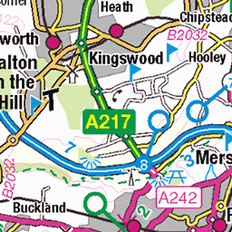
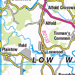
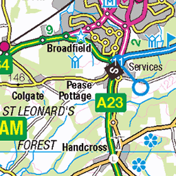
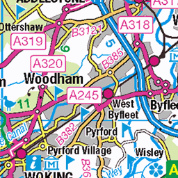
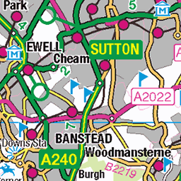
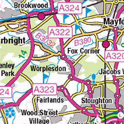
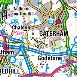
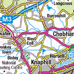
OS Map
This is OS mapping. In some areas, OpenStreetMap shows more footpaths
Spatial NI has online OSNI mapping. Click "Basemap Gallery" (4 squares icon at the top).
Now would be a good time for a cup of tea.
GPX Editor
Record map clicks
Reload map
Photos
Please tag your photos and upload them to the British and Irish Mountains group on Flickr
The other photos have been geo-tagged as on or around the summit. For less busy mountains, it can be a little hit and miss.
Entangled in Green
An interesting Photography Workshop laid on by the National Trust at Leith Hill Rhododendron Wood.
06-Oct-24 • PaulOfHorsham • flickr
leithhill leithhillplace nationaltrust rhododendronwood 54057442534
On the lower slopes of Leith Hill a field of Maize is growing. Then the wooded Weald. On the horizon is the South Downs. Left to right: Chanctonbury Ring, Church tower in Petworth, Arun Valley, Westburton and Bignor Hills, Duncton , Graffham and Heyshott
Commentary. Leith Hill is the highest point of the High Weald in South-East England. The backslope of this Sandstone escarpment climbs steadily but gently from Wotton to the tower at the summit. The south-facing Scarp slope, however, is much steeper. Its dramatic rise from the Weald below, presents views such as this. A chequerboard of woodland and fields spreads southwards as far as the South Downs. On a clear day even the English Channel can be seen through the Shoreham Gap. On this hill, even half way up, it is as if life continues uninterrupted below, with roads, traffic, farms, houses and villages, but here, from its slopes a still, silent breath of fresh air creates a welcome peace, just for a while.
27-Jul-24 • Scotland by NJC. • flickr
54070921181
View from the lower slopes of Leith Hill to Black Down, 280 metres, 20 miles distant to the west, Surrey, England.
Commentary. Leith Hill is the highest point of the High Weald in South-East England. The backslope of this Sandstone escarpment climbs steadily but gently from Wotton to the tower at the summit. The south-facing Scarp slope, however, is much steeper. Its dramatic rise from the Weald below, presents views such as this. A chequerboard of woodland and fields spreads southwards as far as the South Downs. On a clear day even the English Channel can be seen through the Shoreham Gap. On this hill, even half way up, it is as if life continues uninterrupted below, with roads, traffic, farms, houses and villages, but here, from its slopes a still, silent breath of fresh air creates a welcome peace, just for a while.
27-Jul-24 • Scotland by NJC. • flickr
54228282570
View from Abinger Road, Leith Hill across the Surrey/Sussex Weald. Chanctonbury Ring and the Shoreham Gap can be seen in the South Downs.
Commentary. Leith Hill is the highest point of the High Weald in South-East England. The backslope of this Sandstone escarpment climbs steadily but gently from Wotton to the tower at the summit. The south-facing Scarp slope, however, is much steeper. Its dramatic rise from the Weald below, presents views such as this. A chequerboard of woodland and fields spreads southwards as far as the South Downs. On a clear day even the English Channel can be seen through the Shoreham Gap. On this hill, even half way up, it is as if life continues uninterrupted below, with roads, traffic, farms, houses and villages, but here, from its slopes a still, silent breath of fresh air creates a welcome peace, just for a while.
27-Jul-24 • Scotland by NJC. • flickr
54181461115
Amazing pan from Leith Hill Tower to South Downs. Firle Beacon, left to Rackham Hill, right, 30 miles. Leith Hill to Firle Beacon, 40 miles. Leith Hill to Shoreham Gap, right of centre on horizon, 20 miles.
Commentary. Leith Hill is the highest point of the High Weald in South-East England. The backslope of this Sandstone escarpment Climbs steadily but gently from Wotton to the tower at the summit. The south-facing Scarp slope, however, is much steeper. Its dramatic rise from the Weald below, presents views such as this. A chequerboard of woodland and fields spreads southwards as far as the South Downs. On a clear day even the English Channel can be seen through the Shoreham Gap. On this peak it is as if life continues uninterrupted below with roads, traffic, farms, houses and villages, but here, at the summit, a still, silent breath of fresh air creates a welcome peace, just for a while.
27-Jul-24 • Scotland by NJC. • flickr
dorking england unitedkingdom 54107226798
Tea for one and room with a view. View of the Surrey and Sussex Weald to the South Downs from Leith Hill Place, Surrey, England.
Commentary. Richard Hull was one of several renowned figures that resided in Leith Hill Place, below the hill and west of Coldharbour. He was a local eccentric who obviously regretted that Leith Hill was less than 1,000 feet high, by a mere 35 feet. Therefore, it was the second highest hill in South-East England. Walbury Hill, in Berkshire, exceeded it by just nine feet, 974 feet, compared to 965 feet, for his beloved Leith Hill. Being wealthy he decided on an extravagant plan to build a “Folly” or “Look-Out Tower” on the summit. He did so, and thus, one could stand on the top, over 1,030 feet above sea-level. On goes the story…… He chose to be buried beneath the tower when he deceased. However, so topsy-turvy did he view his 18th. Century world, that he insisted that he should be buried upside down. That way, he figured, he was more likely to enter the after-life the right way around. Whatever his ambitions, his tower still provides a magnificent view from London to the Channel Coast. Indeed, it is said, that on a clear day 13 counties can be discerned by their landmarks. Most U.K. mountains cannot claim a view of more than 5 or 6 counties, even on a clear day! For what is still a fairly modest altitude the view from Leith Hill Tower is quite phenomenal.
27-Jul-24 • Scotland by NJC. • flickr
dorking england unitedkingdom 54431691349


Three jet planes in the Stratosphere. Three hot-air balloons in the Troposphere. Zoom in below the top right jet plane. A sunset, winter mist produces a dream landscape of layer upon layer of Sandstone Ridges and Clay Vales across the Surrey and Sussex.
Poem. Oh, sumptuous scene! Myriad of sandstone ridges fade to the horizon, merging with a milky, hazy sky where three jets and three hot-air balloons fly in the stratosphere and troposphere. Black Down (280 metres) breaks the skyline as a gently undulating landscape of Wealden rippling waves presents its tableau of woodland and clearing, woodland and clearing, since time immemorial. Early Spring has the trees bare and skeletal and between the gorse, thin-branched shrubs and bushes seem to link arms, like silken gossamer cob-webs. Shooting into the sun may break a rule but here a lustrous, translucent, dream-like terrain mimics the road to “Middle Earth” and is well-worth the transgression.
24-Feb-19 • Scotland by NJC. • flickr
54209580109

Tilling Springs, one of several sources of the River Tillingbourne, Leith Hill, Surrey, England.
Commentary. Where permeable strata meets impermeable. Greensand meets Atherfield Clay. Source of the short, but enchanting River Tillingbourne. A mere twelve miles long, much more a stream than a river, in fact, several north-flowing streams down Leith Hill’s dip slope. Here tucked away in a private garden is its source, Tilling Springs. A sumptuous green oasis, firs and beech and oak arch over the island sheltering the swan-house. A sun-glinted, peaceful haven in the heart of extensive woodland. South-east of Friday Street and Broadmoor. A veritable Garden of Eden, a secret garden, here in the Surrey Hills.
20-Aug-18 • Scotland by NJC. • flickr
54158460890

The beauty of Leith Hill Rhododendron Wood, Surrey, England.
Commentary. That wonderful organisation, “the National Trust,” keepers of our heritage, manage the Rhododendron woods at Leith Hill Place in Surrey. Some of the most wooded and captivating countryside in South-East England contains the highest viewpoint, the Tower, designed by, and the final resting place of, the local eccentric, and one time owner, of Leith Hill Place, Richard Hull. This image is taken on the southern slopes of Leith Hill near to the house, now owned by the National Trust in honour of another of its owners, the composer, Ralph Vaughan Williams. In high summer, a glimpse through the floribunda incorporates the waxy ovoid leaves of the ubiquitous rhododendron with its massive white and blush-pink blooms. Almost silhouetted against the brightly lit forest glade is the pinnate, symmetrically paired oval leaves of the Rowan tree or Mountain Ash. The luxuriant foliage and fine vistas of this wonderful area are excellent for exploration and relaxation.
01-Jun-17 • Scotland by NJC. • flickr
54125093243
Videos
For more information visit https://en.wikipedia.org/wiki/Leith_Hill Music: "Pictures of the Floating World" by Pale Tussuck.
Experience the stunning fall transformation at Leith Hill! Explore the colorful trails, historic sites, and breathtaking viewpoints of this ...
Leith Hill is the 2nd highest point in the South East of England at 249m (817ft) at Surrey Hills. If and when you climb Leith Hill ...
Join us as we embark on an exhilarating hiking adventure in Leith Hill with the London Club. Ascend to the summit of Leith Hill, ...
Holmwood to Gomshall walk Next event: http://www.senderismoenlondres.co.uk/events.html A very pretty forest walk, quite close ...
Notes
- Data: Database of British and Irish Hills v18.2
- Maps: We use OS mapping for England, Scotland, Wales, and the Isle of Man. Sadly, Channel Islands, Northern (OSNI) and Southern Ireland (OSI) mapping isn't available online, so we use Openstreetmap.