Hills of Britain and Ireland
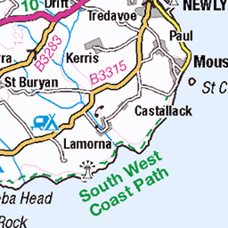
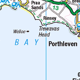
OS Map of Watch Croft (White Downs)
Height: 253m / 830ft • Prominence: 227m / 745ft • Summit : tor 25m SW of trig point • Trip reports (hill-bagging)

PXL_20241120_101511733.RAW-02.ORIGINAL
20-Nov-24 • tompagenet • flickr
carngalvermine jopage penwith 54235799489


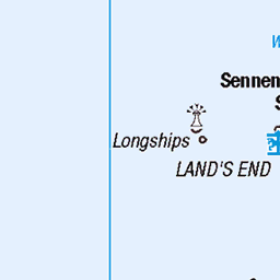
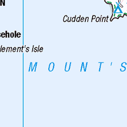
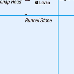
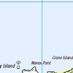
OS Map
This is OS mapping. In some areas, OpenStreetMap shows more footpaths
Spatial NI has online OSNI mapping. Click "Basemap Gallery" (4 squares icon at the top).
Now would be a good time for a cup of tea.


GPX Editor
Record map clicks
Reload map
Photos
Please tag your photos and upload them to the British and Irish Mountains group on Flickr
The other photos have been geo-tagged as on or around the summit. For less busy mountains, it can be a little hit and miss.
PXL_20241120_101511733.RAW-02.ORIGINAL
20-Nov-24 • tompagenet • flickr
carngalvermine jopage penwith 54235799489


Videos
Watch Croft is a 827ft (252 metre) high Marilyn on the Penwith Moors in Cornwall. It is the highest point on the moors and is ...
Morvah village, Watch Croft hill, the Atlantic. West Penwith, Cornwall.
Through 4000 years of history on West Cornwall's Penwith Moors from Madron Well to Lanyon Quoit passing Watch Croft and ...
A video walk on the Penwith Moors of Cornwall from the village of Zennor to Trendrine Hill. Also passing by Trevega Cross, ...
Chapel Carn Brea is a hill between Crows-An-Wra and St Just-in-Penwith in Cornwall. It is the first, last and most westerly hill in ...
Notes
- Data: Database of British and Irish Hills v18.2
- Maps: We use OS mapping for England, Scotland, Wales, and the Isle of Man. Sadly, Channel Islands, Northern (OSNI) and Southern Ireland (OSI) mapping isn't available online, so we use Openstreetmap.