Hills of Britain and Ireland
OS Map of Callow Hill
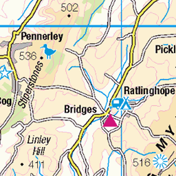
Height: 340m / 1114ft • Prominence: 157m / 515ft • Summit : ground by path • Trip reports (hill-bagging)


Tree-REX
No white swans were spotted on today’s 11 mile walk.
09-Mar-24 • RoystonVasey • flickr
53577418384


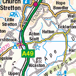
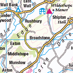
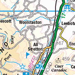
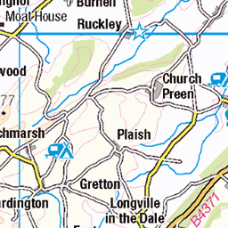
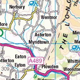
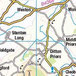
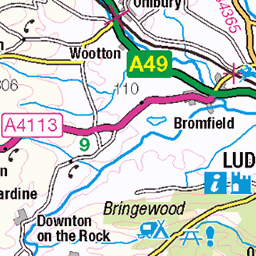
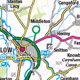
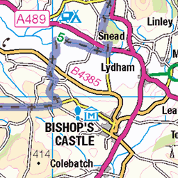
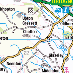
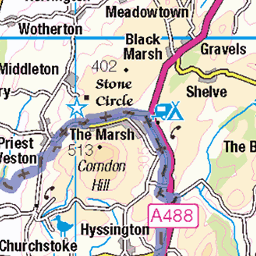
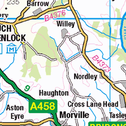
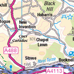
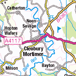
OS Map
This is OS mapping. In some areas, OpenStreetMap shows more footpaths
Spatial NI has online OSNI mapping. Click "Basemap Gallery" (4 squares icon at the top).
Now would be a good time for a cup of tea.
GPX Editor
Record map clicks
Reload map
Photos
Please tag your photos and upload them to the British and Irish Mountains group on Flickr
The other photos have been geo-tagged as on or around the summit. For less busy mountains, it can be a little hit and miss.
Tree-REX
No white swans were spotted on today’s 11 mile walk.
09-Mar-24 • RoystonVasey • flickr
53577418384


2847 Callow Hill
Name:Callow Hill Hill number:2847 Height:336m / 1102ft RHB Section:38A: Shropshire County/UA:Shropshire (CoU) Catchment:Severn Class:Marilyn, Hump, Tump (300-399m), Clem Grid ref:SO 46060 85043 Summit feature:SW corner of tower Drop:154m Col:182m SO531951 Observations:ground 30m NE (SO 46080 85065) is about as high; note trig point 120m SW at SO 45980 84955 is lower
19-Sep-21 • Dugswell2 • flickr
callowhill callowhilltower p154 marilyn hump tump clem floundersfolly gradeiilisted 11052002 51492837380

The Whole World Loves
after sheltering from the rain under some handy trees
08-Mar-20 • RoystonVasey • flickr
canon eos 77d efs 18135mm f3556 is usm shropshire wenlock edge strefford quinny brook rainbow 52445458343
Videos
Callow Hill on my Trek Rail 5.
Picking off the Shropshire hills one peak at a time, or in this case three. Crisp if a little windy February, parking at Church Stretton ...
A random early evening drive through the Wychavon District of Worcestershire via Droitwich and also Abberley and Clows Top in ...
Family Hike/Walk Moderate/Hard in places Hike it for Health takes a hike around Haddon Hill, The Long Mynd, Carding Mill Valley ...
How be do Join us on a wildcamp Join us for wildcamp in the Shropshire Hills and a little favourite of ours called Callow-hill.
Notes
- Data: Database of British and Irish Hills v18.2
- Maps: We use OS mapping for England, Scotland, Wales, and the Isle of Man. Sadly, Channel Islands, Northern (OSNI) and Southern Ireland (OSI) mapping isn't available online, so we use Openstreetmap.