Hills of Britain and Ireland
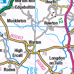
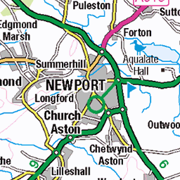
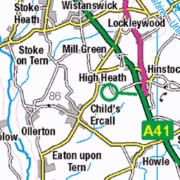
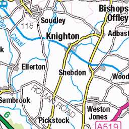
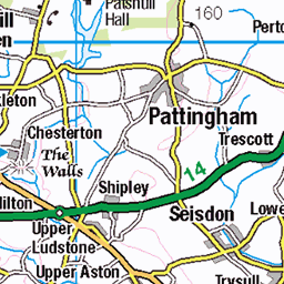
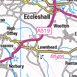
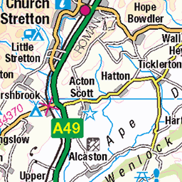
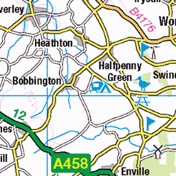
OS Map of The Wrekin
Height: 407m / 1335ft • Prominence: 310m / 1017ft • Summit : no feature: ground 110m NNE of trig point • Trip reports (hill-bagging)

Rain on the way
04-Sep-24 • Mount Fuji Man • flickr
thewrekin wrekin telfordwrekin shropshire 53970001677

Enjoying the view
Today the Hereios of the We’re Here! Group are shooting Stuff with Four Legs.
04-Sep-24 • Mount Fuji Man • flickr
wah werehere shropshire thewrekin bizburadayız buradayız 53971101943

Four-legged creatures ahead
Today the Hereios of the We’re Here! Group are shooting Stuff with Four Legs. During my walk to the top of the Wrekin I saw the odd squirrel though no deer.
04-Sep-24 • Mount Fuji Man • flickr
wah werehere shropshire thewrekin bizburadayız buradayız 53971102038

Mariapolis Group, The Wrekin
Mariapolis Group, The Wrekin 26th July 2024
26-Jul-24 • johnfogarty916 • flickr
trigpoint 53891830848

Mariapolis Group, The Wrekin
Mariapolis Group, The Wrekin 26th July 2024
26-Jul-24 • johnfogarty916 • flickr
trigpoint 53891830393

Mariapolis Group, The Wrekin
Mariapolis Group, The Wrekin 26th July 2024
26-Jul-24 • johnfogarty916 • flickr
trigpoint 53891830133
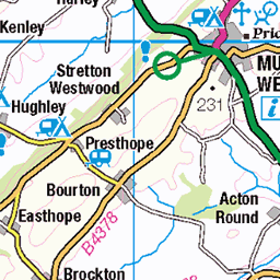
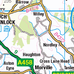
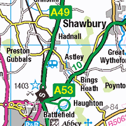
OS Map
This is OS mapping. In some areas, OpenStreetMap shows more footpaths
Spatial NI has online OSNI mapping. Click "Basemap Gallery" (4 squares icon at the top).
Now would be a good time for a cup of tea.

GPX Editor
Record map clicks
Reload map
Photos
Please tag your photos and upload them to the British and Irish Mountains group on Flickr
The other photos have been geo-tagged as on or around the summit. For less busy mountains, it can be a little hit and miss.
Rain on the way
04-Sep-24 • Mount Fuji Man • flickr
thewrekin wrekin telfordwrekin shropshire 53970001677
Enjoying the view
Today the Hereios of the We’re Here! Group are shooting Stuff with Four Legs.
04-Sep-24 • Mount Fuji Man • flickr
wah werehere shropshire thewrekin bizburadayız buradayız 53971101943
Four-legged creatures ahead
Today the Hereios of the We’re Here! Group are shooting Stuff with Four Legs. During my walk to the top of the Wrekin I saw the odd squirrel though no deer.
04-Sep-24 • Mount Fuji Man • flickr
wah werehere shropshire thewrekin bizburadayız buradayız 53971102038
Mariapolis Group, The Wrekin
Mariapolis Group, The Wrekin 26th July 2024
26-Jul-24 • johnfogarty916 • flickr
trigpoint 53891830848
Mariapolis Group, The Wrekin
Mariapolis Group, The Wrekin 26th July 2024
26-Jul-24 • johnfogarty916 • flickr
trigpoint 53891830393
Mariapolis Group, The Wrekin
Mariapolis Group, The Wrekin 26th July 2024
26-Jul-24 • johnfogarty916 • flickr
trigpoint 53891830133

Mariapolis Group, The Wrekin
Mariapolis Group, The Wrekin 26th July 2024
26-Jul-24 • johnfogarty916 • flickr
trigpoint 53892006365

Mariapolis Group, The Wrekin
Mariapolis Group, The Wrekin 26th July 2024
26-Jul-24 • johnfogarty916 • flickr
trigpoint 53891590191

2843 The Wrekin
28-May-22 • Dugswell2 • flickr
wrekin warninglighthillsurfaceblock osbenchmarklocation thewrekin p3104 marilyn hump tump currentcountyuatop clem 52110031840

2843 The Wrekin a
Revisit Wrekin summit and primary trig to bag the surface block. Name:The Wrekin Hill number:2843 Height:406.9m / 1335ft RHB Section:38A: Shropshire County/UA:Telford and Wrekin (UA) Catchment:Severn Class:Marilyn, Hump, Tump (400-499m), Current County/UA Top, Clem Grid ref:SJ 62836 08203 Summit feature:no feature: ground 110m NNE of trig point Drop:310.4m Col:96.5m SJ 8133 2116 Observations:summit is 0.1m higher than ground by trig point Survey:Trimble GeoXH 6000
28-May-22 • Dugswell2 • flickr
wrekin warninglighthillsurfaceblock osbenchmarklocation thewrekin p3104 marilyn hump tump currentcountyuatop clem 52110032730

2843 The Wrekin
Name:The Wrekin Hill number:2843 Height:406.9m / 1335ft RHB Section:38A: Shropshire County/UA:Telford and Wrekin (UA) Catchment:Severn Class:Marilyn, Hump, Tump (400-499m), Current County/UA Top, Clem Grid ref:SJ 62836 08203 Summit feature:no feature: ground 110m NNE of trig point Drop:310.4m Col:96.5m SJ 8133 2116 Observations:summit is 0.1m higher than ground by trig point Survey:Trimble GeoXH 6000
19-Sep-21 • Dugswell2 • flickr
thewrekin p3104 marilyn hump tump clem currentcountyuatop trigpoint 11052002 51491805026


Videos
The Wrekin claims another rider. #emtb #mtb #downhill #enduro #steeps.
Hi and good morning. We're back at The Wrekin today. My goal for today is to ride everything Gary throws at me without having to ...
Blizzard conditions were recorded at the Wrekin, Shropshire, on February 11 as Storm Ciara brings snowfall. Liam Ball, who ...
Hiking on the Edge Would like to introduce their new team member. Oakley the Labrador Retriever Puppy! Join Oakley on his first ...
The 4th of 7 videos recorded Saturday 8th April 2023. I'm exploring an amazing country road on a beautiful day during the Easter ...
Notes
- Data: Database of British and Irish Hills v18.2
- Maps: We use OS mapping for England, Scotland, Wales, and the Isle of Man. Sadly, Channel Islands, Northern (OSNI) and Southern Ireland (OSI) mapping isn't available online, so we use Openstreetmap.