Hills of Britain and Ireland
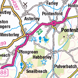
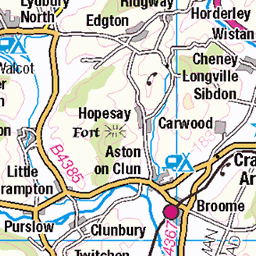
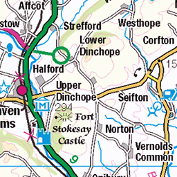
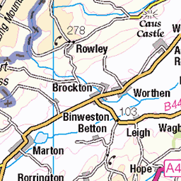
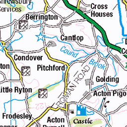
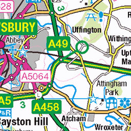
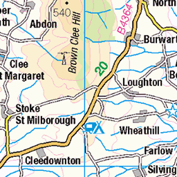
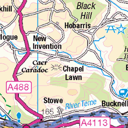
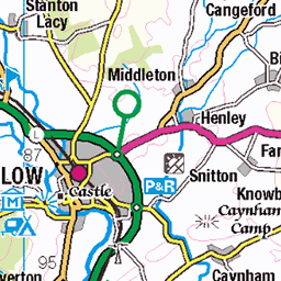
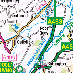
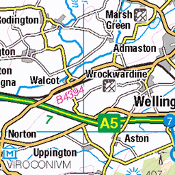
OS Map of Long Mynd - Pole Bank
Height: 517m / 1695ft • Prominence: 191m / 627ft • Summit : trig point • Trip reports (hill-bagging)

Nearing the Hill Top, Carding Mill Valley
29-Dec-24 • andrewtijou • flickr
andrewtijou nikond7200 europe eu uk unitedkingdom england shropshire cardingmillvalley churchstretton 54287375682

Above the Clouds
Brown Clee Hill, the highest summit in Shropshire, is seen across low lying cloud from The Long Mynd. The closer hill to the left is Hope Bowdler Hill.
27-Dec-24 • Jonathan Malpass • flickr
shropshire shropshirehills inversion abovetheclouds moorland mountains mountain hills longmynd thelongmynd england britain browncleehill hopebowdlerhill 54258983222

Mist Filled Valley
Looking west from Pole Bank, the highest point on The Long Mynd, as dusk approaches.
27-Dec-24 • Jonathan Malpass • flickr
shropshire shropshirehills inversion abovetheclouds moorland mountains mountain hills longmynd thelongmynd england britain 54260098873

Long Mynd View
Looking west from Pole Bank, the summit of The Long Mynd, to Heath Mynd and Corndon Hill, with Pumlumon (Plynlimon) and Cadair Idris in the distance.
27-Dec-24 • Jonathan Malpass • flickr
shropshire shropshirehills inversion abovetheclouds moorland mountains mountain hills longmynd thelongmynd england britain corndonhill heathmynd cadairidris pumlumon plynlimon 54260108934

Inversion Sunset
Looking over clouds at sunset from The Long Mynd to Radnor Forest.
27-Dec-24 • Jonathan Malpass • flickr
shropshire shropshirehills inversion abovetheclouds moorland mountains mountain hills longmynd thelongmynd england britain radnorforest 54260098313

Distant Pumlumon
Pumlumon (Plynlimon), in the distance, and Heath Mynd are viewed from The Long Mynd standing above the fog.
27-Dec-24 • Jonathan Malpass • flickr
shropshire shropshirehills inversion abovetheclouds moorland mountains mountain hills longmynd thelongmynd england britain plynlimon pumlumon 54260293310
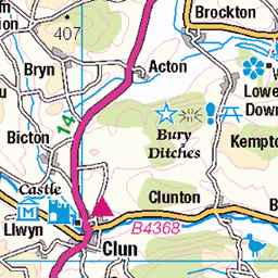
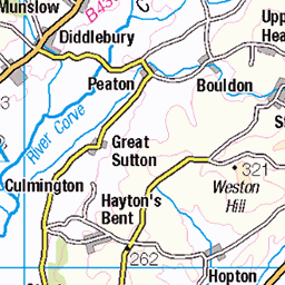
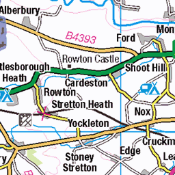
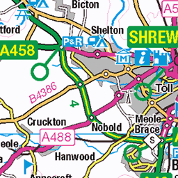
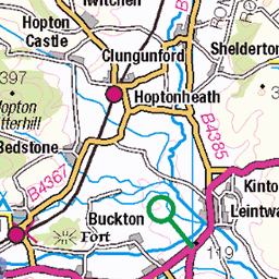
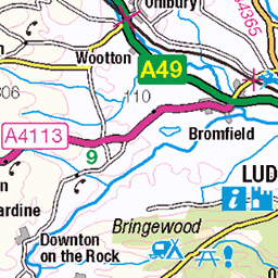
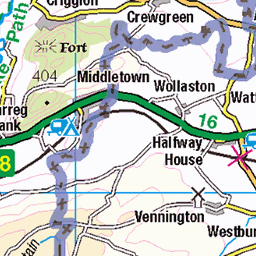
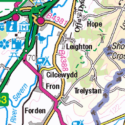
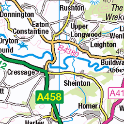
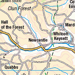
OS Map
This is OS mapping. In some areas, OpenStreetMap shows more footpaths
Spatial NI has online OSNI mapping. Click "Basemap Gallery" (4 squares icon at the top).
Now would be a good time for a cup of tea.

GPX Editor
Record map clicks
Reload map
Photos
Please tag your photos and upload them to the British and Irish Mountains group on Flickr
The other photos have been geo-tagged as on or around the summit. For less busy mountains, it can be a little hit and miss.
Nearing the Hill Top, Carding Mill Valley
29-Dec-24 • andrewtijou • flickr
andrewtijou nikond7200 europe eu uk unitedkingdom england shropshire cardingmillvalley churchstretton 54287375682
Above the Clouds
Brown Clee Hill, the highest summit in Shropshire, is seen across low lying cloud from The Long Mynd. The closer hill to the left is Hope Bowdler Hill.
27-Dec-24 • Jonathan Malpass • flickr
shropshire shropshirehills inversion abovetheclouds moorland mountains mountain hills longmynd thelongmynd england britain browncleehill hopebowdlerhill 54258983222
Mist Filled Valley
Looking west from Pole Bank, the highest point on The Long Mynd, as dusk approaches.
27-Dec-24 • Jonathan Malpass • flickr
shropshire shropshirehills inversion abovetheclouds moorland mountains mountain hills longmynd thelongmynd england britain 54260098873
Long Mynd View
Looking west from Pole Bank, the summit of The Long Mynd, to Heath Mynd and Corndon Hill, with Pumlumon (Plynlimon) and Cadair Idris in the distance.
27-Dec-24 • Jonathan Malpass • flickr
shropshire shropshirehills inversion abovetheclouds moorland mountains mountain hills longmynd thelongmynd england britain corndonhill heathmynd cadairidris pumlumon plynlimon 54260108934
Inversion Sunset
Looking over clouds at sunset from The Long Mynd to Radnor Forest.
27-Dec-24 • Jonathan Malpass • flickr
shropshire shropshirehills inversion abovetheclouds moorland mountains mountain hills longmynd thelongmynd england britain radnorforest 54260098313
Distant Pumlumon
Pumlumon (Plynlimon), in the distance, and Heath Mynd are viewed from The Long Mynd standing above the fog.
27-Dec-24 • Jonathan Malpass • flickr
shropshire shropshirehills inversion abovetheclouds moorland mountains mountain hills longmynd thelongmynd england britain plynlimon pumlumon 54260293310

County Summits
Brown Clee Hill and Titterstone Clee Hill from Pole Bank on The Long Mynd
27-Dec-24 • Jonathan Malpass • flickr
shropshire shropshirehills inversion abovetheclouds moorland mountains mountain hills longmynd thelongmynd england britain cleehills browncleehill titterstonecleehill 54259872516

Welsh Hills from Shropshire
Looking to the Welsh hills from Pole Bank, the summit of The Long Mynd. Heath Mynd is just in England, the adjacent Corndon Hill is just over the border, Pumlumon (Plynlimon) and Cadair Idris are in the distance.
27-Dec-24 • Jonathan Malpass • flickr
shropshire shropshirehills inversion abovetheclouds moorland mountains mountain hills longmynd thelongmynd england britain corndonhill heathmynd cadairidris pumlumon plynlimon 54258982357

September Tadpoles
Seen in a large pool on the Long Mynd. A surprise to me but apparently not that odd. The metamorphosis from tadpole to frog depends on warmth and food and so a shortage of either can delay it. Also in a very few cases a mutation can mean that the tadpoles never develop into frogs. Tadpoles can overwinter and either way can then become frogs or live on as tadpoles. Information courtesy of www.froglife.org" rel="noreferrer nofollow www.froglife.org .
04-Sep-24 • ARG_Flickr • flickr
53995880026

St Helens Ramblers - A party, led by Hugh
Pole Bank trig pillar. Via Whatsapp, so probably taken by A N Other using Carole's mobile.
13-Jul-24 • Jackie & Dennis • flickr
sthelensramblers coachramble circular churchstretton 53989450231

2840 Long Mynd - Pole Bank
Name:Long Mynd - Pole Bank Hill number:2840 Height:516.6m / 1695ft RHB Section:38A: Shropshire County/UA:Shropshire (CoU) Hill area:Long Mynd Catchment:Severn Class:Marilyn, Hump, Dodd (500-599m), Dewey, Clem Grid ref:SO 41521 94444 Summit feature:trig point Drop:190.9m Col:325.7m SO 4009 9954
19-Sep-21 • Dugswell2 • flickr
longmyndpolebank p1909 marilyn hump dodd dewey clem trigpoint 11052002 51492408106

2840 Long Mynd - Pole Bank
Revisit after nearly 16.5 years. Name:Long Mynd - Pole Bank Hill number:2840 Height:516.6m / 1695ft RHB Section:38A: Shropshire County/UA:Shropshire (CoU) Hill area:Long Mynd Catchment:Severn Class:Marilyn, Hump, Dodd (500-599m), Dewey Grid ref:SO 41521 94444 Summit feature:trig point Drop:193m Col:324m SO400995 OS map sheet(s):(1:50k) 137 (1:25k) 217 Survey:Trimble GeoXH 6000
30-Sep-18 • Dugswell2 • flickr
trigpoint s5201 longmounttrigpoint longmyndpolebank p193 marilyn hump dodd dewey tump 44621102844

2840 Long Mynd - Pole Bank a
30-Sep-18 • Dugswell2 • flickr
trigpoint s5201 longmounttrigpoint longmyndpolebank p193 marilyn hump dodd dewey tump 44430715685

2840 Long Mynd - Pole Bank b
30-Sep-18 • Dugswell2 • flickr
trigpoint s5201 longmounttrigpoint longmyndpolebank p193 marilyn hump dodd dewey tump 44430724255

2840 Long Mynd - Pole Bank c
30-Sep-18 • Dugswell2 • flickr
trigpoint s5201 longmounttrigpoint longmyndpolebank p193 marilyn hump dodd dewey tump 44430727585
Videos
A walk up and down Pole Bank, a peak in the Long Mynd region of Shropshire Hills, UK.
Embark on a breathtaking journey through the heart of Shropshire, as we capture the majestic Long Mynd from above with a ...
Having had a nice day out at Powys Castle despite feeling ill at all of Sir Clive loot, stopped on the way back on top of Long Mynd.
This is our first hill walking hiking vlog in the uk. This adventure is hiking one of the Marilyns known as Pole Bank located at the ...
A circular walk starting in the town of Church Stretton and then through and up Carding Mill Valley and on to Pole Bank before ...
Notes
- Data: Database of British and Irish Hills v18.2
- Maps: We use OS mapping for England, Scotland, Wales, and the Isle of Man. Sadly, Channel Islands, Northern (OSNI) and Southern Ireland (OSI) mapping isn't available online, so we use Openstreetmap.