Hills of Britain and Ireland
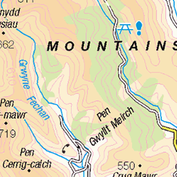
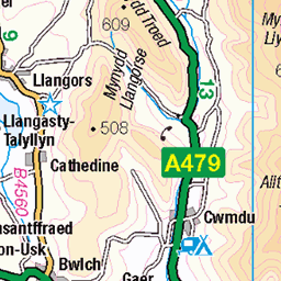
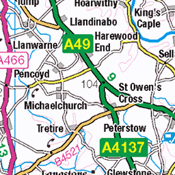
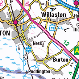
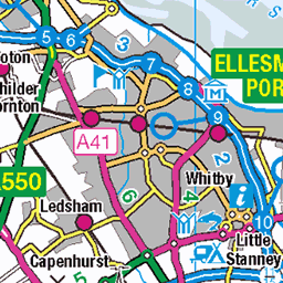
OS Map of Stiperstones
Height: 537m / 1761ft • Prominence: 357m / 1171ft • Summit : rock 1m from trig point • Trip reports (hill-bagging)

Cygnus Rising
The Cygnus region of the milky way rising over The Devils Chair, Stiperstones.
02-Apr-25 • midlands_night_sky • flickr
astro astrolandscape astrophotography astrophotos landscape landscapephotos midlands milkyway milkywayphotos nightsky nikond750 shropshire shropshirehills stargazing starglow stars tokina 54429033292

Crescent moon meets Venus
Early arrival at the Stiperstones Sunday night, I was greeted with a nice crescent moon and a bright planet Venus setting in the western sky.
02-Mar-25 • midlands_night_sky • flickr
astro astrolandscape astrophotography astrophotos landscape landscapephotos midlands nightsky nikond750 shropshire shropshirehills stargazing starglow stars tokina moon moonscape 54367447815

Stiperstones Winter Milky Way
A lovely calm clear night at the Stiperstone, Shropshire.
02-Mar-25 • midlands_night_sky • flickr
astro astrolandscape astrophotography astrophotos landscape landscapephotos midlands milkyway milkywayphotos nightsky nikond750 panorama shropshire shropshirehills stargazing starglow stars tokina orion 54371726599


The Stiperstones
01-Mar-25 • Mount Fuji Man • flickr
stiperstones shropshire hill seenonawalk 54358519086
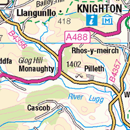
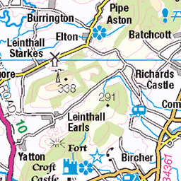
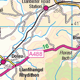
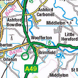
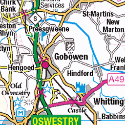
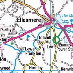
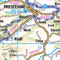
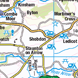
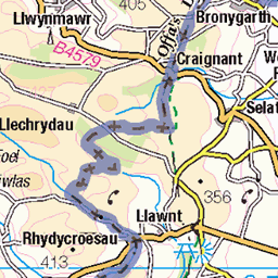
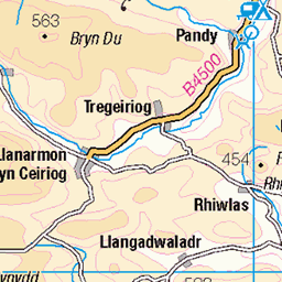
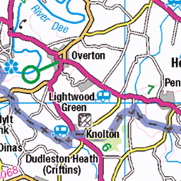
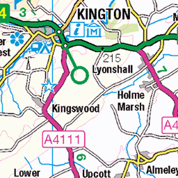
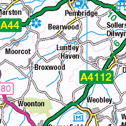
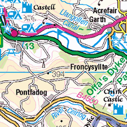
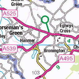
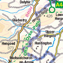
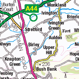
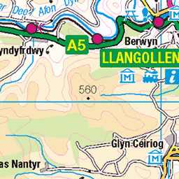
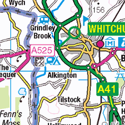
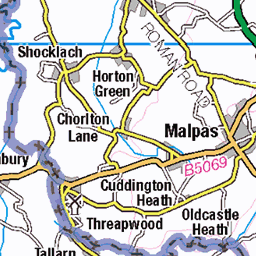
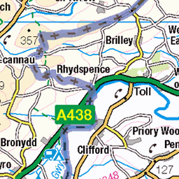
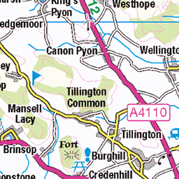
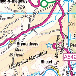
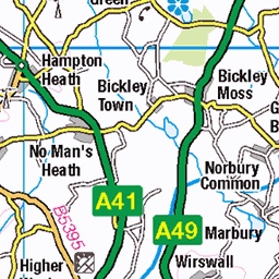
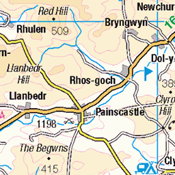
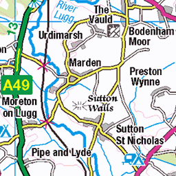
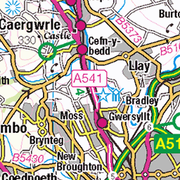
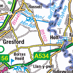
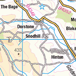
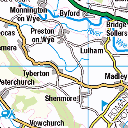
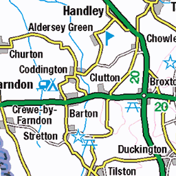
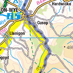
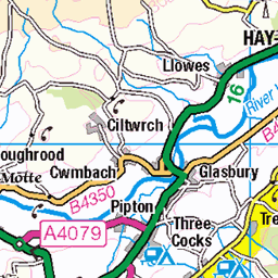
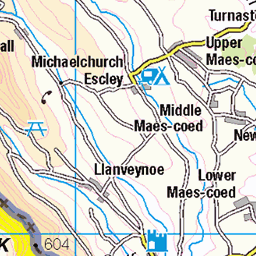
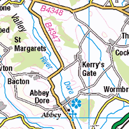
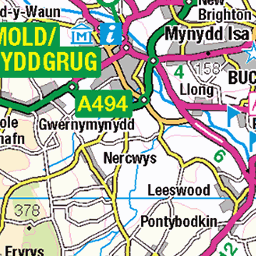
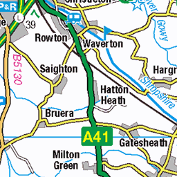
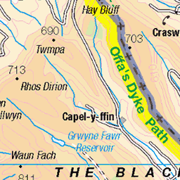
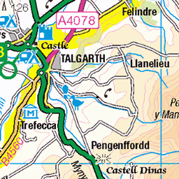
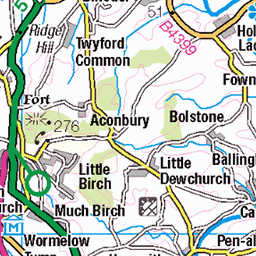
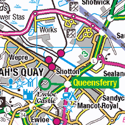
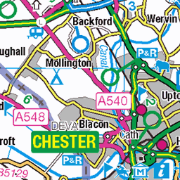
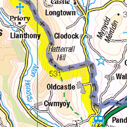
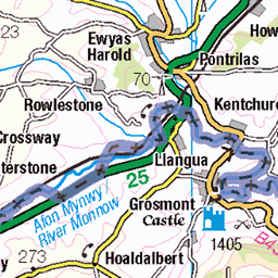
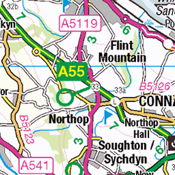
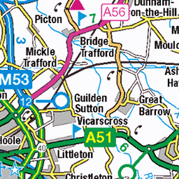
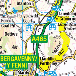
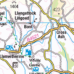
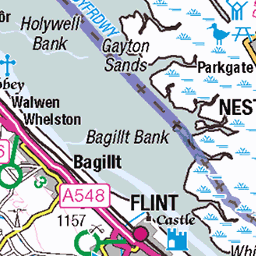
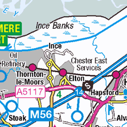
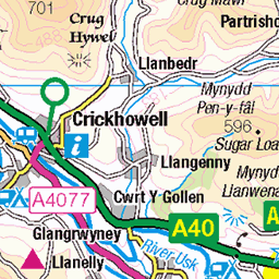
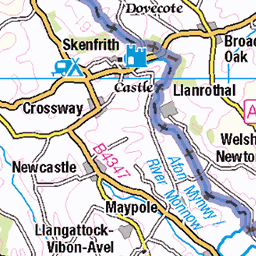
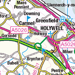
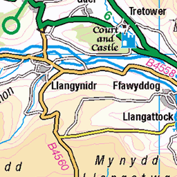
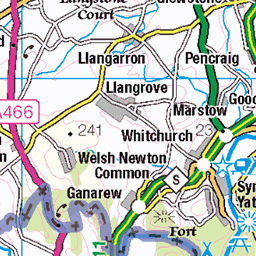
OS Map
This is OS mapping. In some areas, OpenStreetMap shows more footpaths
Spatial NI has online OSNI mapping. Click "Basemap Gallery" (4 squares icon at the top).
Now would be a good time for a cup of tea.


GPX Editor
Record map clicks
Reload map
Photos
Please tag your photos and upload them to the British and Irish Mountains group on Flickr
The other photos have been geo-tagged as on or around the summit. For less busy mountains, it can be a little hit and miss.
Cygnus Rising
The Cygnus region of the milky way rising over The Devils Chair, Stiperstones.
02-Apr-25 • midlands_night_sky • flickr
astro astrolandscape astrophotography astrophotos landscape landscapephotos midlands milkyway milkywayphotos nightsky nikond750 shropshire shropshirehills stargazing starglow stars tokina 54429033292
Crescent moon meets Venus
Early arrival at the Stiperstones Sunday night, I was greeted with a nice crescent moon and a bright planet Venus setting in the western sky.
02-Mar-25 • midlands_night_sky • flickr
astro astrolandscape astrophotography astrophotos landscape landscapephotos midlands nightsky nikond750 shropshire shropshirehills stargazing starglow stars tokina moon moonscape 54367447815
Stiperstones Winter Milky Way
A lovely calm clear night at the Stiperstone, Shropshire.
02-Mar-25 • midlands_night_sky • flickr
astro astrolandscape astrophotography astrophotos landscape landscapephotos midlands milkyway milkywayphotos nightsky nikond750 panorama shropshire shropshirehills stargazing starglow stars tokina orion 54371726599
The Stiperstones
01-Mar-25 • Mount Fuji Man • flickr
stiperstones shropshire hill seenonawalk 54358519086


The Devil's Chair, Stiperstones
There is information about the Stiperstones including the Devil's Chair here: en.wikipedia.org/wiki/Stiperstones" rel="noreferrer nofollow en.wikipedia.org/wiki/Stiperstones
01-Mar-25 • Mount Fuji Man • flickr
stiperstones shropshire hill 54358739273

The Devil's Chair
There is information about the Stiperstones including the Devil's Chair here: en.wikipedia.org/wiki/Stiperstones" rel="noreferrer nofollow en.wikipedia.org/wiki/Stiperstones
01-Mar-25 • Mount Fuji Man • flickr
stiperstones shropshire seenonawalk 54363172993

Dramatic landscape, Stiperstones
01-Mar-25 • Mount Fuji Man • flickr
stiperstones shropshire 54362950276

2838 Stiperstones
Name:Stiperstones Hill number:2838 Height:536.9m / 1761ft RHB Section:38A: Shropshire County/UA:Shropshire (CoU) Hill area:Long Mynd Catchment:Severn Class:Marilyn, Hump, Dodd (500-599m), Dewey, Clem Grid ref:SO 36755 98648 Summit feature:rock 1m from trig point Drop:357.1m Col:179.8m SO 3421 9113
19-Sep-21 • Dugswell2 • flickr
stiperstones p3571 tump marilyn hump dodd dewey clem 11052002 51492527704

2838 Stiperstones
01-Oct-18 • Dugswell2 • flickr
trigpoint stiperstones p3571 marilyn hump dodd dewey tump s1523 stiperstonestrigpoint 44467071305

2838 Stiperstones a
01-Oct-18 • Dugswell2 • flickr
trigpoint stiperstones p3571 marilyn hump dodd dewey tump s1523 stiperstonestrigpoint 45330410582

2838 Stiperstones b
01-Oct-18 • Dugswell2 • flickr
trigpoint stiperstones p3571 marilyn hump dodd dewey tump s1523 stiperstonestrigpoint 44657178294

2838 Stiperstones c
Parked to the SE of Cranberry Rock. Then walked up to Stiperstones, climbed up to the trig again after 16.5 years, then walked over to the Paddock. Returned by same route before the drizzle arrived. Name:Stiperstones Hill number:2838 Height:536.9m / 1761ft RHB Section:38A: Shropshire County/UA:Shropshire (CoU) Hill area:Long Mynd Catchment:Severn Class:Marilyn, Hump, Dodd (500-599m), Dewey Grid ref:SO 36755 98648 Summit feature:rock 1m from trig point Drop:357.1m Col:179.8m SO 3421 9113
01-Oct-18 • Dugswell2 • flickr
trigpoint stiperstones p3571 marilyn hump dodd dewey tump s1523 stiperstonestrigpoint 44467091465
Videos
A flight around the Stiperstones in Shropshire on a hot summers evening 2021. Wikipedia link for more Stiperstones info: ...
Join us on a breathtaking 4K walk through the stunning Stiperstones in the Shropshire Hills. This circular walk takes you through ...
Stiperstones 2020 http://www.shropshiresgreatoutdoors.co.uk/site/stiperstones-national-nature-reserve-nnr/ please note due to ...
What could be better for exploring Shropshire, than a Stiperstones walking adventure - Find the Devils Chair in the Shropshire ...
The Devil's Chair, Stiperstones A misty January Morning 2021 Footage and Editing by Philip J Jones Music by Edward Elgar ...
Notes
- Data: Database of British and Irish Hills v18.2
- Maps: We use OS mapping for England, Scotland, Wales, and the Isle of Man. Sadly, Channel Islands, Northern (OSNI) and Southern Ireland (OSI) mapping isn't available online, so we use Openstreetmap.