Hills of Britain and Ireland
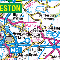
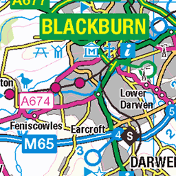
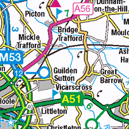
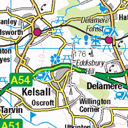
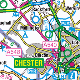
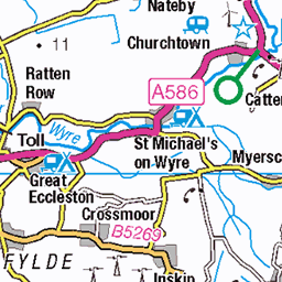
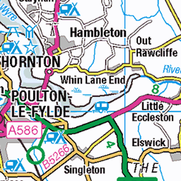
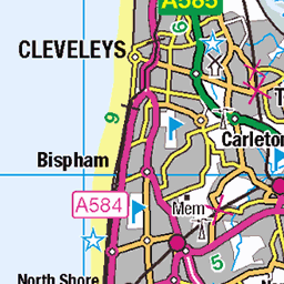
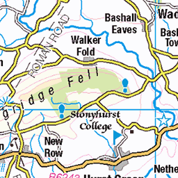
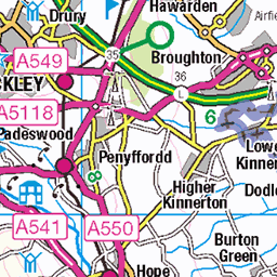
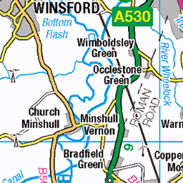
OS Map of Billinge Hill
Height: 179m / 588ft • Prominence: 152m / 499ft • Summit : ground 10m N of stone tower • Trip reports (hill-bagging)

Shocked Rock
This large pebble in the field looked to me as if it had a surprised expression on its face. Maybe it had been ploughed up and it was the first time it had seen the outside world since it disappeared into the Ice Age boulder clay!
16-Jan-25 • ARG_Flickr • flickr
54294287611

Carneddau And Cranes
Approaching Billinge Lump from the north west and the views to Liverpool and Snowdonia opened up. The Carneddau range stretching from Ogwen to Conwy with the MegaMax cranes by the Mersey at Seaforth in view beyond the mosses.
16-Jan-25 • ARG_Flickr • flickr
54295236192

Seaforth Cranes
A closer view of the Megamax cranes at Seaforth from the north western side of Billinge Lump.
16-Jan-25 • ARG_Flickr • flickr
54296354719

Distinctive
As the sun set behind the Clwydian Hills the profile of the Eryri/Snowdonia mountains became much more distinct. Moel Siabod is the mountain in this shot with Knowsley tower blocks rather closer.
16-Jan-25 • ARG_Flickr • flickr
54297017177

Carnes And Blocks
A look at Seaforth's Megamax cranes from Billinge Lump. The two blocks in the distance are the "Ormes" at Llandudno.
16-Jan-25 • ARG_Flickr • flickr
54298128904

Yr Wyddfa And Glyderau
Another sunset view from Billinge Lump. To the left is Y Lliwedd with Snowdon's summit along with that of Garnedd Ugain in the centre i.e. the Snowdon Horseshoe. To the right are the Glyderau with the identification made easier by the knobbly summit of Tryfan. Bravo /photos/192977168@N06/" rel="noreferrer nofollow Horizon et Photographie - soixante huit miles en Anglais :-)
16-Jan-25 • ARG_Flickr • flickr
54298142653
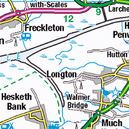
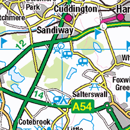
OS Map
This is OS mapping. In some areas, OpenStreetMap shows more footpaths
Spatial NI has online OSNI mapping. Click "Basemap Gallery" (4 squares icon at the top).
Now would be a good time for a cup of tea.


GPX Editor
Record map clicks
Reload map
Photos
Please tag your photos and upload them to the British and Irish Mountains group on Flickr
The other photos have been geo-tagged as on or around the summit. For less busy mountains, it can be a little hit and miss.
Shocked Rock
This large pebble in the field looked to me as if it had a surprised expression on its face. Maybe it had been ploughed up and it was the first time it had seen the outside world since it disappeared into the Ice Age boulder clay!
16-Jan-25 • ARG_Flickr • flickr
54294287611
Carneddau And Cranes
Approaching Billinge Lump from the north west and the views to Liverpool and Snowdonia opened up. The Carneddau range stretching from Ogwen to Conwy with the MegaMax cranes by the Mersey at Seaforth in view beyond the mosses.
16-Jan-25 • ARG_Flickr • flickr
54295236192
Seaforth Cranes
A closer view of the Megamax cranes at Seaforth from the north western side of Billinge Lump.
16-Jan-25 • ARG_Flickr • flickr
54296354719
Distinctive
As the sun set behind the Clwydian Hills the profile of the Eryri/Snowdonia mountains became much more distinct. Moel Siabod is the mountain in this shot with Knowsley tower blocks rather closer.
16-Jan-25 • ARG_Flickr • flickr
54297017177
Carnes And Blocks
A look at Seaforth's Megamax cranes from Billinge Lump. The two blocks in the distance are the "Ormes" at Llandudno.
16-Jan-25 • ARG_Flickr • flickr
54298128904
Yr Wyddfa And Glyderau
Another sunset view from Billinge Lump. To the left is Y Lliwedd with Snowdon's summit along with that of Garnedd Ugain in the centre i.e. the Snowdon Horseshoe. To the right are the Glyderau with the identification made easier by the knobbly summit of Tryfan. Bravo /photos/192977168@N06/" rel="noreferrer nofollow Horizon et Photographie - soixante huit miles en Anglais :-)
16-Jan-25 • ARG_Flickr • flickr
54298142653

From Siabod To Tal y Fan
A post-sunset Eryri panorama from Billinge Lump. Moel Siabod, the Snowdon Horseshoe, the Glyderau and then the long profile of the Carneddau with the dome of Carnedd Llewelyn being the highest and Tal y Fan, above Conwy, being the northernmost outlier.
16-Jan-25 • ARG_Flickr • flickr
54298128899


Ripe Barley
Passing Mountains Farm and looking towards Ashurst's Beacon where I'd been earlier on in the day.
06-Aug-24 • ARG_Flickr • flickr
53919837471

Tontine
A line of foxgloves along the field boundary with Ashurst's Beacon in the distance. Despite the urban encroachment onto green belt there's still a lot to like locally.
25-Jun-24 • ARG_Flickr • flickr
53886192604
Videos
Walk from Carr Mill Dam to Billinge Hill on 27th October 2024.
Discover the breathtaking views from Billinge Hill, the highest point in Merseyside, standing at 179m above sea level. Join me as I ...
Billinge Hill, also known as Billinge Lump, is in the Metropolitan Borough of St Helens in North West England. With a maximum ...
ROC Post Billinge Beacon Merseyside Old County of Lancashire. Opened 1960 closed 1968. This underground structure has ...
Situated between Wigan & St Helens. With views of Liverpool docks, Winter Hill and the Welsh mountains you will not be ...
Notes
- Data: Database of British and Irish Hills v18.2
- Maps: We use OS mapping for England, Scotland, Wales, and the Isle of Man. Sadly, Channel Islands, Northern (OSNI) and Southern Ireland (OSI) mapping isn't available online, so we use Openstreetmap.