Hills of Britain and Ireland
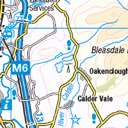
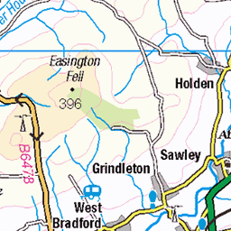
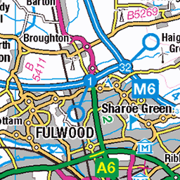
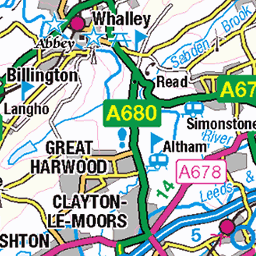
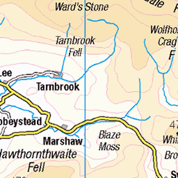
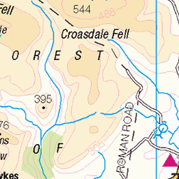
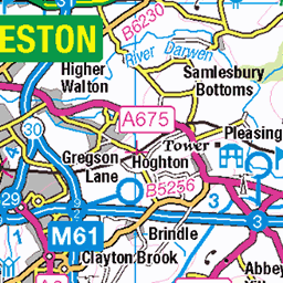
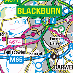
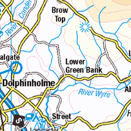
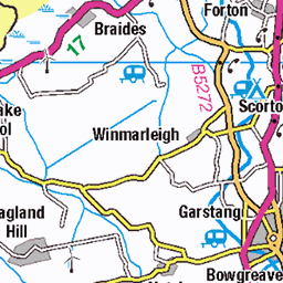
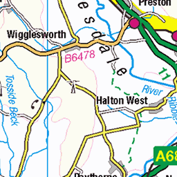
OS Map of Longridge Fell - Spire Hill
Height: 350m / 1148ft • Prominence: 240m / 787ft • Summit : trig point • Trip reports (hill-bagging)

2824 Longridge Fell - Spire Hill
12-Jan-25 • Dugswell2 • flickr
longridgefell lancashire england spirehillwalk longridgefelltrigpoint p240 marilyn longridgefellspirehill hump tump clem 54261216017


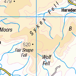
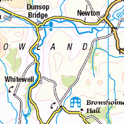
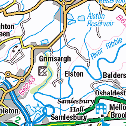
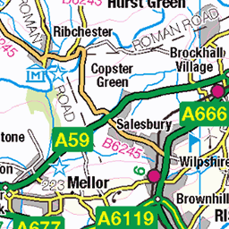
OS Map
This is OS mapping. In some areas, OpenStreetMap shows more footpaths
Spatial NI has online OSNI mapping. Click "Basemap Gallery" (4 squares icon at the top).
Now would be a good time for a cup of tea.

GPX Editor
Record map clicks
Reload map
Photos
Please tag your photos and upload them to the British and Irish Mountains group on Flickr
The other photos have been geo-tagged as on or around the summit. For less busy mountains, it can be a little hit and miss.
2824 Longridge Fell - Spire Hill
12-Jan-25 • Dugswell2 • flickr
longridgefell lancashire england spirehillwalk longridgefelltrigpoint p240 marilyn longridgefellspirehill hump tump clem 54261216017


Videos
So last year we built this trail and I was waiting till it dried before putting a video up but that's not happening so here it is !!
I'll upload a full version of the magic bean after I next go up.
Notes
- Data: Database of British and Irish Hills v18.2
- Maps: We use OS mapping for England, Scotland, Wales, and the Isle of Man. Sadly, Channel Islands, Northern (OSNI) and Southern Ireland (OSI) mapping isn't available online, so we use Openstreetmap.