Hills of Britain and Ireland
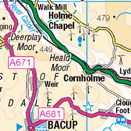
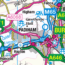
OS Map of Freeholds Top
Height: 454m / 1490ft • Prominence: 155m / 509ft • Summit : no feature: ground 15m SSE of trig point near pond edge • Trip reports (hill-bagging)

Trig Point on Freeholds Top
The summit supports a battered triangulation column, a murky pond and plenty of muddy peat. At 1,489 feet views look both ways into West Yorkshire and Lancashire - with a bit of Greater Manchester too.
09-Mar-25 • Walruscharmer • flickr
triangulationcolumn pond fence moorland troughedgeend windturbines westyorkshire yorkshire england 54382292613

On Trough Edge
On the Rossendale Way long distance footpath , roughly following the county boundary between Lancashire and West Yorkshire. Wide ranging views to the west over the towns of Bacup and Whitworth, with surrounding moorland.
09-Mar-25 • Walruscharmer • flickr
longdistancefootpath rossendaleway gate drystonewall openaccess moorland ladderstile lancashire england 54381183267

Gorpley Reservoir
The reservoir as viewed from moorland below Tooter Hill in a pleasant area of the South Pennines, although it does suffer from a surfeit of pylons, telegraph poles and wind turbines.
11-Apr-23 • Walruscharmer • flickr
gorpleyreservoir countinghill moorland openaccess newplantation electrictransmissionpylons westyorkshire southpennines yorkshire england 52817254941

Steps and overflow Gorpley Reservoir
At the top of Gorpley Clough near Todmorden ..West Yorkshire
54345988786

Gorpley reservoir
This reservoir is in the South Pennines near Todmorden in West Yorkshire.
15-Oct-20 • philcooky • flickr
southpennines reservoirs hillwalkingarea fantasticviews heathermoorland todmorden calderdale westyorkshire nature wildlife 50497647656

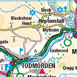
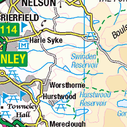
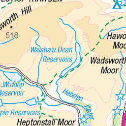
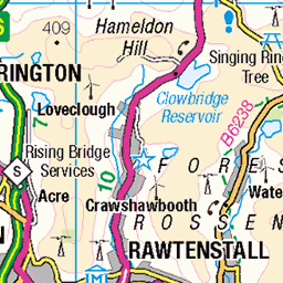
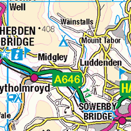
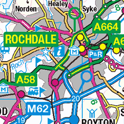
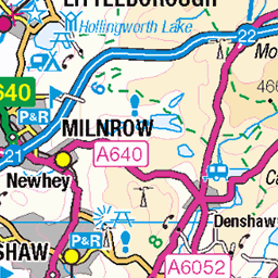
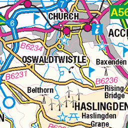
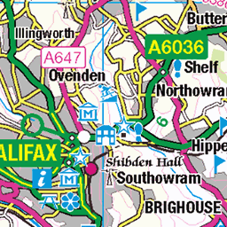
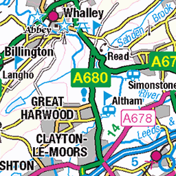
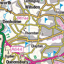
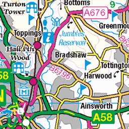
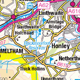
OS Map
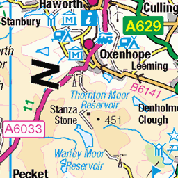
This is OS mapping. In some areas, OpenStreetMap shows more footpaths
Spatial NI has online OSNI mapping. Click "Basemap Gallery" (4 squares icon at the top).
Now would be a good time for a cup of tea.
GPX Editor
Record map clicks
Reload map
Photos
Please tag your photos and upload them to the British and Irish Mountains group on Flickr
The other photos have been geo-tagged as on or around the summit. For less busy mountains, it can be a little hit and miss.
Trig Point on Freeholds Top
The summit supports a battered triangulation column, a murky pond and plenty of muddy peat. At 1,489 feet views look both ways into West Yorkshire and Lancashire - with a bit of Greater Manchester too.
09-Mar-25 • Walruscharmer • flickr
triangulationcolumn pond fence moorland troughedgeend windturbines westyorkshire yorkshire england 54382292613
On Trough Edge
On the Rossendale Way long distance footpath , roughly following the county boundary between Lancashire and West Yorkshire. Wide ranging views to the west over the towns of Bacup and Whitworth, with surrounding moorland.
09-Mar-25 • Walruscharmer • flickr
longdistancefootpath rossendaleway gate drystonewall openaccess moorland ladderstile lancashire england 54381183267
Gorpley Reservoir
The reservoir as viewed from moorland below Tooter Hill in a pleasant area of the South Pennines, although it does suffer from a surfeit of pylons, telegraph poles and wind turbines.
11-Apr-23 • Walruscharmer • flickr
gorpleyreservoir countinghill moorland openaccess newplantation electrictransmissionpylons westyorkshire southpennines yorkshire england 52817254941
Steps and overflow Gorpley Reservoir
At the top of Gorpley Clough near Todmorden ..West Yorkshire
54345988786
Gorpley reservoir
This reservoir is in the South Pennines near Todmorden in West Yorkshire.
15-Oct-20 • philcooky • flickr
southpennines reservoirs hillwalkingarea fantasticviews heathermoorland todmorden calderdale westyorkshire nature wildlife 50497647656

Silver and Gold
25-Feb-18 • Phil West • flickr
calderdale gorpley gorpleyreservoir longexposure todmorden 40237604864


Videos
It's been a while - unfortunately sometimes life gets in the way. There are at least two more walks to upload for you now, including ...
Manpack portable CODAN 2110 amateur radio at Crompton Moor Dec 2020.
Yaesu FT 818 QRP field station @ Flower Scar Rd Todmorden, Calderdale.
A short video at Hail Storm Hill Rochdale Lancs whilst operating an Amateur Radio on the 2 metre Band.
Notes
- Data: Database of British and Irish Hills v18.2
- Maps: We use OS mapping for England, Scotland, Wales, and the Isle of Man. Sadly, Channel Islands, Northern (OSNI) and Southern Ireland (OSI) mapping isn't available online, so we use Openstreetmap.