Hills of Britain and Ireland
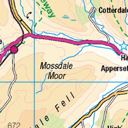
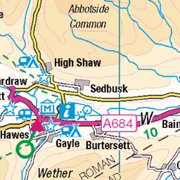
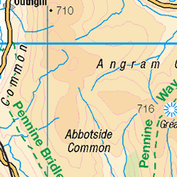
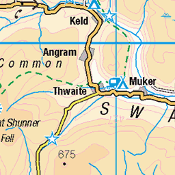
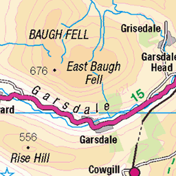
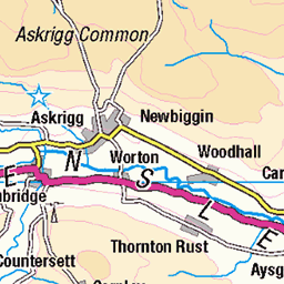
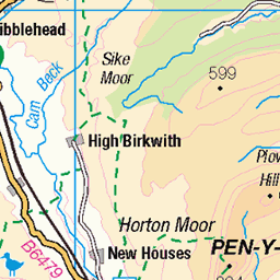
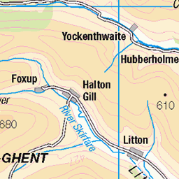
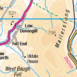
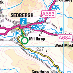
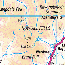
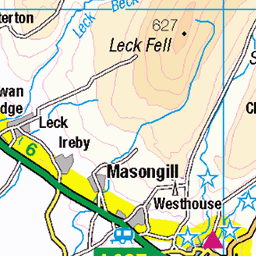
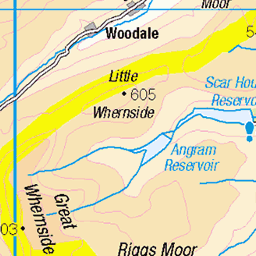
OS Map of Dodd Fell Hill
Height: 668m / 2192ft • Prominence: 232m / 761ft • Summit : ground 8m SE of trig point • Trip reports (hill-bagging)

Pennine way.
The West Cam road.
09-Apr-23 • A tramp in the hills • flickr
doddfellhill pennineway yorkshiredales northyorkshire thewestcamroad 52813525422

Widdale and Grove Head from the traverse around Dodd Fell Hill
12-Jul-18 • clivenorton • flickr
43122127924


OS Map
This is OS mapping. In some areas, OpenStreetMap shows more footpaths
Spatial NI has online OSNI mapping. Click "Basemap Gallery" (4 squares icon at the top).
Now would be a good time for a cup of tea.
GPX Editor
Record map clicks
Reload map
Photos
Please tag your photos and upload them to the British and Irish Mountains group on Flickr
The other photos have been geo-tagged as on or around the summit. For less busy mountains, it can be a little hit and miss.
Pennine way.
The West Cam road.
09-Apr-23 • A tramp in the hills • flickr
doddfellhill pennineway yorkshiredales northyorkshire thewestcamroad 52813525422
Widdale and Grove Head from the traverse around Dodd Fell Hill
12-Jul-18 • clivenorton • flickr
43122127924


Videos
2 dales 30 mountains.
Back out to bag 2 more mountains from the Dales 30 list..This weekend we chose Dodd fell hill [ 2192ft ] and Wether fell [ 2114ft ].
Hello, follow my journey from Hawes to Dodd Fell Hill and Wether Fell/ Drumaldrace as part of my challenge to walk all the 2000ft ...
So, the final vlog from this Yorkshire Dales tour is a fell walk up Drumaldrace. One of the easier fells to walk up but the views were ...
A Campervan Road Trip To the town of Hawes in The Yorkshire Dales, England, UK. Cross Country Mountain Biking in The ...
Notes
- Data: Database of British and Irish Hills v18.2
- Maps: We use OS mapping for England, Scotland, Wales, and the Isle of Man. Sadly, Channel Islands, Northern (OSNI) and Southern Ireland (OSI) mapping isn't available online, so we use Openstreetmap.