Hills of Britain and Ireland
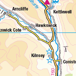
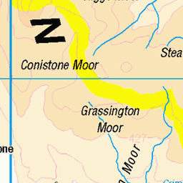
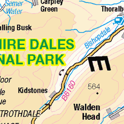
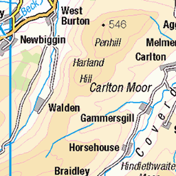
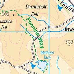
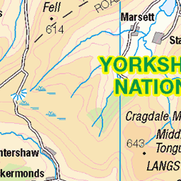
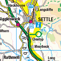
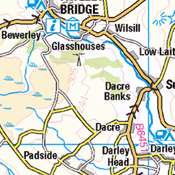
OS Map of Great Whernside
Height: 704m / 2310ft • Prominence: 288m / 945ft • Summit : very large cairn • Trip reports (hill-bagging)

The Top of Great Whernside
Despite the blue sky and warm day, there was still ice and snow in various places on the hill. The Yorkshire Dales National Park. England.
27-Feb-22 • Paul Austin Murphy • flickr
greatwhernside yorkshiredales 52079409521

great whernside
looking north, from the trig point, along the ridge of Great Whernside towards Blackfell Top
28-Jan-22 • Ron Layters • flickr
boulders rocks shattered winter wet gloomy greatwhernside hill yorkshiredales mutedcoloursridge blackfelltop blackdike yorkshiredalesnationalpark landscape kettlewell yorkshire england unitedkingdom slidefilmthenscanned slide transparency fujichrome velvia leicar6 leica r6 ronlayters 51848119084

Great Whernside, from Little Whernside, Apr. 2021
17-Apr-21 • Great Uncle David • flickr
greatwhernside mountains yorkshiredales england northyorkshire 51123249998

Great Whernside, Apr. 2021
17-Apr-21 • Great Uncle David • flickr
greatwhernside mountains yorkshiredales england northyorkshire 51122770102

Blackfell Crags, Great Whernside, Apr. 2021
17-Apr-21 • Great Uncle David • flickr
greatwhernside mountains yorkshiredales england northyorkshire 51123077604

Great Whernside summit, Apr. 2021
17-Apr-21 • Great Uncle David • flickr
greatwhernside mountains yorkshiredales england northyorkshire 51123070504
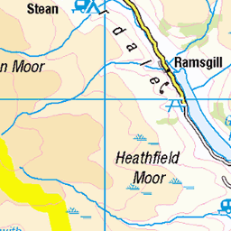
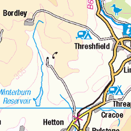
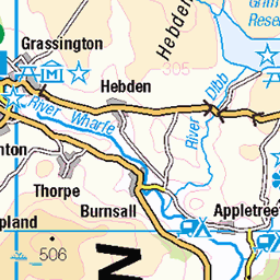
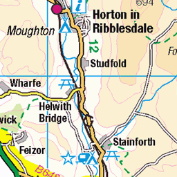
OS Map
This is OS mapping. In some areas, OpenStreetMap shows more footpaths
Spatial NI has online OSNI mapping. Click "Basemap Gallery" (4 squares icon at the top).
Now would be a good time for a cup of tea.
GPX Editor
Record map clicks
Reload map
Photos
Please tag your photos and upload them to the British and Irish Mountains group on Flickr
The other photos have been geo-tagged as on or around the summit. For less busy mountains, it can be a little hit and miss.
The Top of Great Whernside
Despite the blue sky and warm day, there was still ice and snow in various places on the hill. The Yorkshire Dales National Park. England.
27-Feb-22 • Paul Austin Murphy • flickr
greatwhernside yorkshiredales 52079409521
great whernside
looking north, from the trig point, along the ridge of Great Whernside towards Blackfell Top
28-Jan-22 • Ron Layters • flickr
boulders rocks shattered winter wet gloomy greatwhernside hill yorkshiredales mutedcoloursridge blackfelltop blackdike yorkshiredalesnationalpark landscape kettlewell yorkshire england unitedkingdom slidefilmthenscanned slide transparency fujichrome velvia leicar6 leica r6 ronlayters 51848119084
Great Whernside, from Little Whernside, Apr. 2021
17-Apr-21 • Great Uncle David • flickr
greatwhernside mountains yorkshiredales england northyorkshire 51123249998
Great Whernside, Apr. 2021
17-Apr-21 • Great Uncle David • flickr
greatwhernside mountains yorkshiredales england northyorkshire 51122770102
Blackfell Crags, Great Whernside, Apr. 2021
17-Apr-21 • Great Uncle David • flickr
greatwhernside mountains yorkshiredales england northyorkshire 51123077604
Great Whernside summit, Apr. 2021
17-Apr-21 • Great Uncle David • flickr
greatwhernside mountains yorkshiredales england northyorkshire 51123070504

Great Whernside, Apr. 2021
17-Apr-21 • Great Uncle David • flickr
greatwhernside mountains yorkshiredales england northyorkshire 51123317066

Cotton Grass
Cotton Grass on the lower slopes of Great Whernside with Buckden Pike in the background.
landscape yorkshire northyorkshire yorkshiredales cravendistrict wharfedale greatwhernside buckdenpike moorland cottongrass harestailcottongrass 49972397178

Great Whernside
The trig point at the summit of Great Whernside near Kettlewell. In the distance can be seen Pen-y-ghent and Plover Hill (10.2 miles away) and Ingleborough (16.2 miles away), as the crow flies.
landscape yorkshire northyorkshire yorkshiredales wharfedale kettlewell greatwhernside trigpoint penyghent ingleborough ploverfell 49962539193

Great Whernside
A panorama taken from the gritstone-topped summit of Great Whernside across the limestone landscape of Wharfedale on a beautifully clear morning.
landscape yorkshire northyorkshire yorkshiredales cravendistrict wharfedale greatwhernside buckdenpike penyghent ingleborough ploverfell gritstonetors limestone panorama 49966177431

Great Whernside: The Summit
23-Apr-10 • johnabutler2 • flickr
england marilyn britain yorkshire hill summit moor fell cairn hewitt wharfedale yorkshiredales trig nuttall greatwhernside hill2781 5259812921

Great Whernside: The Summit
23-Apr-10 • johnabutler2 • flickr
england marilyn britain yorkshire hill summit moor fell cairn hewitt wharfedale yorkshiredales trig nuttall greatwhernside hill2781 5259815619

Great Whernside: The Summit
23-Apr-10 • johnabutler2 • flickr
england marilyn britain yorkshire hill summit moor fell cairn hewitt wharfedale yorkshiredales nuttall greatwhernside hill2781 5260424364
Videos
Day 1 of a new project...we aim to spend the year bagging the Dales 30, 30 mountains in the Yorkshire Dales national park that ...
A beautiful walk up Great Whernside and onto little Whernside.
Have a look at the highest house in Yorkshire and the highest Chapel in England. Hag Dyke on the slopes of Great Whernside ...
Our walk up Great Whernside from the village of Kettlewell in the Yorkshire Dales.
Walking from Buckden to Kettlewell via the summits of Buckden Pike (702m) and Great Whernside (704m). A beautiful day up on ...
Notes
- Data: Database of British and Irish Hills v18.2
- Maps: We use OS mapping for England, Scotland, Wales, and the Isle of Man. Sadly, Channel Islands, Northern (OSNI) and Southern Ireland (OSI) mapping isn't available online, so we use Openstreetmap.