Hills of Britain and Ireland
OS Map of Ingleborough
Height: 723m / 2373ft • Prominence: 427m / 1401ft • Summit : large cairn between trig point and shelter • Trip reports (hill-bagging)

Approaching Ingleborough
07-Apr-25 • Nicholas Coates • flickr
ingleborough threepeaks yorkshire yorkshiredales yorkshirethreepeaks yorkshire3peaks 3peaks sony a7c spring chapelledale yorkshiredalesnationalpark 54447204000

Ingleborough Plateau
07-Apr-25 • Nicholas Coates • flickr
ingleborough threepeaks yorkshire yorkshiredales yorkshirethreepeaks yorkshire3peaks 3peaks sony a7c spring chapelledale yorkshiredalesnationalpark summit plateau penyghent 54445096480

Quaking Pot
One of the larger holes in the limestone landscape below and surrounding the Ingleborough massif.
27-Feb-25 • ARG_Flickr • flickr
54375995772


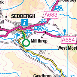
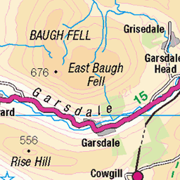
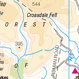
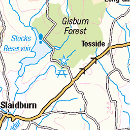
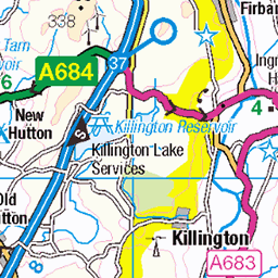
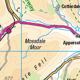
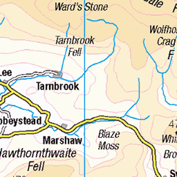
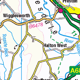
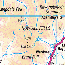
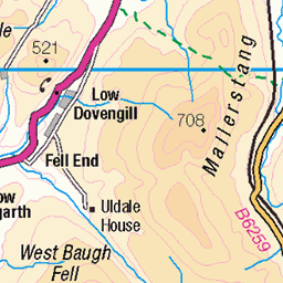
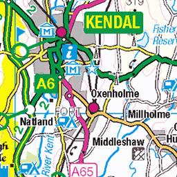
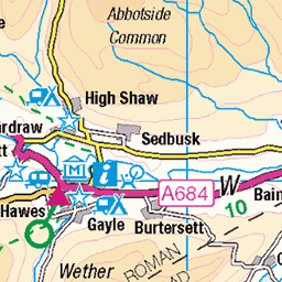
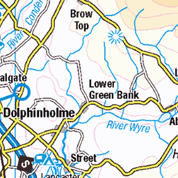
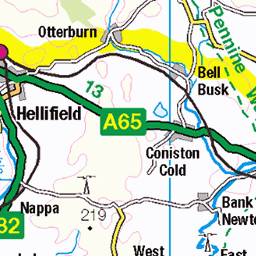
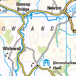
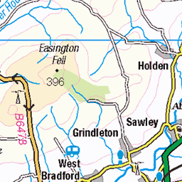
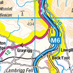
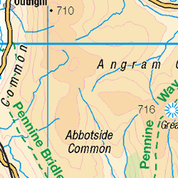
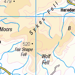
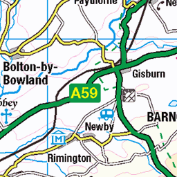
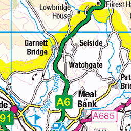
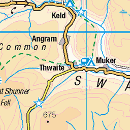
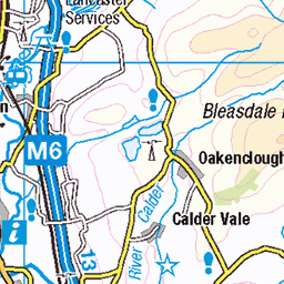
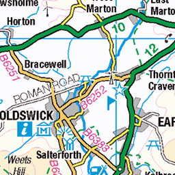
OS Map
This is OS mapping. In some areas, OpenStreetMap shows more footpaths
Spatial NI has online OSNI mapping. Click "Basemap Gallery" (4 squares icon at the top).
Now would be a good time for a cup of tea.
GPX Editor
Record map clicks
Reload map
Photos
Please tag your photos and upload them to the British and Irish Mountains group on Flickr
The other photos have been geo-tagged as on or around the summit. For less busy mountains, it can be a little hit and miss.
Approaching Ingleborough
07-Apr-25 • Nicholas Coates • flickr
ingleborough threepeaks yorkshire yorkshiredales yorkshirethreepeaks yorkshire3peaks 3peaks sony a7c spring chapelledale yorkshiredalesnationalpark 54447204000
Ingleborough Plateau
07-Apr-25 • Nicholas Coates • flickr
ingleborough threepeaks yorkshire yorkshiredales yorkshirethreepeaks yorkshire3peaks 3peaks sony a7c spring chapelledale yorkshiredalesnationalpark summit plateau penyghent 54445096480
Quaking Pot
One of the larger holes in the limestone landscape below and surrounding the Ingleborough massif.
27-Feb-25 • ARG_Flickr • flickr
54375995772


2780 Ingleborough
Walked up from Little Stainforth on the Dales High Way then walked onto Chapel-le-Dale. Name:Ingleborough Hill number:2780 Height:723.3m / 2373ft County/UA:North Yorkshire Topographical area:EP03 Whernside-buckden SMC/RHB section:35B: The Central Pennines Nuttall/Wainwright area:Yorkshire Dales - Southern Fells Catchment:Lune Class:Marilyn, Hump, Simm, Hewitt, Nuttall, Buxton & Lewis, Bridge, Clem, Trail 100 Grid ref:SD 74125 74587 Summit feature:large cairn between trig point and shelter Drop:427m Col:296m SD755793 Observations:trig point (SD74119 74560) is 25m S; natural ground by cairn 60m W at SD 74066 74585 is lower; highest natural ground is at SD 74125 74577 close to S perimeter of large cairn Survey:Abney level
28-Aug-24 • Dugswell2 • flickr
daleshighway day5stainforthtochapelledale ingleboroughtrigpoint ingleborough trigpoint s5619 p427 marilyn hump simm hewitt nuttall buxtonlewis bridge clem trail100 tump 53954679154

2780 Ingleborough a
28-Aug-24 • Dugswell2 • flickr
daleshighway day5stainforthtochapelledale ingleboroughtrigpoint ingleborough trigpoint s5619 p427 marilyn hump simm hewitt nuttall buxtonlewis bridge clem trail100 tump 53954348101
Videos
I decided to try a ten mile hike up Ingleborough in the Yorkshire Dales National Park and it was unbelievable! Charlie came with ...
Ingleborough, Yorkshire 3 Peaks, UK challenge and amazing views. First long hiking 24 mile took around 12 hours to complete ...
Created with the #GoPro App on my iPhone.
I should of been on a rest day during my Pennineway journey, unfortunately a slip put a stop top that 6 days ago. preparation and ...
From ingleton travel along Clapham old road for 1.6m until you reach the junction for Cold Coats. Limited off road parking is ...
Notes
- Data: Database of British and Irish Hills v18.2
- Maps: We use OS mapping for England, Scotland, Wales, and the Isle of Man. Sadly, Channel Islands, Northern (OSNI) and Southern Ireland (OSI) mapping isn't available online, so we use Openstreetmap.