Hills of Britain and Ireland
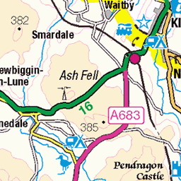
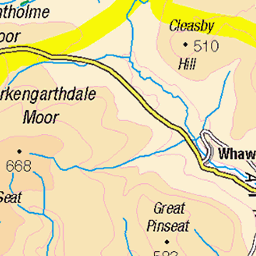
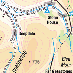
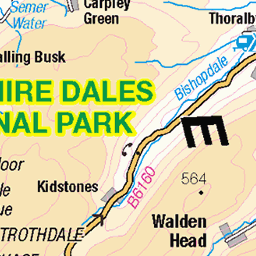
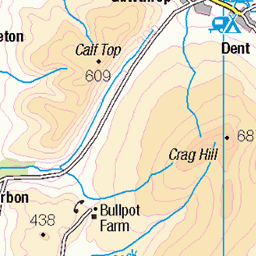
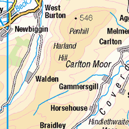
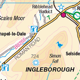
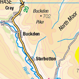
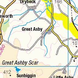
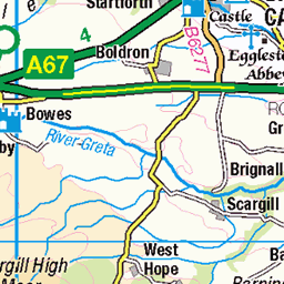
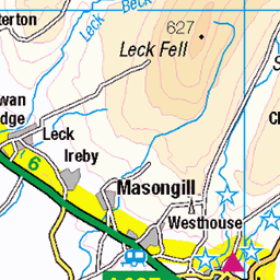
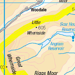
OS Map of Lovely Seat
Height: 675m / 2214ft • Prominence: 149m / 489ft • Summit : ground 5m NE of shelter • Trip reports (hill-bagging)

Above the Dales
A late afternoon autumn view from Lovely Seat, the summit above Stags Fell on the Wensleydale side and Muker Common on the Swaledale side. This shot looks over Wensleydale and up Widdale with the outlines of Ingleborough and Whernside prominent in the distance as we look into the low afternoon sun.
26-Oct-24 • Jonathan Malpass • flickr
yorkshire yorkshiredales wensleydale swaledale lovelyseat stagsfell mukercommon ingleborough whernside widdale buttertubs 54130995679


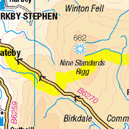
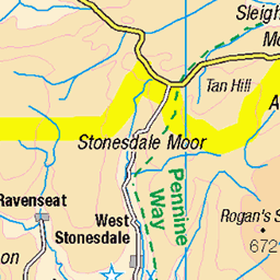
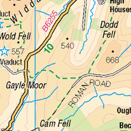
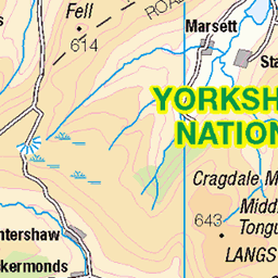
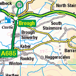
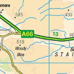
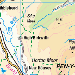
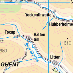
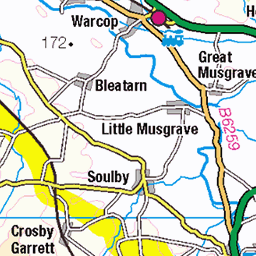
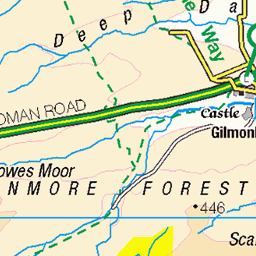
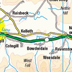
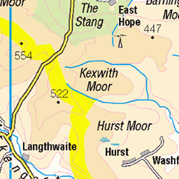
OS Map
This is OS mapping. In some areas, OpenStreetMap shows more footpaths
Spatial NI has online OSNI mapping. Click "Basemap Gallery" (4 squares icon at the top).
Now would be a good time for a cup of tea.
GPX Editor
Record map clicks
Reload map
Photos
Please tag your photos and upload them to the British and Irish Mountains group on Flickr
The other photos have been geo-tagged as on or around the summit. For less busy mountains, it can be a little hit and miss.
Above the Dales
A late afternoon autumn view from Lovely Seat, the summit above Stags Fell on the Wensleydale side and Muker Common on the Swaledale side. This shot looks over Wensleydale and up Widdale with the outlines of Ingleborough and Whernside prominent in the distance as we look into the low afternoon sun.
26-Oct-24 • Jonathan Malpass • flickr
yorkshire yorkshiredales wensleydale swaledale lovelyseat stagsfell mukercommon ingleborough whernside widdale buttertubs 54130995679


Videos
A 10 mile walk from Thwaite in Swaldale. The route joins the Pennine Way and heads west then south as it slowly climbs up to ...
'Lovely Great Hike' up on the Swaledale / Wensleydale / Mallerstang watershed. This 21 mile walk (plus 950m of ascent) is a new ...
Got there in the end, but we were lucky it was sooo dry. #vwcalifornia #walkstonowhere.
A fabulous walk to the top of the 3rd highest of the Dales 30 @ 716 metres.
I finally made it to the top of Lovely Seat as part of The Dales 30 Challenge. Starting in Thwaite I walked up the Buttertubs Pass to ...
Notes
- Data: Database of British and Irish Hills v18.2
- Maps: We use OS mapping for England, Scotland, Wales, and the Isle of Man. Sadly, Channel Islands, Northern (OSNI) and Southern Ireland (OSI) mapping isn't available online, so we use Openstreetmap.