Hills of Britain and Ireland
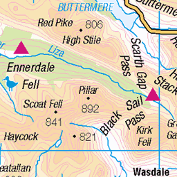
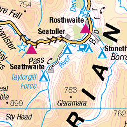
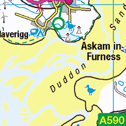
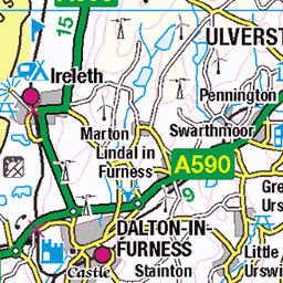
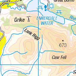
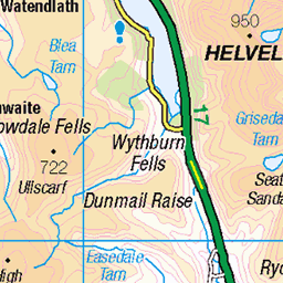
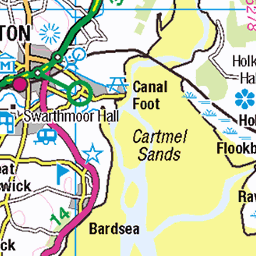
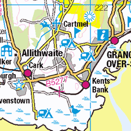
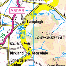
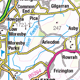
OS Map of Dunnerdale Fells
Height: 280m / 919ft • Prominence: 12m / 39ft • Summit : two stones on a rock • Trip reports (hill-bagging)


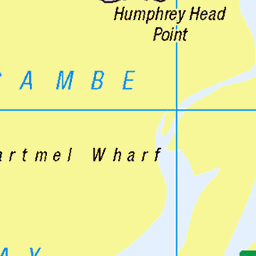
OS Map
This is OS mapping. In some areas, OpenStreetMap shows more footpaths
Spatial NI has online OSNI mapping. Click "Basemap Gallery" (4 squares icon at the top).
Now would be a good time for a cup of tea.


GPX Editor
Record map clicks
Reload map
Photos
Please tag your photos and upload them to the British and Irish Mountains group on Flickr
The other photos have been geo-tagged as on or around the summit. For less busy mountains, it can be a little hit and miss.

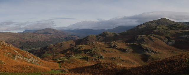
Great Stickle from The Nursery
broughtonmills gateposts hovelknott littlestickle greatstickle evening panasonicgx8 lumix 53390597139

Lickle Valley
with the Duddon Estuary beyond
broughtonmills hovelknott evening duddonestuary farmland outcrop panasonicgx8 lumix 53390288551

The Duddon Estuary
from the edge of the Dunnerdale fells
eveninglight dunnerdale duddonestuary licklevalley shadows sea clouds wpd24nature 53438860264

England 2023 09-009
OLYMPUS DIGITAL CAMERA
15-Jun-23 • stollenvernichter • flickr
ulpha copelanddistrict england motorrad tour motorradtour 53038470255
Videos
The first of hopefully many short films using my Dji Mavic Air 2s. A short film highlighting Autumn in Dunnerdale.
Discovering the remains of the Roman Fort after Eskdale Elevation fell race off Hardknott Pass, The Lake District, England 15 April ...
Avoiding the roads we venture high into the fells to complete our circular hike of Coniston Water. This 17.5 mile hike achieves over ...
Could this be the best way up Scafell Pike in the Southern Fells? https://www.youtube.com/@TonysTrails?sub_confirmation=1 ...
So windy I was nearly knocked over! This is just to the west of the southern end of Coniston Water. You can walk from the lay-by ...
Notes
- Data: Database of British and Irish Hills v18.2
- Maps: We use OS mapping for England, Scotland, Wales, and the Isle of Man. Sadly, Channel Islands, Northern (OSNI) and Southern Ireland (OSI) mapping isn't available online, so we use Openstreetmap.